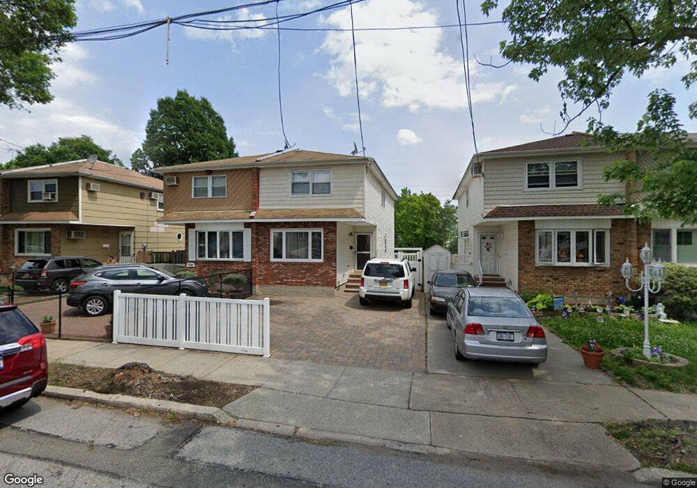
1942 N Railroad Ave Staten Island, NY 10306
Oakwood NeighborhoodEstimated Value: $683,674 - $723,000
3
Beds
2
Baths
1,312
Sq Ft
$537/Sq Ft
Est. Value
About This Home
This home is located at 1942 N Railroad Ave, Staten Island, NY 10306 and is currently estimated at $705,169, approximately $537 per square foot. 1942 N Railroad Ave is a home located in Richmond County with nearby schools including P.S. 50 Frank Hankinson School, Myra S. Barnes Intermediate School 24, and New Dorp High School.
Ownership History
Date
Name
Owned For
Owner Type
Purchase Details
Closed on
Dec 7, 2007
Sold by
Tsui Peter and Tsui Laura
Bought by
Balsamo Lorenzo and Sarno Della Ann
Current Estimated Value
Home Financials for this Owner
Home Financials are based on the most recent Mortgage that was taken out on this home.
Original Mortgage
$353,500
Interest Rate
5.8%
Mortgage Type
Purchase Money Mortgage
Purchase Details
Closed on
Jul 31, 2000
Sold by
Parrino Jerome F
Bought by
Tsui Peter and Tsui Laura
Home Financials for this Owner
Home Financials are based on the most recent Mortgage that was taken out on this home.
Original Mortgage
$161,600
Interest Rate
8.13%
Create a Home Valuation Report for This Property
The Home Valuation Report is an in-depth analysis detailing your home's value as well as a comparison with similar homes in the area
Home Values in the Area
Average Home Value in this Area
Purchase History
| Date | Buyer | Sale Price | Title Company |
|---|---|---|---|
| Balsamo Lorenzo | $392,500 | None Available | |
| Tsui Peter | $202,000 | -- |
Source: Public Records
Mortgage History
| Date | Status | Borrower | Loan Amount |
|---|---|---|---|
| Previous Owner | Balsamo Lorenzo | $353,500 | |
| Previous Owner | Tsui Peter | $161,600 |
Source: Public Records
Tax History Compared to Growth
Tax History
| Year | Tax Paid | Tax Assessment Tax Assessment Total Assessment is a certain percentage of the fair market value that is determined by local assessors to be the total taxable value of land and additions on the property. | Land | Improvement |
|---|---|---|---|---|
| 2025 | $5,747 | $40,800 | $6,270 | $34,530 |
| 2024 | $5,759 | $36,720 | $6,915 | $29,805 |
| 2023 | $5,466 | $28,314 | $6,337 | $21,977 |
| 2022 | $5,046 | $35,700 | $8,460 | $27,240 |
| 2021 | $5,000 | $34,560 | $8,460 | $26,100 |
| 2020 | $5,038 | $29,820 | $8,460 | $21,360 |
| 2019 | $4,939 | $30,780 | $8,460 | $22,320 |
| 2018 | $4,512 | $23,595 | $7,940 | $15,655 |
| 2017 | $4,238 | $22,260 | $8,260 | $14,000 |
| 2016 | $3,888 | $21,000 | $8,460 | $12,540 |
| 2015 | $4,070 | $22,968 | $7,470 | $15,498 |
| 2014 | $4,070 | $22,795 | $7,414 | $15,381 |
Source: Public Records
Map
Nearby Homes
- 1915 N Railroad Ave
- 77 Acorn St
- 122 Guyon Ave
- 238 Montreal Ave
- 100 Savoy St Unit 1, 39, 43, 45, 46
- 14 Savoy St Unit 14
- 16 Savoy St Unit 16
- 44 Thomas St
- 39 Thomas St
- 2075 N Railroad Ave
- 56 Wolverine St
- 2889 Amboy Rd
- 28 Peter Ave
- 158 Malone Ave
- 55 Amber St
- 55 O'Gorman Ave
- 207 Oak Ave
- 276 Fairbanks Ave
- 4 Penn Ave
- 745 Clawson St
- 1940 N Railroad Ave
- 1944 N Railroad Ave
- 1946 N Railroad Ave
- 1936 N Railroad Ave
- 1950 N Railroad Ave
- 1934 N Railroad Ave
- 1952 N Railroad Ave
- 1930 N Railroad Ave
- 1954 N Railroad Ave
- 1928 N Railroad Ave
- 1956 N Railroad Ave
- 1926 N Railroad Ave
- 1941 N Railroad Ave
- 1943 N Railroad Ave
- 1937 N Railroad Ave
- 1958 N Railroad Ave
- 1945 N Railroad Ave
- 1935 N Railroad Ave
- 1947 N Railroad Ave
- 1949 S Railroad Ave Unit 1951