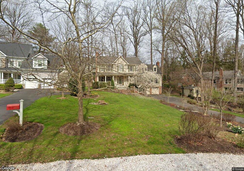
1942 Rhode Island Ave McLean, VA 22101
Estimated Value: $1,931,000 - $2,274,000
5
Beds
5
Baths
3,582
Sq Ft
$585/Sq Ft
Est. Value
About This Home
This home is located at 1942 Rhode Island Ave, McLean, VA 22101 and is currently estimated at $2,094,359, approximately $584 per square foot. 1942 Rhode Island Ave is a home located in Fairfax County with nearby schools including Chesterbrook Elementary School, Longfellow Middle School, and Montessori School Of Mclean.
Ownership History
Date
Name
Owned For
Owner Type
Purchase Details
Closed on
Jan 30, 2018
Sold by
Golding Nadja Zalokar
Bought by
Golding Nadja Zalokar and Nadja Zalokar Golding Trust
Current Estimated Value
Purchase Details
Closed on
Jul 9, 2016
Sold by
Golding Nadja Z
Bought by
Golding Nadja Z
Purchase Details
Closed on
Jan 10, 1996
Sold by
Potomac Custom Builders Inc
Bought by
Golding Edward L
Home Financials for this Owner
Home Financials are based on the most recent Mortgage that was taken out on this home.
Original Mortgage
$542,350
Interest Rate
7.31%
Mortgage Type
Purchase Money Mortgage
Create a Home Valuation Report for This Property
The Home Valuation Report is an in-depth analysis detailing your home's value as well as a comparison with similar homes in the area
Home Values in the Area
Average Home Value in this Area
Purchase History
| Date | Buyer | Sale Price | Title Company |
|---|---|---|---|
| Golding Nadja Zalokar | -- | None Available | |
| Golding Nadja Z | -- | Central Title | |
| Golding Edward L | $677,949 | -- |
Source: Public Records
Mortgage History
| Date | Status | Borrower | Loan Amount |
|---|---|---|---|
| Previous Owner | Golding Edward L | $542,350 |
Source: Public Records
Tax History Compared to Growth
Tax History
| Year | Tax Paid | Tax Assessment Tax Assessment Total Assessment is a certain percentage of the fair market value that is determined by local assessors to be the total taxable value of land and additions on the property. | Land | Improvement |
|---|---|---|---|---|
| 2025 | $19,451 | $1,802,230 | $827,000 | $975,230 |
| 2024 | $19,451 | $1,574,010 | $788,000 | $786,010 |
| 2023 | $18,346 | $1,534,690 | $788,000 | $746,690 |
| 2022 | $17,571 | $1,450,690 | $704,000 | $746,690 |
| 2021 | $16,481 | $1,330,690 | $584,000 | $746,690 |
| 2020 | $16,584 | $1,330,690 | $584,000 | $746,690 |
| 2019 | $15,971 | $1,279,130 | $574,000 | $705,130 |
| 2018 | $14,426 | $1,254,400 | $554,000 | $700,400 |
| 2017 | $15,982 | $1,306,310 | $552,000 | $754,310 |
| 2016 | $15,975 | $1,306,310 | $552,000 | $754,310 |
| 2015 | $15,109 | $1,279,340 | $547,000 | $732,340 |
| 2014 | $14,950 | $1,268,340 | $536,000 | $732,340 |
Source: Public Records
Map
Nearby Homes
- 1843 Rhode Island Ave
- 1830 Massachusetts Ave
- 2107 Elliott Ave
- 3623 N Rockingham St
- 6434 Noble Dr
- 6511 Ivy Hill Dr
- 6424 Divine St
- 2115 Natahoa Ct
- 2123 Natahoa Ct
- 2136 Powhatan St
- 6304 Old Dominion Dr
- 3946 N Dumbarton St
- 6449 Orland St
- 1705 East Ave
- 1730 Barbee St
- 1806 Dumbarton St
- 6514 Byrnes Dr
- 6528 36th St N
- 2005 Highboro Way
- 6330 Cross St
- 1934 Rhode Island Ave
- 1946 Rhode Island Ave
- 1941 Rhode Island Ave
- 1961 Massachusetts Ave
- 1950 Rhode Island Ave
- 1955 Massachusetts Ave
- 1930 Rhode Island Ave
- 1965 Massachusetts Ave
- 6328 N Kensington St
- 1951 Massachusetts Ave
- 1969 Massachusetts Ave
- 1953 Massachusetts Ave
- 1939 Rhode Island Ave
- 1937 Rhode Island Ave
- 1935 Rhode Island Ave
- 1926 Rhode Island Ave
- 1954 Rhode Island Ave
- 1949 Massachusetts Ave
- 6308 N Kensington St
- 6331 N Kensington St