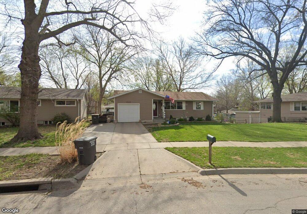
1942 Skyline Dr Lincoln, NE 68506
Central Lincoln NeighborhoodEstimated Value: $245,000 - $276,000
2
Beds
1
Bath
955
Sq Ft
$271/Sq Ft
Est. Value
About This Home
This home is located at 1942 Skyline Dr, Lincoln, NE 68506 and is currently estimated at $258,587, approximately $270 per square foot. 1942 Skyline Dr is a home located in Lancaster County with nearby schools including Holmes Elementary School, Lefler Middle School, and Lincoln Southeast High School.
Ownership History
Date
Name
Owned For
Owner Type
Purchase Details
Closed on
Aug 26, 2013
Sold by
Stewart Nathan D and Stewart Alison C
Bought by
Spencer Brent G
Current Estimated Value
Home Financials for this Owner
Home Financials are based on the most recent Mortgage that was taken out on this home.
Original Mortgage
$106,000
Outstanding Balance
$79,267
Interest Rate
4.53%
Mortgage Type
New Conventional
Estimated Equity
$179,320
Purchase Details
Closed on
Nov 28, 2011
Sold by
The Bank Of New York Mellon
Bought by
Stewart Nathan D and Stewart Alison C
Home Financials for this Owner
Home Financials are based on the most recent Mortgage that was taken out on this home.
Original Mortgage
$81,000
Interest Rate
4.03%
Mortgage Type
Future Advance Clause Open End Mortgage
Purchase Details
Closed on
Aug 5, 2011
Sold by
Powell Linda E and Powell James R
Bought by
The Bank Of New York Mellon
Purchase Details
Closed on
May 10, 2001
Sold by
Klein Curtis A and Wiedemann Klein Julie
Bought by
Powell Linda E
Home Financials for this Owner
Home Financials are based on the most recent Mortgage that was taken out on this home.
Original Mortgage
$102,000
Interest Rate
12.25%
Create a Home Valuation Report for This Property
The Home Valuation Report is an in-depth analysis detailing your home's value as well as a comparison with similar homes in the area
Home Values in the Area
Average Home Value in this Area
Purchase History
| Date | Buyer | Sale Price | Title Company |
|---|---|---|---|
| Spencer Brent G | $133,000 | Dataquick Title Llc | |
| Stewart Nathan D | $55,000 | None Available | |
| The Bank Of New York Mellon | $85,600 | None Available | |
| Powell Linda E | $120,000 | -- |
Source: Public Records
Mortgage History
| Date | Status | Borrower | Loan Amount |
|---|---|---|---|
| Open | Spencer Brent G | $106,000 | |
| Previous Owner | Stewart Nathan D | $81,000 | |
| Previous Owner | Powell Linda E | $102,000 | |
| Closed | Powell Linda E | $18,000 |
Source: Public Records
Tax History Compared to Growth
Tax History
| Year | Tax Paid | Tax Assessment Tax Assessment Total Assessment is a certain percentage of the fair market value that is determined by local assessors to be the total taxable value of land and additions on the property. | Land | Improvement |
|---|---|---|---|---|
| 2025 | $3,488 | $265,400 | $69,000 | $196,400 |
| 2024 | $3,488 | $249,400 | $57,500 | $191,900 |
| 2023 | $3,922 | $234,000 | $57,500 | $176,500 |
| 2022 | $3,703 | $185,800 | $40,000 | $145,800 |
| 2021 | $3,503 | $185,800 | $40,000 | $145,800 |
| 2020 | $3,201 | $167,500 | $40,000 | $127,500 |
| 2019 | $3,201 | $167,500 | $40,000 | $127,500 |
| 2018 | $2,829 | $147,400 | $40,000 | $107,400 |
| 2017 | $2,855 | $147,400 | $40,000 | $107,400 |
| 2016 | $2,600 | $133,500 | $35,000 | $98,500 |
| 2015 | $2,582 | $133,500 | $35,000 | $98,500 |
| 2014 | $2,524 | $129,800 | $40,000 | $89,800 |
| 2013 | -- | $93,000 | $40,000 | $53,000 |
Source: Public Records
Map
Nearby Homes
- 1731 E Manor Dr
- 1920 Riviera Dr
- 6220 Sumner St
- 2001 Morningside Dr
- 1610 Circle Dr
- 6301 Newton St
- 5505 Sumner St
- 1401 S 58th St
- 5300 Franklin St
- 6123 A St
- 5530 Normal Blvd
- 6545 Flint Ridge Place
- 6341 Rainier Dr
- 1210 Eastridge Dr
- 2533 S 55th St
- 1850 E Bermuda Dr
- 1830 E Bermuda Dr
- 1725 S 50th St
- 1521 Kingston Rd
- 2836 Ponca St