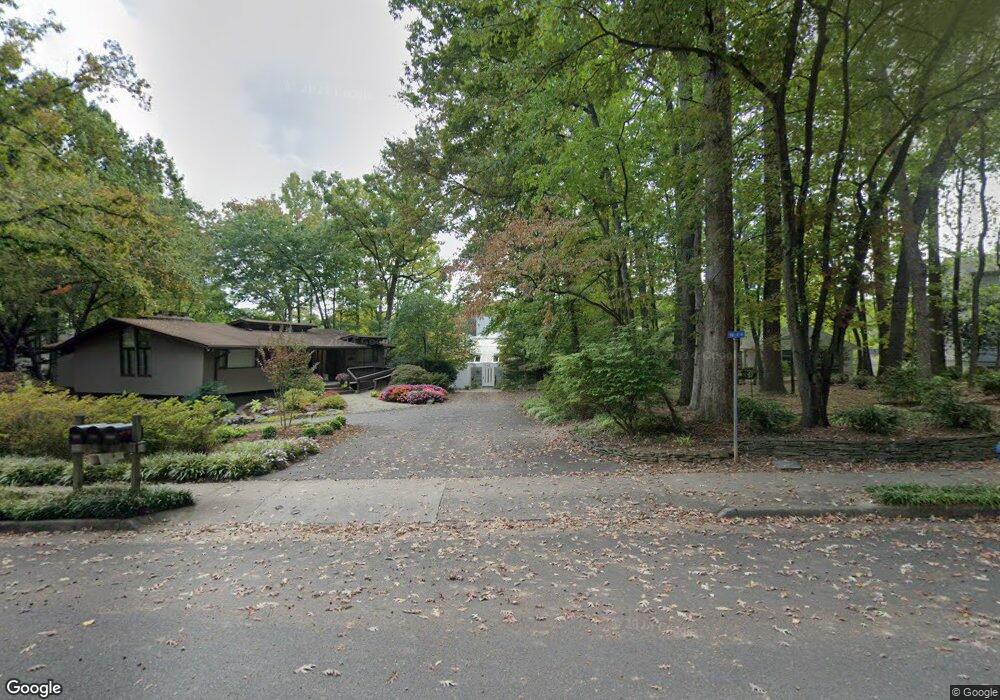
1942 Upper Lake Dr Reston, VA 20191
Estimated Value: $1,998,000 - $2,086,731
About This Home
This home is located at 1942 Upper Lake Dr, Reston, VA 20191 and is currently estimated at $2,055,933, approximately $618 per square foot. 1942 Upper Lake Dr is a home located in Fairfax County with nearby schools including Sunrise Valley Elementary, Langston Hughes Middle School, and South Lakes High School.
Ownership History
We collect this data history from publicly available records. To have your information removed, we recommend requesting removal directly through your county’s website.
Purchase Details
Home Financials for this Owner
Home Financials are based on the most recent Mortgage that was taken out on this home.Purchase Details
Home Financials for this Owner
Home Financials are based on the most recent Mortgage that was taken out on this home.Purchase Details
Home Values in the Area
Average Home Value in this Area
Purchase History
We collect this data history from publicly available records. To have your information removed, we recommend requesting removal directly through your county’s website.
| Date | Buyer | Sale Price | Title Company |
|---|---|---|---|
| $1,375,000 | -- | ||
| $850,000 | -- | ||
| $118,880 | -- |
Mortgage History
We collect this data history from publicly available records. To have your information removed, we recommend requesting removal directly through your county’s website.
| Date | Status | Borrower | Loan Amount |
|---|---|---|---|
| Open | $625,000 | ||
| Previous Owner | $525,000 |
Tax History
We collect this data history from publicly available records. To have your information removed, we recommend requesting removal directly through your county’s website.
| Year | Tax Paid | Tax Assessment Tax Assessment Total Assessment is a certain percentage of the fair market value that is determined by local assessors to be the total taxable value of land and additions on the property. | Land | Improvement |
|---|---|---|---|---|
| 2025 | $18,404 | $1,834,280 | $942,000 | $892,280 |
| 2024 | $18,404 | $1,526,630 | $764,000 | $762,630 |
| 2023 | $17,006 | $1,446,680 | $764,000 | $682,680 |
| 2022 | $16,543 | $1,446,680 | $764,000 | $682,680 |
| 2021 | $14,317 | $1,173,030 | $695,000 | $478,030 |
| 2020 | $13,696 | $1,113,030 | $635,000 | $478,030 |
| 2019 | $13,854 | $1,125,880 | $635,000 | $490,880 |
| 2018 | $12,112 | $1,053,250 | $572,000 | $481,250 |
| 2017 | $12,723 | $1,053,250 | $572,000 | $481,250 |
| 2016 | $13,527 | $1,122,130 | $626,000 | $496,130 |
| 2015 | $12,623 | $1,085,380 | $626,000 | $459,380 |
| 2014 | $12,596 | $1,085,380 | $626,000 | $459,380 |
Map
- 1953 Winterport Cluster
- 1931 Winterport Cluster
- 2050 Chadds Ford Dr
- 2006 Headlands Cir
- 1953 Lakeport Way
- 11213 Silentwood Ln
- 2121 Whisper Way
- 1904A Villaridge Dr
- 1951 Sagewood Ln Unit 231
- 1917B Villaridge Dr
- 1927B Villaridge Dr
- 2043 Wethersfield Ct
- 2201 Cedar Cove Ct
- 2105 S Bay Ln
- 11103 Lake Chapel Ln
- 11142 Beaver Trail Ct
- 11144 Beaver Trail Ct Unit 11144
- 11100 Beaver Trail Ct Unit LL
- 2037 Durand Dr
- 11025A Villaridge Ct
- 2004 Halyard Ln
- 2002 Halyard Ln
- 2006 Halyard Ln
- 2009 Halyard Ln
- 2000 Halyard Ln
- 1946 Upper Lake Dr
- 2003 Halyard Ln
- 2007 Halyard Ln
- 2001 Halyard Ln
- 1944 Upper Lake Dr
- 2005 Halyard Ln
- 2010 Upper Lake Dr
- 1940 Upper Lake Dr
- 2001 Upper Lake Dr
- 1949 Upper Lake Dr
- 1947 Upper Lake Dr
- 2007 Upper Lake Dr
- 1945 Upper Lake Dr
- 1938 Upper Lake Dr
- 2009 Upper Lake Dr
Ask me questions while you tour the home.