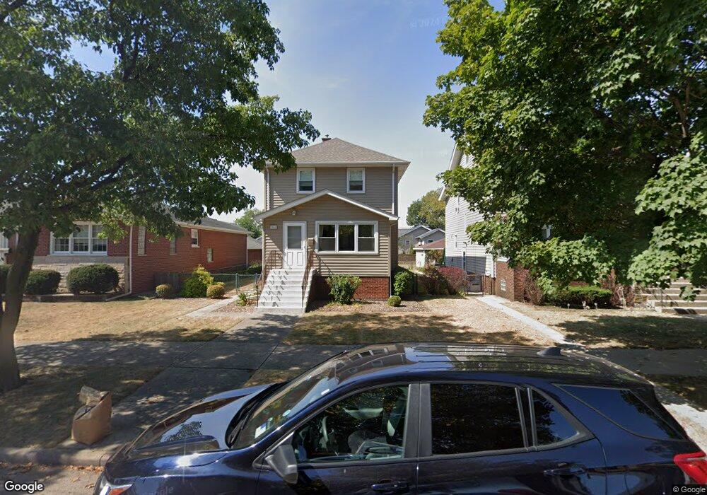
1942 Wespark Ave Whiting, IN 46394
Estimated Value: $214,890 - $254,000
3
Beds
2
Baths
1,320
Sq Ft
$180/Sq Ft
Est. Value
About This Home
This home is located at 1942 Wespark Ave, Whiting, IN 46394 and is currently estimated at $236,973, approximately $179 per square foot. 1942 Wespark Ave is a home located in Lake County with nearby schools including Benjamin Franklin Elementary School, Eggers Middle School, and Hammond High School.
Ownership History
Date
Name
Owned For
Owner Type
Purchase Details
Closed on
Nov 28, 2018
Sold by
Kovach Thomas R
Bought by
Kovach Thomas R
Current Estimated Value
Purchase Details
Closed on
Sep 25, 2015
Sold by
Kovach Thomas R
Bought by
Kovach Thomas R
Home Financials for this Owner
Home Financials are based on the most recent Mortgage that was taken out on this home.
Original Mortgage
$172,500
Outstanding Balance
$168,100
Interest Rate
3.45%
Mortgage Type
Reverse Mortgage Home Equity Conversion Mortgage
Estimated Equity
$68,873
Purchase Details
Closed on
Sep 13, 2012
Sold by
Depalmo Doreen T and Kovach Living Trust
Bought by
Kovach Thomas R
Create a Home Valuation Report for This Property
The Home Valuation Report is an in-depth analysis detailing your home's value as well as a comparison with similar homes in the area
Home Values in the Area
Average Home Value in this Area
Purchase History
| Date | Buyer | Sale Price | Title Company |
|---|---|---|---|
| Kovach Thomas R | -- | None Available | |
| Kovach Thomas R | -- | None Available | |
| Kovach Thomas R | -- | None Available |
Source: Public Records
Mortgage History
| Date | Status | Borrower | Loan Amount |
|---|---|---|---|
| Open | Kovach Thomas R | $172,500 |
Source: Public Records
Tax History
| Year | Tax Paid | Tax Assessment Tax Assessment Total Assessment is a certain percentage of the fair market value that is determined by local assessors to be the total taxable value of land and additions on the property. | Land | Improvement |
|---|---|---|---|---|
| 2025 | $1,768 | $216,200 | $31,900 | $184,300 |
| 2024 | $8,833 | $208,700 | $31,900 | $176,800 |
| 2023 | $1,642 | $184,800 | $32,300 | $152,500 |
| 2022 | $1,642 | $178,000 | $32,300 | $145,700 |
| 2021 | $1,610 | $163,400 | $21,800 | $141,600 |
| 2020 | $1,579 | $159,600 | $21,800 | $137,800 |
| 2019 | $1,641 | $126,200 | $21,800 | $104,400 |
| 2018 | $1,610 | $121,800 | $21,800 | $100,000 |
| 2017 | $1,781 | $120,900 | $21,800 | $99,100 |
| 2016 | $1,692 | $117,700 | $21,800 | $95,900 |
| 2014 | $1,669 | $115,200 | $21,800 | $93,400 |
| 2013 | $1,461 | $107,100 | $21,800 | $85,300 |
Source: Public Records
Map
Nearby Homes
- 1828 Stanton Ave
- 1121 Benedict Ave
- 2144 Superior Ave
- 2134 Lincoln Ave
- 1207 Lakeview Ave
- 1944 Warwick Ave
- 1806 Brown Ave
- 1710 Atchison Ave
- 2231 Davis Ave
- 1314 121st St
- 1704 Central Ave
- 1711 Central Ave
- 1631 Cleveland Ave
- 2027 1/2 Davidson Place
- 2019 Davidson Place
- 1813 Sheridan Ave
- 1709 Parkview Ave
- 1633 Central Ave
- 1643 Roberts Ave
- 2140 Indianapolis Blvd
- 1946 Wespark Ave
- 1936 Wespark Ave
- 1948 Wespark Ave
- 1932 Wespark Ave
- 1941 Lake Ave
- 1937 Lake Ave
- 1945 Lake Ave
- 1930 Wespark Ave
- 1949 Lake Ave
- 1931 Lake Ave
- 1941 Wespark Ave
- 1937 Wespark Ave
- 1943 Wespark Ave
- 2004 Wespark Ave
- 1935 Wespark Ave
- 1926 Wespark Ave
- 1947 Wespark Ave
- 1927 Lake Ave
- 1931 Wespark Ave
- 2008 Wespark Ave