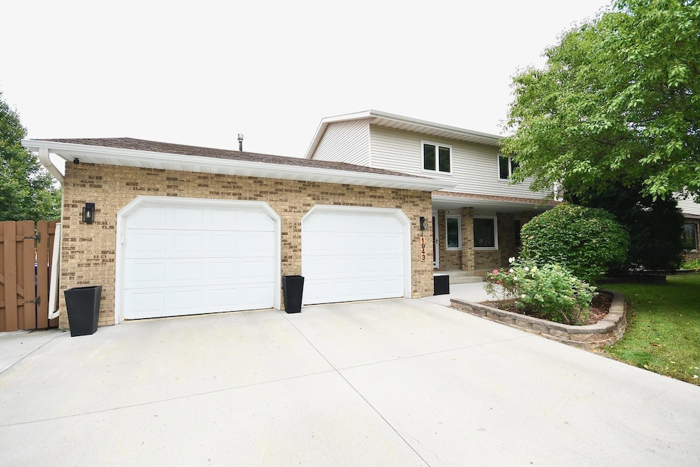
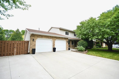
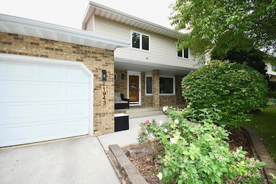
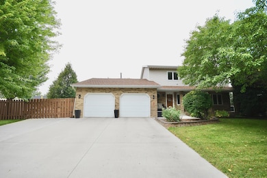
1943 19th St S Fargo, ND 58103
South High NeighborhoodEstimated payment $2,740/month
Highlights
- Radiant Floor
- Gazebo
- The kitchen features windows
- No HOA
- Double Oven
- Living Room
About This Home
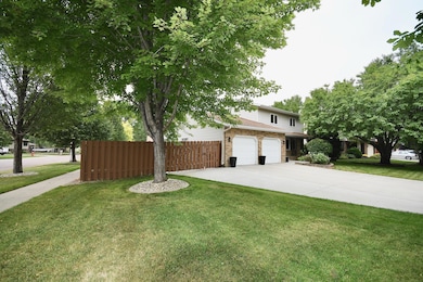
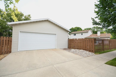
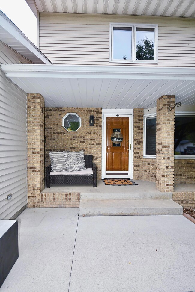
Welcome to this spacious two-story, 5-bedroom, 4-bathroom home situated on a desirable corner lot in a quiet neighborhood. This property features a large heated attached two-stall garage plus an oversized detached heated shop, perfect for projects, hobbies, or extra storage. RV hookup and additional parking provide convenience for all your vehicles and toys. The yard is beautifully landscaped with an underground sprinkler system, a garden area, and mature trees offering shade and privacy. Inside, you’ll find generous living spaces designed for comfort and functionality, making this the perfect place to call home!
Home Details
Home Type
- Single Family
Est. Annual Taxes
- $4,873
Year Built
- Built in 1983
Lot Details
- 0.3 Acre Lot
- Lot Dimensions are 80x160
Parking
- 2 Car Garage
Home Design
- Steel Siding
Interior Spaces
- 2-Story Property
- Family Room
- Living Room
- Dining Room
- Radiant Floor
- Basement Fills Entire Space Under The House
Kitchen
- Double Oven
- Cooktop
- Microwave
- Freezer
- Dishwasher
- Disposal
- The kitchen features windows
Bedrooms and Bathrooms
- 5 Bedrooms
Laundry
- Laundry Room
- Dryer
- Washer
Outdoor Features
- Gazebo
Utilities
- Forced Air Heating and Cooling System
- Baseboard Heating
Community Details
- No Home Owners Association
- Southview Villages Subdivision
Listing and Financial Details
- Assessor Parcel Number 01284001980000
Map
Home Values in the Area
Average Home Value in this Area
Tax History
| Year | Tax Paid | Tax Assessment Tax Assessment Total Assessment is a certain percentage of the fair market value that is determined by local assessors to be the total taxable value of land and additions on the property. | Land | Improvement |
|---|---|---|---|---|
| 2024 | $4,873 | $190,050 | $42,850 | $147,200 |
| 2023 | $4,843 | $171,200 | $42,850 | $128,350 |
| 2022 | $4,438 | $152,850 | $42,850 | $110,000 |
| 2021 | $3,586 | $123,700 | $43,200 | $80,500 |
| 2020 | $3,542 | $123,700 | $43,200 | $80,500 |
| 2019 | $3,546 | $123,700 | $27,000 | $96,700 |
| 2018 | $3,503 | $123,700 | $27,000 | $96,700 |
| 2017 | $3,376 | $120,100 | $27,000 | $93,100 |
| 2016 | $2,961 | $116,600 | $27,000 | $89,600 |
| 2015 | $3,370 | $125,600 | $18,350 | $107,250 |
| 2014 | $3,157 | $114,200 | $18,350 | $95,850 |
| 2013 | $3,038 | $114,200 | $18,350 | $95,850 |
Property History
| Date | Event | Price | List to Sale | Price per Sq Ft |
|---|---|---|---|---|
| 12/02/2025 12/02/25 | Price Changed | $445,000 | -0.9% | $154 / Sq Ft |
| 11/10/2025 11/10/25 | Price Changed | $449,000 | -2.2% | $155 / Sq Ft |
| 11/03/2025 11/03/25 | For Sale | $459,000 | -- | $159 / Sq Ft |
Purchase History
| Date | Type | Sale Price | Title Company |
|---|---|---|---|
| Warranty Deed | $374,000 | New Title Company Name |
Mortgage History
| Date | Status | Loan Amount | Loan Type |
|---|---|---|---|
| Open | $336,600 | New Conventional |
Source: NorthstarMLS
MLS Number: 6811589
APN: 01-2840-01980-000
Disclaimer: Certain information contained herein is derived from information provided by parties other than Homes.com. All information provided is deemed reliable, but is not guaranteed to be accurate and should be independently verified.
![]() Based on information submitted to the MLS GRID. All data is obtained from various sources and may not have been verified by broker or MLS GRID. Supplied Open House Information is subject to change without notice. All information should be independently reviewed and verified for accuracy. Properties may or may not be listed by the office/agent presenting the information. Some IDX listings have been excluded from this website.
Based on information submitted to the MLS GRID. All data is obtained from various sources and may not have been verified by broker or MLS GRID. Supplied Open House Information is subject to change without notice. All information should be independently reviewed and verified for accuracy. Properties may or may not be listed by the office/agent presenting the information. Some IDX listings have been excluded from this website.
The Digital Millennium Copyright Act of 1998, 17 U.S.C. § 512 (the “DMCA”) provides recourse for copyright owners who believe that material appearing on the Internet infringes their rights under U.S. copyright law. If you believe in good faith that any content or material made available in connection with our website or services infringes your copyright, you (or your agent) may send us a notice requesting that the content or material be removed, or access to it blocked.
Notices must be sent in writing by email to DMCAnotice@MLSGrid.com.
The DMCA requires that your notice of alleged copyright infringement include the following information:
(1) description of the copyrighted work that is the subject of claimed infringement;
(2) description of the alleged infringing content and information sufficient to permit us to locate the content;
(3) contact information for you, including your address, telephone number and email address;
(4) a statement by you that you have a good faith belief that the content in the manner complained of is not authorized by the copyright owner, or its agent, or by the operation of any law;
(5) a statement by you, signed under penalty of perjury, that the information in the notification is accurate and that you have the authority to enforce the copyrights that are claimed to be infringed; and
(6) a physical or electronic signature of the copyright owner or a person authorized to act on the copyright owner’s behalf. Failure to include all of the above information may result in the delay of the processing of your complaint.
- 2320 20th Ave S Unit 7
- 2326 20th Ave S Unit 9
- 1917 16 1 2 St S
- 1737 Park Blvd S
- 2402 18th St S Unit 3
- 1725 Whitestone Cir S
- 2301 23rd Ave S
- 1543 25th Ave S
- 1834 14 1 2 St S
- 1718 15th St S
- 2440 15th St S Unit B14
- 1405 25th Ave S Unit A201
- 2419 25 1 2 Ave S Unit 205
- 1545 15th St S
- 2202 15th Ave S
- 1710 14th St S
- 2507 25th St S Unit 201K
- 2535 25th St S Unit 203
- 2535 25th St S Unit 204B
- 1550 14 1 2 St S
- 1920 21st Ave S
- 1502-1534 17th St S
- 2801 23rd Ave SW
- 2540 14th St S
- 3001- 3217 23rd Ave S
- 2602-2620 14th St S
- 1621 University Dr S
- 2641 15th St S
- 1538 27th Ave S
- 120 University Dr S Unit 1
- 2542 Villa Dr S
- 2728-2924 15th Ave S
- 1129 22nd St S Unit 15
- 1445 W Gateway Cir S
- 1372 32nd St S
- 3193 17th St S
- 2211 11th Ave S
- 3301-3318 16th Ave SW
- 1435 33rd St S
- 719 21st St S
