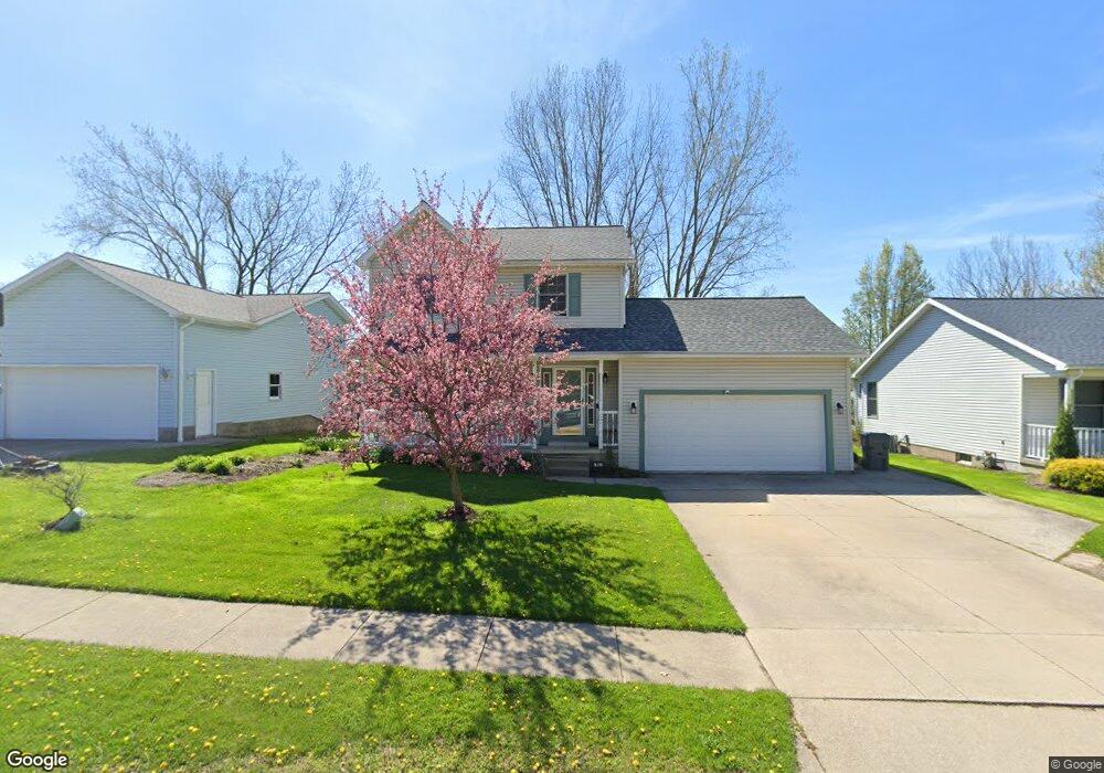
1943 E Gore Rd Erie, PA 16510
Millcreek NeighborhoodEstimated Value: $297,000 - $335,000
4
Beds
3
Baths
1,640
Sq Ft
$195/Sq Ft
Est. Value
About This Home
This home is located at 1943 E Gore Rd, Erie, PA 16510 and is currently estimated at $319,749, approximately $194 per square foot. 1943 E Gore Rd is a home located in Erie County with nearby schools including Belle Valley Elementary School, McDowell High School, and James S. Wilson Middle School.
Ownership History
Date
Name
Owned For
Owner Type
Purchase Details
Closed on
Sep 30, 2008
Sold by
Washek Stephen and Washek Vicki
Bought by
Kehl Steven J and Kehl Jennifer J
Current Estimated Value
Home Financials for this Owner
Home Financials are based on the most recent Mortgage that was taken out on this home.
Original Mortgage
$134,000
Outstanding Balance
$89,576
Interest Rate
6.54%
Mortgage Type
Purchase Money Mortgage
Estimated Equity
$230,173
Purchase Details
Closed on
Mar 14, 1997
Sold by
Colussi Louis A
Bought by
Washek Stephen
Create a Home Valuation Report for This Property
The Home Valuation Report is an in-depth analysis detailing your home's value as well as a comparison with similar homes in the area
Home Values in the Area
Average Home Value in this Area
Purchase History
| Date | Buyer | Sale Price | Title Company |
|---|---|---|---|
| Kehl Steven J | $167,500 | None Available | |
| Washek Stephen | $127,900 | -- |
Source: Public Records
Mortgage History
| Date | Status | Borrower | Loan Amount |
|---|---|---|---|
| Open | Kehl Steven J | $134,000 |
Source: Public Records
Tax History Compared to Growth
Tax History
| Year | Tax Paid | Tax Assessment Tax Assessment Total Assessment is a certain percentage of the fair market value that is determined by local assessors to be the total taxable value of land and additions on the property. | Land | Improvement |
|---|---|---|---|---|
| 2025 | $4,943 | $179,870 | $36,300 | $143,570 |
| 2024 | $4,814 | $179,870 | $36,300 | $143,570 |
| 2023 | $4,544 | $179,870 | $36,300 | $143,570 |
| 2022 | $4,366 | $179,870 | $36,300 | $143,570 |
| 2021 | $4,319 | $179,870 | $36,300 | $143,570 |
| 2020 | $4,274 | $179,870 | $36,300 | $143,570 |
| 2019 | $4,203 | $179,870 | $36,300 | $143,570 |
| 2018 | $4,100 | $179,870 | $36,300 | $143,570 |
| 2017 | $4,091 | $179,870 | $36,300 | $143,570 |
| 2016 | $4,819 | $179,870 | $36,300 | $143,570 |
| 2015 | $4,774 | $179,870 | $36,300 | $143,570 |
| 2014 | $1,526 | $179,870 | $36,300 | $143,570 |
Source: Public Records
Map
Nearby Homes
- 2034 E Gore Rd
- 0 Conrad Rd
- 4315 Fargo St
- 4206 Stanton St
- 4030 Mcclelland Ave
- 2021 E 38th St
- 3950 Rice Ave
- 3816 Stanton St
- 2227 E 38th St
- 4102 Davison Ave
- 5149 Henderson Rd Unit 139
- 5149 Henderson Rd Unit 110
- 2259 E 38th St
- 1323 E Grandview Blvd
- 2554 Pepper Tree Dr
- 4309 Koehler Rd
- 1621 E 37th St
- 8220 Wattsburg Rd
- 0 Old French Rd Unit 181790
- 4813 Grouse Hollow Dr
- 1937 E Gore Rd
- 1949 E Gore Rd
- 1931 E Gore Rd
- 2003 E Gore Rd
- 1944 E Gore Rd
- 1950 E Gore Rd
- 1938 E Gore Rd
- 2009 E Gore Rd
- 1925 E Gore Rd
- 1932 E Gore Rd
- 2004 E Gore Rd
- 1919 E Gore Rd
- 1944 Asheboro Dr
- 2015 E Gore Rd
- 1926 E Gore Rd
- 1950 Asheboro Dr
- 2010 E Gore Rd
- 2002 Asheboro Dr
- 1932 Asheboro Dr
- 2008 Asheboro Dr