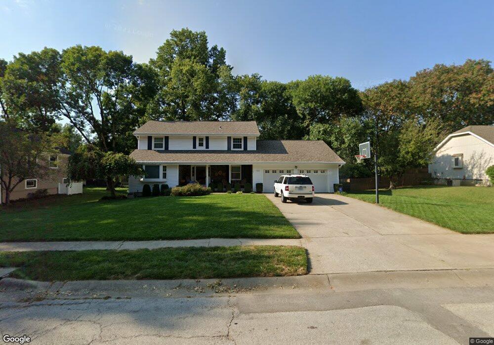
1943 Larkspur Dr Liberty, MO 64068
Estimated Value: $372,394 - $401,000
4
Beds
3
Baths
2,154
Sq Ft
$180/Sq Ft
Est. Value
About This Home
This home is located at 1943 Larkspur Dr, Liberty, MO 64068 and is currently estimated at $388,099, approximately $180 per square foot. 1943 Larkspur Dr is a home located in Clay County with nearby schools including Alexander Doniphan Elementary School, Discovery Middle School, and Liberty High School.
Ownership History
Date
Name
Owned For
Owner Type
Purchase Details
Closed on
Jan 19, 1999
Sold by
Alvey John W and Alvey Christine D
Bought by
Alvey John W and Alvey Christine D
Current Estimated Value
Home Financials for this Owner
Home Financials are based on the most recent Mortgage that was taken out on this home.
Original Mortgage
$90,225
Interest Rate
6.66%
Create a Home Valuation Report for This Property
The Home Valuation Report is an in-depth analysis detailing your home's value as well as a comparison with similar homes in the area
Home Values in the Area
Average Home Value in this Area
Purchase History
| Date | Buyer | Sale Price | Title Company |
|---|---|---|---|
| Alvey John W | -- | -- |
Source: Public Records
Mortgage History
| Date | Status | Borrower | Loan Amount |
|---|---|---|---|
| Previous Owner | Alvey John W | $90,225 |
Source: Public Records
Tax History Compared to Growth
Tax History
| Year | Tax Paid | Tax Assessment Tax Assessment Total Assessment is a certain percentage of the fair market value that is determined by local assessors to be the total taxable value of land and additions on the property. | Land | Improvement |
|---|---|---|---|---|
| 2025 | $3,819 | $57,080 | -- | -- |
| 2024 | $3,819 | $49,650 | -- | -- |
| 2023 | $3,883 | $49,650 | $0 | $0 |
| 2022 | $3,636 | $45,900 | $0 | $0 |
| 2021 | $3,608 | $45,904 | $7,220 | $38,684 |
| 2020 | $3,497 | $41,780 | $0 | $0 |
| 2019 | $3,496 | $41,781 | $6,840 | $34,941 |
| 2018 | $3,108 | $36,460 | $0 | $0 |
| 2017 | $2,630 | $36,460 | $4,180 | $32,280 |
| 2016 | $2,630 | $31,140 | $4,180 | $26,960 |
| 2015 | $2,630 | $31,140 | $4,180 | $26,960 |
| 2014 | $2,588 | $30,400 | $4,750 | $25,650 |
Source: Public Records
Map
Nearby Homes
- 1507 Amesbury Ave
- 1733 Welleslay Ln
- 1323 Amesbury Ave
- 509 Belmont St
- 420 Belmont St
- 415 Monterey Ave
- 1537 Canterbury Ln
- 1218 Canterbury Ln
- 2116 Winding Woods Dr
- 1124 Amesbury Ave
- Lot 2 Bent Oaks Dr
- Lot 2A Oak Crest Dr
- 918 Amesbury Ave
- 1327 Easton Ct
- 862 Amesbury Ave
- 1304 Wellington Way
- 1205 Blackberry Dr
- 1331 Park Ln
- 11852 N Kentucky Ave
- 1991 Harvest Rd
- 1937 Larkspur Dr
- 1949 Larkspur Dr
- 1702 Bluebell Ave
- 2001 Clay Cir
- 2000 Clay Cir
- 2005 Clay Dr
- 1948 Larkspur Dr
- 1708 Bluebell Ave
- 1942 Larkspur Dr
- 2011 Clay Dr
- 1701 Bluebell Ave
- 1936 Larkspur Dr
- 2000 Clay Dr
- 2021 Clay Dr
- 2005 Clay Cir
- 1707 Bluebell Ave
- 1714 Bluebell Ave
- 1944 Clay Dr
- 1930 Larkspur Dr
- 1939 Clay Dr