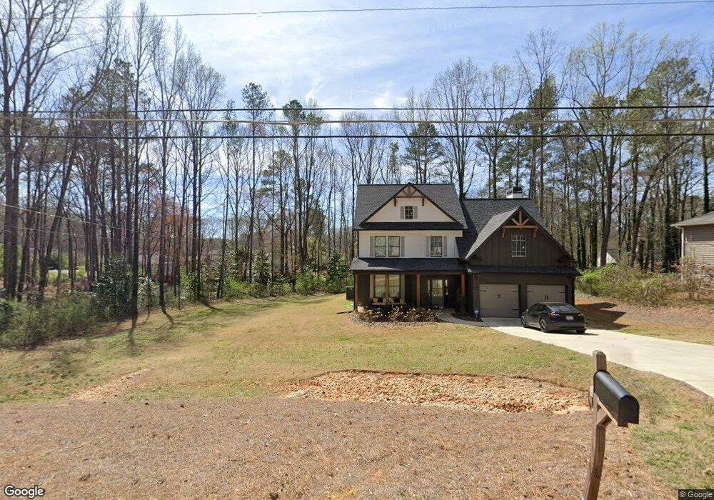
1943 Leila St Austell, GA 30106
Estimated Value: $495,000 - $584,000
4
Beds
3
Baths
2,782
Sq Ft
$197/Sq Ft
Est. Value
About This Home
This home is located at 1943 Leila St, Austell, GA 30106 and is currently estimated at $547,850, approximately $196 per square foot. 1943 Leila St is a home located in Cobb County with nearby schools including Deerwood Elementary School, Austell Elementary School, and Garrett Middle School.
Ownership History
Date
Name
Owned For
Owner Type
Purchase Details
Closed on
May 11, 2022
Sold by
B & R Investments And Construction Llc
Bought by
Haynes Charmeisha
Current Estimated Value
Home Financials for this Owner
Home Financials are based on the most recent Mortgage that was taken out on this home.
Original Mortgage
$510,150
Outstanding Balance
$481,259
Interest Rate
4.67%
Mortgage Type
New Conventional
Estimated Equity
$66,591
Purchase Details
Closed on
Aug 16, 2021
Sold by
Mahmoudi Pousty Mr
Bought by
B & R Investments And Construction Llc
Home Financials for this Owner
Home Financials are based on the most recent Mortgage that was taken out on this home.
Original Mortgage
$340,000
Interest Rate
2.9%
Mortgage Type
Purchase Money Mortgage
Create a Home Valuation Report for This Property
The Home Valuation Report is an in-depth analysis detailing your home's value as well as a comparison with similar homes in the area
Home Values in the Area
Average Home Value in this Area
Purchase History
| Date | Buyer | Sale Price | Title Company |
|---|---|---|---|
| Haynes Charmeisha | $550,000 | Kham Law Llc | |
| B & R Investments And Construction Llc | $70,000 | None Available |
Source: Public Records
Mortgage History
| Date | Status | Borrower | Loan Amount |
|---|---|---|---|
| Open | Haynes Charmeisha | $510,150 | |
| Previous Owner | B & R Investments And Construction Llc | $340,000 |
Source: Public Records
Tax History Compared to Growth
Tax History
| Year | Tax Paid | Tax Assessment Tax Assessment Total Assessment is a certain percentage of the fair market value that is determined by local assessors to be the total taxable value of land and additions on the property. | Land | Improvement |
|---|---|---|---|---|
| 2025 | $6,413 | $226,348 | $16,000 | $210,348 |
| 2024 | $6,417 | $226,348 | $16,000 | $210,348 |
| 2023 | $5,528 | $210,348 | $16,000 | $194,348 |
| 2022 | $425 | $14,000 | $14,000 | $0 |
| 2021 | $364 | $12,000 | $12,000 | $0 |
| 2020 | $364 | $12,000 | $12,000 | $0 |
| 2019 | $97 | $3,200 | $3,200 | $0 |
| 2018 | $97 | $3,200 | $3,200 | $0 |
| 2017 | $92 | $3,200 | $3,200 | $0 |
| 2016 | $92 | $3,200 | $3,200 | $0 |
| 2015 | $94 | $3,200 | $3,200 | $0 |
| 2014 | -- | $3,240 | $0 | $0 |
Source: Public Records
Map
Nearby Homes
- 1943 Arnold Dr
- 1971 Annette Ln
- 1 Perkerson Mill Rd SW
- 5164 Medford Ln
- 5154 Medford Ln
- Bayberry Plan at Sawmill Creek - Bungalow Series
- Wisteria Plan at Sawmill Creek - Bungalow Series
- Redbud Plan at Sawmill Creek - Bungalow Series
- 1803 Gherry Dr
- Laurel Plan at Avenbrook
- Rosedale Plan at Avenbrook
- Fulmont at Avenbrook Plan at Avenbrook
- Addison Plan at Avenbrook
- Conley Plan at Avenbrook
- 1645 Fulmont Cir
- 2179 Warren Dr
- 2136 Perkerson Mill Rd SW
- 0 Harris St Unit 7661273
- 5410 Beth Dr
- 1675 Huntcrest Park SW
- 1943 Leila St Unit 1943&1953
- 1943 Lelia St
- 1961 Lelia St
- 1933 Lelia St
- 1959 Oakbluff Dr
- 1950 Arnold Dr Unit 30
- 1950 Arnold Dr
- 1933 Leila St
- 1973 Lelia St
- 1955 Oakbluff Way SW
- 1955 Oakbluff Dr Unit 1955
- 1955 Oakbluff Dr
- 1955 Oakbluff Dr Unit 1
- 1930 Arnold Dr
- 1963 Oakbluff Dr
- 1951 Oakbluff Dr
- 1951 Oakbluff Dr
- 1970 Arnold Dr
- 1920 Arnold Dr
- 1984 Arnold Dr