Estimated Value: $521,000
3
Beds
2
Baths
2,914
Sq Ft
$179/Sq Ft
Est. Value
About This Home
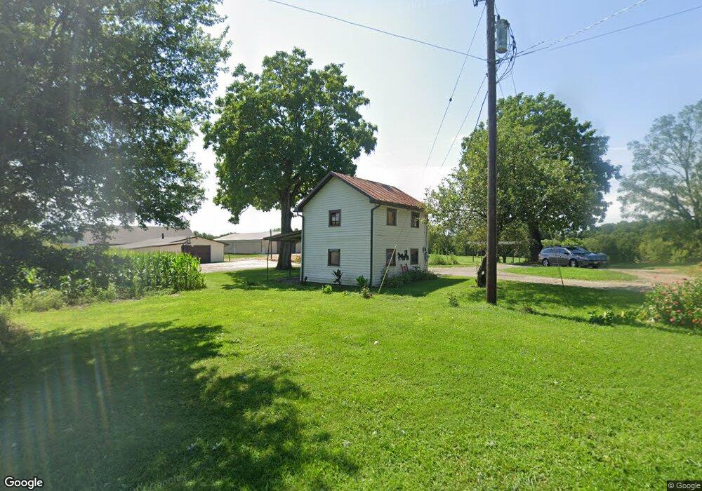
This home is located at 1943 Stone Rd, Xenia, OH 45385 and is currently estimated at $521,000, approximately $178 per square foot. 1943 Stone Rd is a home located in Greene County with nearby schools including Xenia High School.
Ownership History
Date
Name
Owned For
Owner Type
Purchase Details
Closed on
Nov 5, 2021
Sold by
Davis Terry E and Davis Barbara L
Bought by
Honnold Cary and Honnold Shelley
Current Estimated Value
Purchase Details
Closed on
Dec 3, 2020
Sold by
Davis Terry E and Davis Barbara L
Bought by
Boike Robert D and Boike Alicia L
Purchase Details
Closed on
Nov 20, 2014
Sold by
Davis Terry E
Bought by
Davis Terry E and Davis Barbara L
Home Financials for this Owner
Home Financials are based on the most recent Mortgage that was taken out on this home.
Original Mortgage
$457,000
Interest Rate
3.91%
Mortgage Type
Future Advance Clause Open End Mortgage
Purchase Details
Closed on
May 16, 2011
Sold by
Davis William A and Davis Betty L
Bought by
Davis William A
Home Financials for this Owner
Home Financials are based on the most recent Mortgage that was taken out on this home.
Original Mortgage
$253,687
Interest Rate
4.91%
Mortgage Type
Stand Alone Refi Refinance Of Original Loan
Create a Home Valuation Report for This Property
The Home Valuation Report is an in-depth analysis detailing your home's value as well as a comparison with similar homes in the area
Home Values in the Area
Average Home Value in this Area
Purchase History
| Date | Buyer | Sale Price | Title Company |
|---|---|---|---|
| Honnold Cary | $339,200 | None Available | |
| Boike Robert D | $350,300 | None Available | |
| Davis Terry E | $632,000 | None Available | |
| Davis William A | -- | Attorney |
Source: Public Records
Mortgage History
| Date | Status | Borrower | Loan Amount |
|---|---|---|---|
| Previous Owner | Davis Terry E | $457,000 | |
| Previous Owner | Davis William A | $253,687 |
Source: Public Records
Tax History Compared to Growth
Tax History
| Year | Tax Paid | Tax Assessment Tax Assessment Total Assessment is a certain percentage of the fair market value that is determined by local assessors to be the total taxable value of land and additions on the property. | Land | Improvement |
|---|---|---|---|---|
| 2024 | $3,131 | $146,410 | $84,670 | $61,740 |
| 2023 | $3,131 | $147,380 | $84,670 | $62,710 |
| 2022 | $3,586 | $136,520 | $70,100 | $66,420 |
| 2021 | $4,692 | $162,840 | $96,420 | $66,420 |
| 2020 | $4,508 | $162,840 | $96,420 | $66,420 |
| 2019 | $4,845 | $145,980 | $84,580 | $61,400 |
| 2018 | $4,862 | $145,980 | $84,580 | $61,400 |
| 2017 | $3,620 | $145,980 | $84,580 | $61,400 |
| 2016 | $5,574 | $136,200 | $75,300 | $60,900 |
| 2015 | $5,443 | $136,200 | $75,300 | $60,900 |
| 2014 | $8,183 | $137,230 | $75,300 | $61,930 |
Source: Public Records
Map
Nearby Homes
- 1293 Gultice Rd
- 2400 U S 68
- 1736 Winchester Rd
- 2783 Us Route 68 S
- 966 U S 68
- 841 Paintersville New Jasp Rd
- 0 U S 68
- 01 Jasper Rd
- 2268 E Spring Valley Paintersville Rd
- 0 Jasper Rd Unit 931350
- 0 Gultice Rd Unit 940427
- 3710 N Lakeshore Dr
- OA Apache Trail
- 827 Blackfoot Trail
- 3620 Old Winchester Trail
- 0A Old Winchester Trail
- 0C Old Winchester Trail
- 0B Old Winchester Trail
- 260 Pocahontas St
- 875 Osage Trail
- 1943 Stone Rd Unit 1
- 1897 Stone Rd
- 1881 Stone Rd
- 1850 Stone Rd
- 1798 Needmore Rd
- 1811 Ireland Rd
- 289 Sutton Rd
- 1766 Needmore Rd
- 1783 Ireland Rd
- 1788 Needmore Rd
- 1846 Needmore Rd
- 1824 Ireland Rd
- 1827 Stone Rd
- 1791 Needmore Rd
- 1786 Ireland Rd
- 2163 Stone Rd
- 1761 Needmore Rd
- 1811 Stone Rd
- 0 Stone Rd Unit 2736788
- 0 Stone Rd Unit 2736785