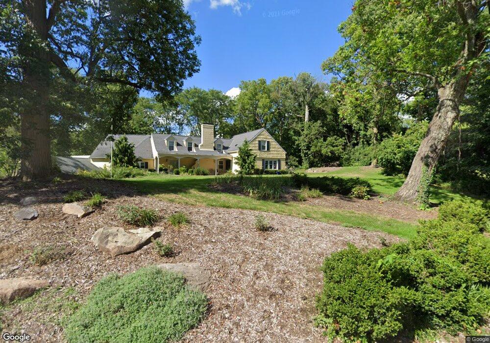
1943 Tait Circle Rd Dayton, OH 45429
Estimated Value: $560,103 - $601,000
4
Beds
4
Baths
3,201
Sq Ft
$182/Sq Ft
Est. Value
About This Home
This home is located at 1943 Tait Circle Rd, Dayton, OH 45429 and is currently estimated at $582,026, approximately $181 per square foot. 1943 Tait Circle Rd is a home located in Montgomery County with nearby schools including Southdale Elementary School, Van Buren Middle School, and Kettering Fairmont High School.
Ownership History
Date
Name
Owned For
Owner Type
Purchase Details
Closed on
Mar 6, 2006
Sold by
Lindley Douglas N and Lindley Kimberly K
Bought by
Heaton Daniel R and Heaton Linda Kay
Current Estimated Value
Home Financials for this Owner
Home Financials are based on the most recent Mortgage that was taken out on this home.
Original Mortgage
$168,800
Outstanding Balance
$96,298
Interest Rate
6.33%
Mortgage Type
Fannie Mae Freddie Mac
Estimated Equity
$485,728
Create a Home Valuation Report for This Property
The Home Valuation Report is an in-depth analysis detailing your home's value as well as a comparison with similar homes in the area
Home Values in the Area
Average Home Value in this Area
Purchase History
| Date | Buyer | Sale Price | Title Company |
|---|---|---|---|
| Heaton Daniel R | $336,000 | None Available |
Source: Public Records
Mortgage History
| Date | Status | Borrower | Loan Amount |
|---|---|---|---|
| Open | Heaton Daniel R | $168,800 |
Source: Public Records
Tax History Compared to Growth
Tax History
| Year | Tax Paid | Tax Assessment Tax Assessment Total Assessment is a certain percentage of the fair market value that is determined by local assessors to be the total taxable value of land and additions on the property. | Land | Improvement |
|---|---|---|---|---|
| 2024 | $7,666 | $133,080 | $27,900 | $105,180 |
| 2023 | $7,666 | $133,080 | $27,900 | $105,180 |
| 2022 | $9,325 | $128,030 | $26,820 | $101,210 |
| 2021 | $8,622 | $128,030 | $26,820 | $101,210 |
| 2020 | $8,648 | $128,030 | $26,820 | $101,210 |
| 2019 | $8,995 | $118,470 | $26,820 | $91,650 |
| 2018 | $9,044 | $118,470 | $26,820 | $91,650 |
| 2017 | $8,326 | $118,470 | $26,820 | $91,650 |
| 2016 | $8,296 | $111,470 | $26,820 | $84,650 |
| 2015 | $7,923 | $111,470 | $26,820 | $84,650 |
| 2014 | $7,923 | $111,470 | $26,820 | $84,650 |
| 2012 | -- | $109,560 | $26,820 | $82,740 |
Source: Public Records
Map
Nearby Homes
- 1905 Tait Circle Rd
- 4458 Moraine Ridge Ln
- 4301 Tait Rd
- 2174 Renshaw Ave
- 2227 Los Arrow Dr
- 1881 Mattis Dr
- 4661 Richwood Dr
- 1955 Kresswood Cir
- 1673 W Stroop Rd
- 1524 Hillwood Dr
- 4792 Loxley Dr
- 1692 Hillwood Dr
- 3915 Utica Dr
- 1773 Hillwood Dr
- 4796 Lamme Rd
- 4400 Royal Ridge Way
- 5048 Oak Manor Ct
- 3789 Elmira Dr
- 4207 S Dixie Dr
- 4005 Ellery Ave
- 1907 Tait Circle Rd
- 1931 Tait Circle Rd
- 4372 Stonehenge Ln
- 19 Tait Circle Rd
- 0 Tait Circle Rd Unit 612840
- 4380 Stonehenge Ln
- 4485 Tait Rd
- 200 Tait Rd
- 4700 Stonehenge Ln
- 1916 Tait Circle Rd
- 1908 Tait Circle Rd
- 1901 Tait Circle Rd
- 600 Tait Rd
- 1944 Tait Circle Rd
- 1949 Tait Circle Rd
- 1952 Tait Circle Rd
- 4369 Stonehenge Ln
- 4455 Tait Rd
- 4377 Stonehenge Ln
- 4671 Moraine Ridge Ln