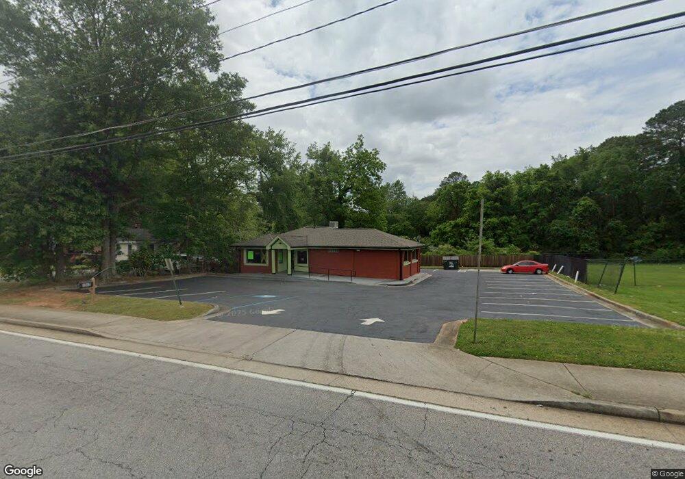
1943 Wesley Chapel Rd Decatur, GA 30035
Southwest DeKalb NeighborhoodEstimated Value: $400,663
2
Beds
1
Bath
1,748
Sq Ft
$229/Sq Ft
Est. Value
About This Home
This home is located at 1943 Wesley Chapel Rd, Decatur, GA 30035 and is currently estimated at $400,663, approximately $229 per square foot. 1943 Wesley Chapel Rd is a home located in DeKalb County with nearby schools including Canby Lane Elementary School, Mary McLeod Bethune Middle School, and Towers High School.
Ownership History
Date
Name
Owned For
Owner Type
Purchase Details
Closed on
Oct 25, 2021
Sold by
Rags Enterprises Llc
Bought by
Eat Right Caribbean Restaurant Inc
Current Estimated Value
Purchase Details
Closed on
Feb 26, 2016
Sold by
Rankine Waldon
Bought by
Rags Enterprises Llc
Home Financials for this Owner
Home Financials are based on the most recent Mortgage that was taken out on this home.
Original Mortgage
$176,250
Interest Rate
3.79%
Create a Home Valuation Report for This Property
The Home Valuation Report is an in-depth analysis detailing your home's value as well as a comparison with similar homes in the area
Home Values in the Area
Average Home Value in this Area
Purchase History
| Date | Buyer | Sale Price | Title Company |
|---|---|---|---|
| Eat Right Caribbean Restaurant Inc | $350,000 | -- | |
| Rags Enterprises Llc | $235,000 | -- |
Source: Public Records
Mortgage History
| Date | Status | Borrower | Loan Amount |
|---|---|---|---|
| Previous Owner | Rags Enterprises Llc | $176,250 |
Source: Public Records
Tax History Compared to Growth
Tax History
| Year | Tax Paid | Tax Assessment Tax Assessment Total Assessment is a certain percentage of the fair market value that is determined by local assessors to be the total taxable value of land and additions on the property. | Land | Improvement |
|---|---|---|---|---|
| 2025 | $5,894 | $131,080 | $78,240 | $52,840 |
| 2024 | $5,085 | $112,840 | $72,200 | $40,640 |
| 2023 | $5,085 | $112,840 | $72,200 | $40,640 |
| 2022 | $5,873 | $132,160 | $90,280 | $41,880 |
| 2021 | $2,935 | $65,240 | $24,760 | $40,480 |
| 2020 | $2,935 | $65,240 | $24,760 | $40,480 |
| 2019 | $2,935 | $65,240 | $24,760 | $40,480 |
| 2018 | $2,961 | $65,240 | $24,760 | $40,480 |
| 2017 | $3,092 | $65,240 | $24,760 | $40,480 |
| 2016 | $2,955 | $65,240 | $24,760 | $40,480 |
| 2014 | $3,027 | $65,240 | $24,760 | $40,480 |
Source: Public Records
Map
Nearby Homes
- 4172 Brenda Dr
- 0 Brenda Dr Unit 8584601
- 0 Brenda Dr Unit 8577504
- 0 Brenda Dr Unit 8479629
- 0 Brenda Dr Unit 8441621
- 0 Brenda Dr Unit 7443530
- 0 Brenda Dr Unit 8763523
- 0 Brenda Dr Unit 8718881
- 0 Brenda Dr Unit 8454744
- 0 Brenda Dr Unit 7520531
- 0 Brenda Dr Unit 8786271
- 0 Brenda Dr Unit 7028625
- 0 Brenda Dr Unit 7486223
- 0 Brenda Dr Unit 7512838
- 0 Brenda Dr Unit 7586998
- 0 Brenda Dr
- 4166 Brenda Dr
- 4162 Brenda Dr
- 4173 Brenda Dr
- 4165 Brenda Dr