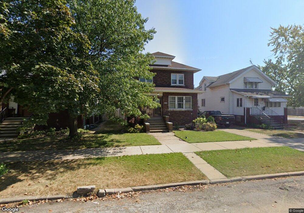
1943 Wespark Ave Whiting, IN 46394
Estimated Value: $246,000 - $272,000
4
Beds
2
Baths
2,128
Sq Ft
$122/Sq Ft
Est. Value
About This Home
This home is located at 1943 Wespark Ave, Whiting, IN 46394 and is currently estimated at $260,196, approximately $122 per square foot. 1943 Wespark Ave is a home located in Lake County with nearby schools including Benjamin Franklin Elementary School, Eggers Middle School, and Hammond High School.
Ownership History
Date
Name
Owned For
Owner Type
Purchase Details
Closed on
Jun 12, 2013
Sold by
Tokoly John J and Perez Tokoky
Bought by
Tokoly John J and Perez Tokoly Suzette
Current Estimated Value
Purchase Details
Closed on
Jun 6, 2008
Sold by
Tokoly John J
Bought by
Tokoly John J and Perez Suzette
Home Financials for this Owner
Home Financials are based on the most recent Mortgage that was taken out on this home.
Original Mortgage
$40,500
Interest Rate
5.88%
Mortgage Type
Purchase Money Mortgage
Purchase Details
Closed on
Apr 25, 2008
Sold by
Knazur Maria S and Bair Maria S
Bought by
Tokoly John J
Home Financials for this Owner
Home Financials are based on the most recent Mortgage that was taken out on this home.
Original Mortgage
$40,500
Interest Rate
5.88%
Mortgage Type
Purchase Money Mortgage
Create a Home Valuation Report for This Property
The Home Valuation Report is an in-depth analysis detailing your home's value as well as a comparison with similar homes in the area
Home Values in the Area
Average Home Value in this Area
Purchase History
| Date | Buyer | Sale Price | Title Company |
|---|---|---|---|
| Tokoly John J | -- | None Available | |
| Tokoly John J | -- | None Available | |
| Tokoly John J | -- | None Available |
Source: Public Records
Mortgage History
| Date | Status | Borrower | Loan Amount |
|---|---|---|---|
| Closed | Tokoly John J | $40,500 |
Source: Public Records
Tax History Compared to Growth
Tax History
| Year | Tax Paid | Tax Assessment Tax Assessment Total Assessment is a certain percentage of the fair market value that is determined by local assessors to be the total taxable value of land and additions on the property. | Land | Improvement |
|---|---|---|---|---|
| 2024 | $10,013 | $246,000 | $35,000 | $211,000 |
| 2023 | $2,685 | $209,500 | $36,400 | $173,100 |
| 2022 | $2,685 | $201,400 | $36,400 | $165,000 |
| 2021 | $2,485 | $185,700 | $24,500 | $161,200 |
| 2020 | $2,560 | $189,600 | $24,500 | $165,100 |
| 2019 | $2,593 | $183,400 | $24,500 | $158,900 |
| 2018 | $2,702 | $176,500 | $24,500 | $152,000 |
| 2017 | $3,026 | $173,900 | $24,500 | $149,400 |
| 2016 | $2,543 | $168,700 | $24,500 | $144,200 |
| 2014 | $5,298 | $170,200 | $24,500 | $145,700 |
| 2013 | $2,232 | $156,300 | $24,500 | $131,800 |
Source: Public Records
Map
Nearby Homes
- 1916 Wespark Ave
- 2024 Lake Ave
- 2036 Atchison Ave
- 1014 Reese Ave
- 2134 Lincoln Ave
- 2231 Davis Ave
- 1944 Warwick Ave
- 1314 121st St
- 1710 Atchison Ave
- 1726 Davis Ave
- 1704 Central Ave
- 1630 Cleveland Ave
- 2027 1/2 Davidson Place
- 2019 Davidson Place
- 2033 Davidson Place
- 1631 Cleveland Ave
- 1813 Sheridan Ave
- 1828 Oliver St
- 1717 Warwick Ave
- 2140 Indianapolis Blvd
- 1947 Wespark Ave
- 1941 Wespark Ave
- 1937 Wespark Ave
- 1935 Wespark Ave
- 1946 Superior Ave
- 1942 Superior Ave
- 1948 Superior Ave
- 2005 Wespark Ave
- 1940 Superior Ave
- 1931 Wespark Ave
- 1946 Wespark Ave
- 1936 Superior Ave
- 1948 Wespark Ave
- 1942 Wespark Ave
- 2007 Wespark Ave
- 2006 Superior Ave
- 1927 Wespark Ave
- 1934 Superior Ave
- 1936 Wespark Ave
- 2009 Wespark Ave