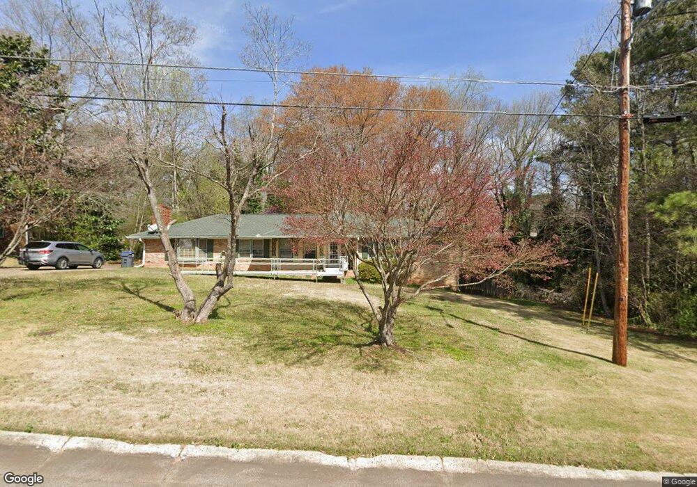
1944 Brannon Dr Unit 2 Austell, GA 30106
Estimated Value: $301,000 - $391,000
3
Beds
2
Baths
2,202
Sq Ft
$151/Sq Ft
Est. Value
About This Home
This home is located at 1944 Brannon Dr Unit 2, Austell, GA 30106 and is currently estimated at $332,196, approximately $150 per square foot. 1944 Brannon Dr Unit 2 is a home located in Cobb County with nearby schools including Deerwood Elementary School, Austell Elementary School, and Garrett Middle School.
Ownership History
Date
Name
Owned For
Owner Type
Purchase Details
Closed on
Nov 8, 2017
Sold by
Acker
Bought by
Acker John N and Acker J E Jr Trust
Current Estimated Value
Purchase Details
Closed on
Apr 11, 2011
Sold by
Acker Joseph
Bought by
Acker J E Jr Living Trust
Purchase Details
Closed on
Sep 1, 2006
Sold by
Jge Props Inc
Bought by
Acker Joseph
Purchase Details
Closed on
Oct 28, 1999
Sold by
Atkinson Peter J and Atkinson Ana M
Bought by
Fox Daniel A and Fox Janet S
Home Financials for this Owner
Home Financials are based on the most recent Mortgage that was taken out on this home.
Original Mortgage
$131,450
Interest Rate
7.81%
Mortgage Type
VA
Purchase Details
Closed on
May 8, 1995
Sold by
Bannister Patsy C
Bought by
Atkinson Peter J
Create a Home Valuation Report for This Property
The Home Valuation Report is an in-depth analysis detailing your home's value as well as a comparison with similar homes in the area
Home Values in the Area
Average Home Value in this Area
Purchase History
| Date | Buyer | Sale Price | Title Company |
|---|---|---|---|
| Acker John N | -- | -- | |
| Acker J E Jr Living Trust | -- | -- | |
| Acker Joseph | $120,000 | -- | |
| Fox Daniel A | $128,900 | -- | |
| Atkinson Peter J | $92,500 | -- |
Source: Public Records
Mortgage History
| Date | Status | Borrower | Loan Amount |
|---|---|---|---|
| Previous Owner | Fox Daniel A | $131,450 | |
| Closed | Atkinson Peter J | $0 |
Source: Public Records
Tax History Compared to Growth
Tax History
| Year | Tax Paid | Tax Assessment Tax Assessment Total Assessment is a certain percentage of the fair market value that is determined by local assessors to be the total taxable value of land and additions on the property. | Land | Improvement |
|---|---|---|---|---|
| 2025 | $4,158 | $138,012 | $24,000 | $114,012 |
| 2024 | $4,161 | $138,012 | $24,000 | $114,012 |
| 2023 | $3,698 | $122,668 | $18,000 | $104,668 |
| 2022 | $1,847 | $60,844 | $10,000 | $50,844 |
| 2021 | $1,847 | $60,844 | $10,000 | $50,844 |
| 2020 | $1,659 | $54,672 | $10,000 | $44,672 |
| 2019 | $1,973 | $64,992 | $10,000 | $54,992 |
| 2018 | $1,542 | $50,820 | $7,200 | $43,620 |
| 2017 | $1,085 | $37,736 | $6,000 | $31,736 |
| 2016 | $1,091 | $37,964 | $5,600 | $32,364 |
| 2015 | $947 | $32,160 | $8,000 | $24,160 |
| 2014 | $955 | $32,160 | $0 | $0 |
Source: Public Records
Map
Nearby Homes
- 1971 Annette Ln
- 1803 Gherry Dr
- 1943 Arnold Dr
- 1841 Mobley St
- 0 Harris St Unit 7661273
- 1 Perkerson Mill Rd SW
- 5466 Davis Dr
- 5410 Beth Dr
- 5320 Beth Dr
- Laurel Plan at Avenbrook
- Rosedale Plan at Avenbrook
- Fulmont at Avenbrook Plan at Avenbrook
- Addison Plan at Avenbrook
- Conley Plan at Avenbrook
- 2140 Perkerson Mill Rd
- Bayberry Plan at Sawmill Creek - Bungalow Series
- Wisteria Plan at Sawmill Creek - Bungalow Series
- Redbud Plan at Sawmill Creek - Bungalow Series
- 5164 Medford Ln
- 5154 Medford Ln
- 1968 Brannon Dr
- 1920 Brannon Dr
- 1967 Annette Ln
- 1978 Brannon Dr
- 1947 Annette Ln SW
- 1947 Annette Ln Unit 8
- 1967 Brannon Dr
- 1937 Brannon Dr
- 1923 Annette Ln Unit 2
- 1977 Brannon Dr
- 1977 Annette Ln
- 1917 Annette Ln
- 1917 Annette Ln SW
- 1987 Brannon Dr
- 1988 Brannon Dr
- 1942 Gherry Dr
- 1900 Gherry Dr
- 1987 Annette Ln
- 1932 Annette Ln
- 1897 Annette Ln