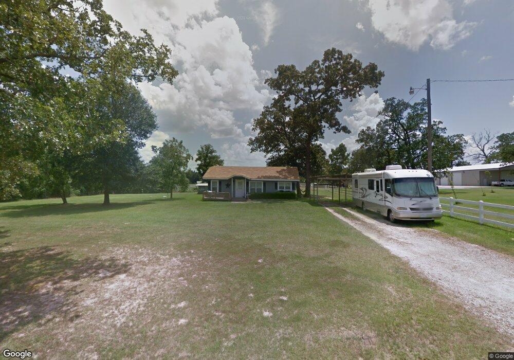
1944 Carrell Rd Lufkin, TX 75901
Estimated Value: $151,886 - $239,000
2
Beds
1
Bath
1,224
Sq Ft
$161/Sq Ft
Est. Value
About This Home
This home is located at 1944 Carrell Rd, Lufkin, TX 75901 and is currently estimated at $196,722, approximately $160 per square foot. 1944 Carrell Rd is a home located in Angelina County with nearby schools including Slack Elementary School, Burley Primary School, and Lufkin Middle School.
Ownership History
Date
Name
Owned For
Owner Type
Purchase Details
Closed on
Feb 23, 2021
Sold by
Reyes Brittany L and Henson Brittany L
Bought by
Reyes Hipolito
Current Estimated Value
Purchase Details
Closed on
Aug 30, 2011
Sold by
Strickland Travis Milton and Allen Strickland Cessali M
Bought by
Henson Brittany L
Home Financials for this Owner
Home Financials are based on the most recent Mortgage that was taken out on this home.
Original Mortgage
$81,542
Interest Rate
4.25%
Mortgage Type
FHA
Purchase Details
Closed on
Jun 28, 2007
Sold by
Durham Linda
Bought by
Strickland Travis Milton and Allen Cessali N
Home Financials for this Owner
Home Financials are based on the most recent Mortgage that was taken out on this home.
Original Mortgage
$78,000
Interest Rate
6.19%
Mortgage Type
New Conventional
Create a Home Valuation Report for This Property
The Home Valuation Report is an in-depth analysis detailing your home's value as well as a comparison with similar homes in the area
Home Values in the Area
Average Home Value in this Area
Purchase History
| Date | Buyer | Sale Price | Title Company |
|---|---|---|---|
| Reyes Hipolito | -- | None Available | |
| Henson Brittany L | -- | Community Title Company | |
| Strickland Travis Milton | $78,000 | Community Title |
Source: Public Records
Mortgage History
| Date | Status | Borrower | Loan Amount |
|---|---|---|---|
| Previous Owner | Henson Brittany L | $81,542 | |
| Previous Owner | Strickland Travis Milton | $78,000 |
Source: Public Records
Tax History Compared to Growth
Tax History
| Year | Tax Paid | Tax Assessment Tax Assessment Total Assessment is a certain percentage of the fair market value that is determined by local assessors to be the total taxable value of land and additions on the property. | Land | Improvement |
|---|---|---|---|---|
| 2025 | $2,085 | $131,830 | $41,170 | $90,660 |
| 2024 | $2,052 | $129,760 | $41,170 | $88,590 |
| 2023 | $1,815 | $128,430 | $41,170 | $87,260 |
| 2022 | $1,917 | $109,350 | $29,380 | $79,970 |
| 2021 | $1,985 | $102,740 | $29,380 | $73,360 |
| 2020 | $1,481 | $76,900 | $11,220 | $65,680 |
| 2019 | $1,592 | $76,960 | $11,220 | $65,740 |
| 2018 | $0 | $75,810 | $11,220 | $64,590 |
| 2017 | $0 | $73,370 | $11,220 | $62,150 |
Source: Public Records
Map
Nearby Homes
- R97410 Carrell Rd
- Tbd U S 69
- 4695 Farm-To-market 841
- 4685 Farm-To-market 841
- 570 E Texas Rd
- 4449 Benton Dr
- lot 1 Leslie Ln
- lot 3 Leslie Ln
- lot 2 Leslie Ln
- 191 Deer Ln
- 165 Preston St
- 132 Preston St
- 873 E Texas Rd
- 106 Oakwood Dr
- 4515 Farm-To-market 841
- 0 Farm-To-market 841
- 4311 Farm-To-market 841
- ID 13148 Farm-To-market 841
- 13.29 acres Joyce Ln
- 3749 Fm 841
- 1874 Carrell Rd
- 3 Fanny Carroll Rd
- 3 Fanny Carroll Rd
- 0 Fanny Carroll Rd
- R58719 Fanny Carroll Rd
- 1826 Fanny Carroll Rd
- 1847 Carrell Rd
- 1825 Carrell Rd
- 2320 Carrell Rd
- 1909 Carrell Rd
- 1909 Carrell Rd
- 2061 Carrell Rd
- 1591 Carrell Rd
- 1591 Carrell Rd
- 1591 Carrell Rd
- 1637 Carrell Rd
- 1567 Carrell Rd
- 1567 Carrell Rd
- 1507 Carrell Rd
- 5276 Fm 841