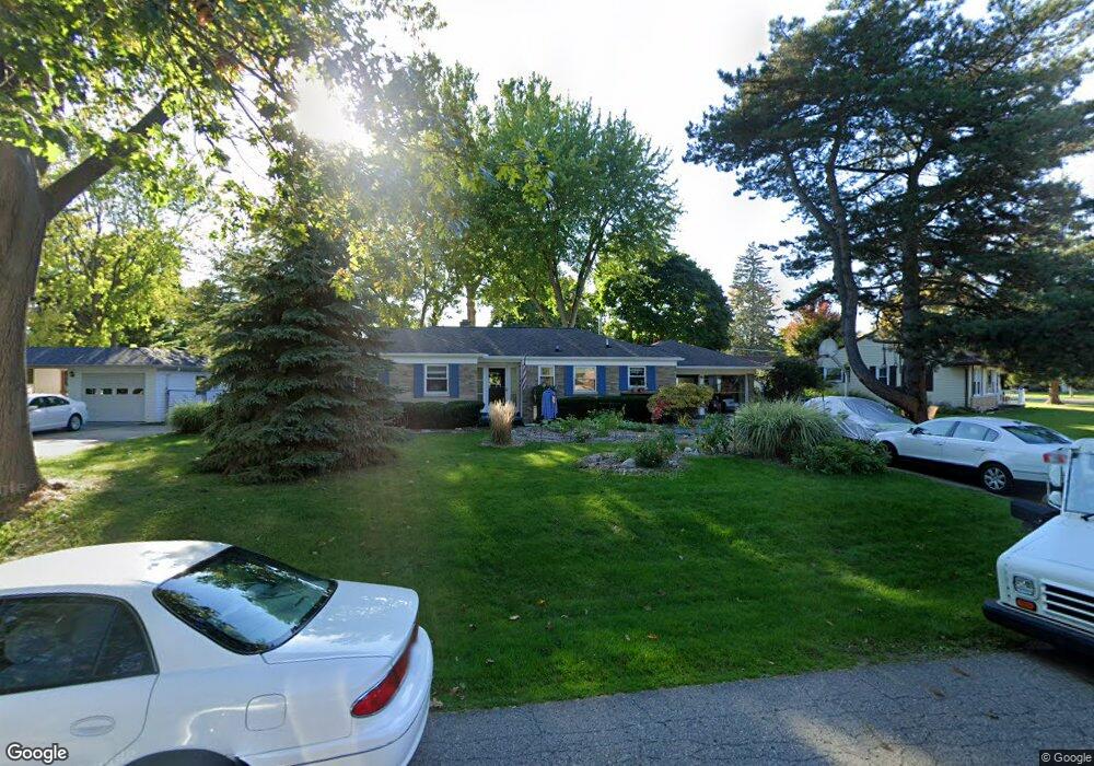
1944 Cumberland Rd Lansing, MI 48906
Northwestside NeighborhoodEstimated Value: $225,000 - $245,000
--
Bed
2
Baths
1,555
Sq Ft
$151/Sq Ft
Est. Value
About This Home
This home is located at 1944 Cumberland Rd, Lansing, MI 48906 and is currently estimated at $234,563, approximately $150 per square foot. 1944 Cumberland Rd is a home located in Ingham County with nearby schools including Cumberland Elementary School, Pattengill Academy, and J.W. Sexton High School.
Ownership History
Date
Name
Owned For
Owner Type
Purchase Details
Closed on
Jul 20, 2015
Sold by
Blackwell Dorothy R
Bought by
Richter Michael R
Current Estimated Value
Purchase Details
Closed on
Sep 14, 1999
Sold by
Wagener Stefan and Wagener Sharon Kay
Bought by
Blackwell Michael and Blackwell Dorothy
Home Financials for this Owner
Home Financials are based on the most recent Mortgage that was taken out on this home.
Original Mortgage
$98,950
Interest Rate
7.93%
Mortgage Type
Purchase Money Mortgage
Purchase Details
Closed on
Mar 1, 1995
Create a Home Valuation Report for This Property
The Home Valuation Report is an in-depth analysis detailing your home's value as well as a comparison with similar homes in the area
Home Values in the Area
Average Home Value in this Area
Purchase History
| Date | Buyer | Sale Price | Title Company |
|---|---|---|---|
| Richter Michael R | -- | None Available | |
| Blackwell Michael | $123,700 | Midstate Title Company | |
| -- | $95,000 | -- |
Source: Public Records
Mortgage History
| Date | Status | Borrower | Loan Amount |
|---|---|---|---|
| Previous Owner | Blackwell Michael | $98,950 |
Source: Public Records
Tax History Compared to Growth
Tax History
| Year | Tax Paid | Tax Assessment Tax Assessment Total Assessment is a certain percentage of the fair market value that is determined by local assessors to be the total taxable value of land and additions on the property. | Land | Improvement |
|---|---|---|---|---|
| 2025 | $4,620 | $115,000 | $15,700 | $99,300 |
| 2024 | $37 | $112,700 | $15,700 | $97,000 |
| 2023 | $4,329 | $94,700 | $15,700 | $79,000 |
| 2022 | $3,898 | $88,600 | $12,300 | $76,300 |
| 2021 | $3,817 | $82,800 | $10,100 | $72,700 |
| 2020 | $3,794 | $79,000 | $10,100 | $68,900 |
| 2019 | $3,640 | $71,600 | $10,100 | $61,500 |
| 2018 | $3,407 | $68,200 | $10,100 | $58,100 |
| 2017 | $3,263 | $68,200 | $10,100 | $58,100 |
| 2016 | $3,120 | $61,800 | $10,100 | $51,700 |
| 2015 | $3,120 | $58,500 | $20,187 | $38,313 |
| 2014 | $3,120 | $56,200 | $24,224 | $31,976 |
Source: Public Records
Map
Nearby Homes
- 2111 Delta River Dr
- 2220 Delta River Dr
- 5250 N Grand River Ave
- 2241 Cumberland Rd
- 4005 N Grand River Ave
- 3021 N Grand River Ave
- 2316 Barstow Rd
- 1523 Biltmore Blvd
- 2400 Leon Ave
- 1900 Kaplan St
- 4221 N Grand River Ave
- 1425 Muskegon Ave
- 2123 Cogswell Dr
- 2519 Byrnes Rd
- 2300 Byrnes Rd
- 1620 Comfort St
- 2206 Kuerbitz Dr
- 2524 Newport Dr
- 2601 Newport Dr
- 3230 Sheffer Ave
- 1950 Cumberland Rd
- 1930 Cumberland Rd
- 1916 Cumberland Rd
- 2004 Cumberland Rd
- 1910 Cumberland Rd
- 1951 Cumberland Rd
- 1935 Cumberland Rd
- 2005 Cumberland Rd
- 1945 Cumberland Rd
- 2014 Cumberland Rd
- 1939 Cumberland Rd
- 1931 Cumberland Rd
- 1902 Cumberland Rd
- 1927 Cumberland Rd
- 1923 Cumberland Rd
- 1917 Cumberland Rd
- 2011 Cumberland Rd
- 2218 Pembroke Rd
- 2024 Cumberland Rd
- 1909 Cumberland Rd