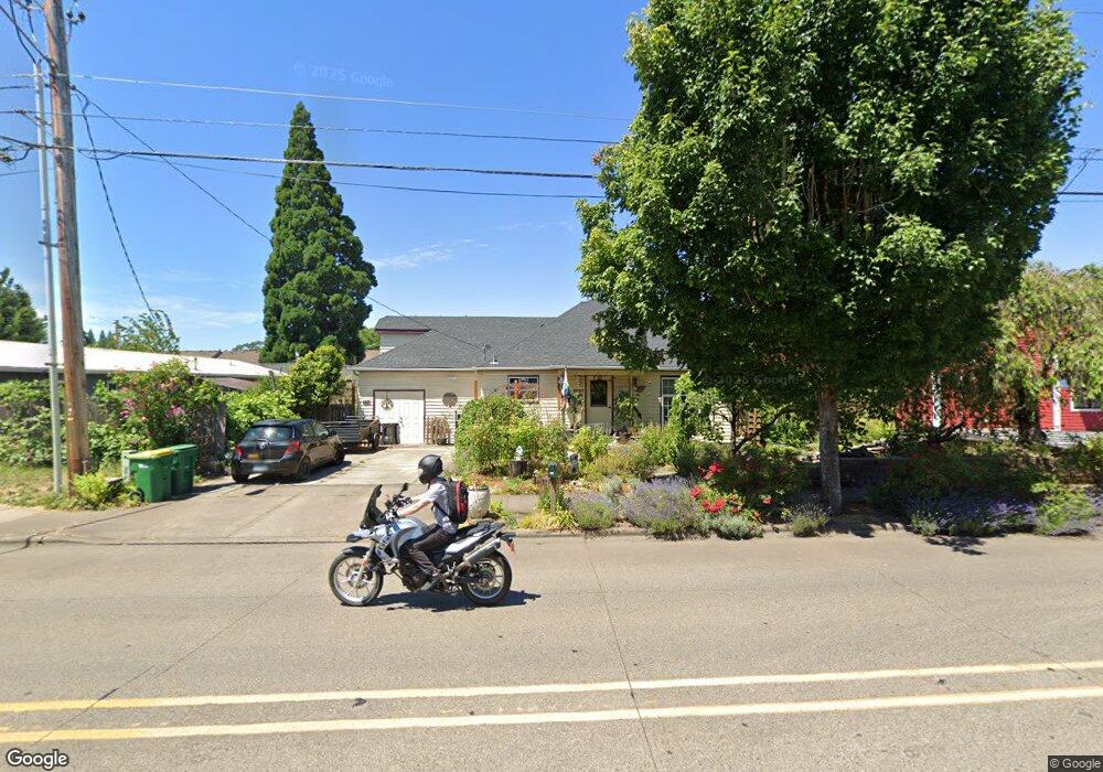
1944 Maple St Forest Grove, OR 97116
Estimated Value: $446,000 - $478,000
3
Beds
2
Baths
1,796
Sq Ft
$256/Sq Ft
Est. Value
About This Home
This home is located at 1944 Maple St, Forest Grove, OR 97116 and is currently estimated at $459,369, approximately $255 per square foot. 1944 Maple St is a home located in Washington County with nearby schools including Joseph Gale Elementary School, Neil Armstrong Middle School, and Tom McCall Upper Elementary School.
Ownership History
Date
Name
Owned For
Owner Type
Purchase Details
Closed on
May 24, 2002
Sold by
Vanbemmel Daniel D and Vanbemmel Julie A
Bought by
Scott Kevin C and Scott Jennifer L
Current Estimated Value
Home Financials for this Owner
Home Financials are based on the most recent Mortgage that was taken out on this home.
Original Mortgage
$157,429
Outstanding Balance
$65,634
Interest Rate
6.89%
Mortgage Type
FHA
Estimated Equity
$393,735
Create a Home Valuation Report for This Property
The Home Valuation Report is an in-depth analysis detailing your home's value as well as a comparison with similar homes in the area
Purchase History
| Date | Buyer | Sale Price | Title Company |
|---|---|---|---|
| Scott Kevin C | $159,900 | Fidelity National Title Co |
Source: Public Records
Mortgage History
| Date | Status | Borrower | Loan Amount |
|---|---|---|---|
| Open | Scott Kevin C | $157,429 |
Source: Public Records
Tax History
| Year | Tax Paid | Tax Assessment Tax Assessment Total Assessment is a certain percentage of the fair market value that is determined by local assessors to be the total taxable value of land and additions on the property. | Land | Improvement |
|---|---|---|---|---|
| 2026 | $1,439 | $80,810 | -- | -- |
| 2025 | $1,439 | $78,460 | -- | -- |
| 2024 | $1,389 | $76,180 | -- | -- |
| 2023 | $1,389 | $73,970 | $0 | $0 |
| 2022 | $1,214 | $73,970 | $0 | $0 |
| 2021 | $1,198 | $69,730 | $0 | $0 |
| 2020 | $1,192 | $67,700 | $0 | $0 |
| 2019 | $1,165 | $65,730 | $0 | $0 |
| 2018 | $1,130 | $63,820 | $0 | $0 |
| 2017 | $1,095 | $61,970 | $0 | $0 |
| 2016 | $1,064 | $60,170 | $0 | $0 |
| 2015 | $1,023 | $58,420 | $0 | $0 |
| 2014 | $1,018 | $56,720 | $0 | $0 |
Source: Public Records
Map
Nearby Homes
- 2902 19th Ave
- 2210 Maple St
- 3404 19th Ave Unit 215
- 3404 19th Ave Unit 103
- 0 Kingwood St
- 2820 19th Ave
- 3457 Poplar Ct
- 2813 Maywood Dr
- 2366 Kingwood St
- 1821 Hawthorne St
- 3128 Brittany Dr
- 1822 Hawthorne St
- 2358 Kingwood St
- 2991 25th Ave
- 1813 Filbert St
- 1701 Fir Rd
- 2025 Elm St Unit 1-D
- 2743 15th Place
- 1721 Sequoia Ct
- 2837 25th Place
- 3129-3133 19th Place Forest Grove
- 3129 19th Place
- 3127 19th Place
- 3130 Pacific Ave
- 3133 19th Place
- 1926 Maple St
- 3115 19th Place
- 1925 Maple St
- 3118 19th Place
- 1916 Maple St
- 3118 19th Ave
- 3116 19th Place
- 1912 Maple St
- 3103 Pacific Ave
- 3121 19th Ave
- 1902 Maple St
- 3127 Pacific Ave
- 3139 Pacific Ave
- 3113 19th Ave
- 2017 Laurel St
Your Personal Tour Guide
Ask me questions while you tour the home.