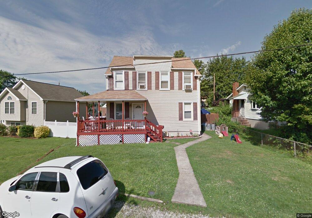
1944 Maxwell Ave Dundalk, MD 21222
Estimated Value: $277,000 - $320,000
Studio
1
Bath
1,776
Sq Ft
$169/Sq Ft
Est. Value
About This Home
This home is located at 1944 Maxwell Ave, Dundalk, MD 21222 and is currently estimated at $299,389, approximately $168 per square foot. 1944 Maxwell Ave is a home located in Baltimore County with nearby schools including Dundalk Elementary, Dundalk Middle School, and Dundalk High School.
Ownership History
Date
Name
Owned For
Owner Type
Purchase Details
Closed on
Feb 12, 1996
Sold by
Lipka Lawrence J
Bought by
Suhre Michael J and Suhre Tracy L
Current Estimated Value
Purchase Details
Closed on
Dec 6, 1994
Sold by
R & L Real Estate Prop Inc
Bought by
Lipka Lawrence J
Home Financials for this Owner
Home Financials are based on the most recent Mortgage that was taken out on this home.
Original Mortgage
$96,000
Interest Rate
8.81%
Purchase Details
Closed on
Jul 20, 1992
Sold by
Bird N Hand Vent Ures Inc
Bought by
R & L Real Estate Property Inc
Create a Home Valuation Report for This Property
The Home Valuation Report is an in-depth analysis detailing your home's value as well as a comparison with similar homes in the area
Home Values in the Area
Average Home Value in this Area
Purchase History
| Date | Buyer | Sale Price | Title Company |
|---|---|---|---|
| Suhre Michael J | $103,000 | -- | |
| Lipka Lawrence J | $96,000 | -- | |
| R & L Real Estate Property Inc | $31,000 | -- |
Source: Public Records
Mortgage History
| Date | Status | Borrower | Loan Amount |
|---|---|---|---|
| Previous Owner | Lipka Lawrence J | $96,000 |
Source: Public Records
Tax History
| Year | Tax Paid | Tax Assessment Tax Assessment Total Assessment is a certain percentage of the fair market value that is determined by local assessors to be the total taxable value of land and additions on the property. | Land | Improvement |
|---|---|---|---|---|
| 2025 | $2,834 | $188,967 | -- | -- |
| 2024 | $2,834 | $172,433 | $0 | $0 |
| 2023 | $1,407 | $155,900 | $48,400 | $107,500 |
| 2022 | $2,565 | $144,767 | $0 | $0 |
| 2021 | $2,484 | $133,633 | $0 | $0 |
| 2020 | $2,484 | $122,500 | $48,400 | $74,100 |
| 2019 | $2,300 | $118,600 | $0 | $0 |
| 2018 | $2,211 | $114,700 | $0 | $0 |
| 2017 | $2,206 | $110,800 | $0 | $0 |
| 2016 | $2,094 | $110,800 | $0 | $0 |
| 2015 | $2,094 | $110,800 | $0 | $0 |
| 2014 | $2,094 | $113,500 | $0 | $0 |
Source: Public Records
Map
Nearby Homes
- 6904 Homeway
- 1849 Portship Rd
- 138 Highshire Ct
- 1802 Portship Rd
- 1900 Monumental Rd
- 37 Liberty Pkwy
- 101 Willow Spring Rd
- 100 Willow Spring Rd
- 78 N Dundalk Ave
- 1914 Snyder Ave
- 1627 Malvern St
- 213 Colgate Ave
- 7113 Foundry St
- 241 Colgate Ave
- 49 Kinship Rd
- 118 Ventnor Terrace
- 7150 Smoke Stack Rd
- 35 Kinship Rd
- 6573 Saint Helena Ave
- 1823 Walnut Ave
- 1940 Maxwell Ave
- 1950 Maxwell Ave
- 1938 Maxwell Ave
- 1935 Dundalk Ave
- 1933 Dundalk Ave
- 1939 Dundalk Ave
- 1912 Queensway
- 1910 Queensway
- 1914 Queensway
- 1936 Maxwell Ave
- 1931 Dundalk Ave
- 1908 Queensway
- 1941 Dundalk Ave
- 1916 Queensway
- 1943 Dundalk Ave
- 1906 Queensway
- 1929 Dundalk Ave
- 1932 Maxwell Ave
- 1945 Dundalk Ave
Your Personal Tour Guide
Ask me questions while you tour the home.