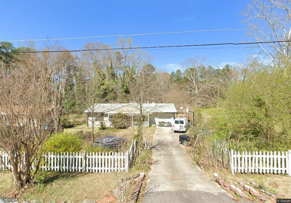
1944 Mcduffie Rd Austell, GA 30106
Estimated Value: $317,308 - $350,000
3
Beds
2
Baths
2,046
Sq Ft
$165/Sq Ft
Est. Value
About This Home
This home is located at 1944 Mcduffie Rd, Austell, GA 30106 and is currently estimated at $338,077, approximately $165 per square foot. 1944 Mcduffie Rd is a home located in Cobb County with nearby schools including Clarkdale Elementary School, Garrett Middle School, and South Cobb High School.
Ownership History
Date
Name
Owned For
Owner Type
Purchase Details
Closed on
Dec 30, 2024
Sold by
Wood Crawford and Wood Chuck
Bought by
Wood Greg
Current Estimated Value
Purchase Details
Closed on
Dec 5, 2024
Sold by
Wood Gregory
Bought by
Wood Chuck and Wood Angie
Purchase Details
Closed on
Jul 30, 1997
Sold by
Camp David M
Bought by
Wood Gregory E
Home Financials for this Owner
Home Financials are based on the most recent Mortgage that was taken out on this home.
Original Mortgage
$91,450
Interest Rate
7.5%
Mortgage Type
VA
Create a Home Valuation Report for This Property
The Home Valuation Report is an in-depth analysis detailing your home's value as well as a comparison with similar homes in the area
Home Values in the Area
Average Home Value in this Area
Purchase History
| Date | Buyer | Sale Price | Title Company |
|---|---|---|---|
| Wood Greg | -- | None Listed On Document | |
| Wood Chuck | -- | None Listed On Document | |
| Wood Chuck | -- | None Listed On Document | |
| Wood Gregory E | $90,000 | -- |
Source: Public Records
Mortgage History
| Date | Status | Borrower | Loan Amount |
|---|---|---|---|
| Previous Owner | Wood Gregory E | $91,450 |
Source: Public Records
Tax History
| Year | Tax Paid | Tax Assessment Tax Assessment Total Assessment is a certain percentage of the fair market value that is determined by local assessors to be the total taxable value of land and additions on the property. | Land | Improvement |
|---|---|---|---|---|
| 2025 | $621 | $131,848 | $26,000 | $105,848 |
| 2024 | $623 | $131,848 | $26,000 | $105,848 |
| 2023 | $285 | $87,660 | $15,200 | $72,460 |
| 2022 | $491 | $87,660 | $15,200 | $72,460 |
| 2021 | $2,660 | $87,660 | $15,200 | $72,460 |
| 2020 | $1,460 | $64,884 | $14,000 | $50,884 |
| 2019 | $1,460 | $64,884 | $14,000 | $50,884 |
| 2018 | $1,370 | $60,776 | $14,000 | $46,776 |
| 2017 | $1,330 | $60,776 | $14,000 | $46,776 |
| 2016 | $1,334 | $60,776 | $14,000 | $46,776 |
| 2015 | $621 | $29,912 | $12,800 | $17,112 |
| 2014 | $626 | $29,912 | $0 | $0 |
Source: Public Records
Map
Nearby Homes
- 2034 Drennon Ave
- 1808 Elmwood Dr
- 4349 Kousa Rd Unit 4
- 2081 Lenoa Ln
- 2083 Lenoa Ln
- 2085 Lenoa Ln
- 4688 Bennett St
- 2110 Plum Ln
- 2013 Chesley Dr
- 4630 Hemlock Dr
- 4420 Pink Rose Ct
- 4390 Chelou Dr
- 4814 Clove Dr SW
- 1741 Seayes Rd
- 1951 Bay Beauty Ln Unit 10
- 4778 Garrett Dr SW
- 4809 Hemlock Dr
- 2349 Shire Ct
- 1590 Debbie Dr SW
- 2373 Buckley Ct
- 1954 Mcduffie Rd
- 1914 Mcduffie Rd
- 1960 Mcduffie Rd
- 1939 Mcduffie Rd
- 1949 Mcduffie Rd
- 1968 Mcduffie Rd
- 1929 Mcduffie Rd
- 1976 Mcduffie Rd
- 1930 Drennon Ave
- 1981 Mcduffie Rd
- 1944 Drennon Ave
- 1940 Drennon Ave
- 1946 Drennon Ave
- 1946 Drennon Ave Unit 1946
- 1942 Drennon Ave
- 1900 Drennon Ave
- 1948 Drennon Ave
- 1950 Drennon Ave
- 1956 Drennon Ave
- 1956 Drennon Ave Unit 1956
Your Personal Tour Guide
Ask me questions while you tour the home.