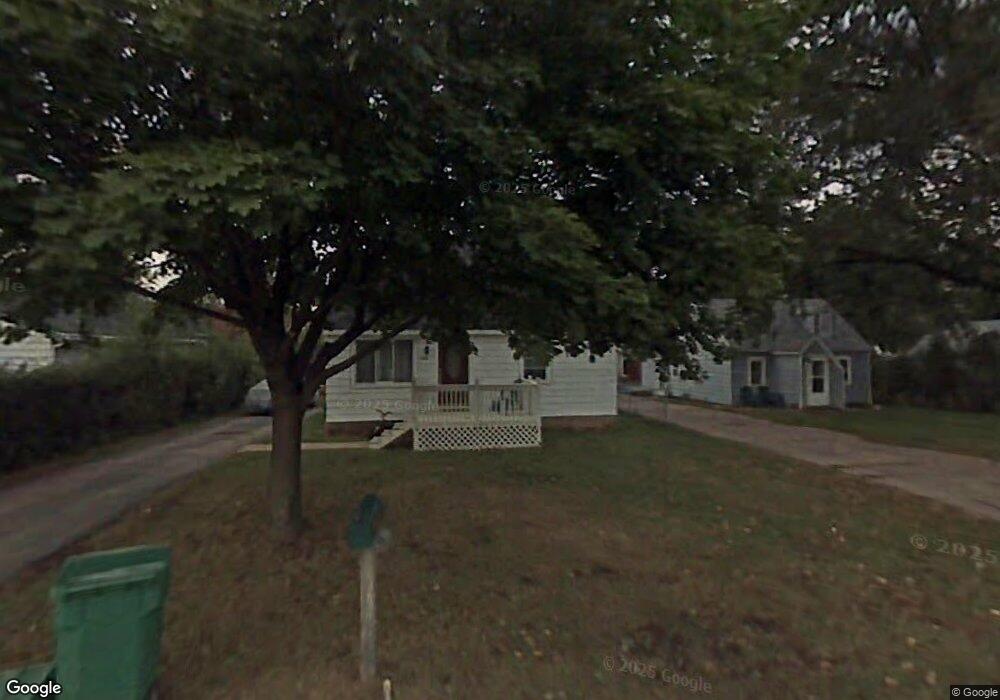
1944 Mound Ave Beloit, WI 53511
Estimated Value: $98,000 - $126,000
2
Beds
1
Bath
1,028
Sq Ft
$115/Sq Ft
Est. Value
About This Home
This home is located at 1944 Mound Ave, Beloit, WI 53511 and is currently estimated at $118,009, approximately $114 per square foot. 1944 Mound Ave is a home located in Rock County with nearby schools including Robinson Elementary School, Aldrich Intermediate School, and Memorial High School.
Ownership History
Date
Name
Owned For
Owner Type
Purchase Details
Closed on
Jul 10, 2017
Sold by
Teeter Dale
Bought by
Grover Richard D
Current Estimated Value
Purchase Details
Closed on
Sep 2, 2005
Sold by
Krumer Earl F and Krumer Gloria J
Bought by
Teeter Dale and Teeter Charlene
Home Financials for this Owner
Home Financials are based on the most recent Mortgage that was taken out on this home.
Original Mortgage
$40,500
Interest Rate
5.89%
Mortgage Type
New Conventional
Create a Home Valuation Report for This Property
The Home Valuation Report is an in-depth analysis detailing your home's value as well as a comparison with similar homes in the area
Home Values in the Area
Average Home Value in this Area
Purchase History
| Date | Buyer | Sale Price | Title Company |
|---|---|---|---|
| Grover Richard D | $47,000 | -- | |
| Teeter Dale | $45,000 | None Available |
Source: Public Records
Mortgage History
| Date | Status | Borrower | Loan Amount |
|---|---|---|---|
| Previous Owner | Teeter Dale | $40,500 |
Source: Public Records
Tax History
| Year | Tax Paid | Tax Assessment Tax Assessment Total Assessment is a certain percentage of the fair market value that is determined by local assessors to be the total taxable value of land and additions on the property. | Land | Improvement |
|---|---|---|---|---|
| 2025 | $1,143 | $72,500 | $6,400 | $66,100 |
| 2024 | $802 | $72,500 | $6,400 | $66,100 |
| 2023 | $896 | $72,500 | $6,400 | $66,100 |
| 2022 | $869 | $47,000 | $5,300 | $41,700 |
| 2021 | $1,108 | $47,000 | $5,300 | $41,700 |
| 2020 | $1,068 | $47,000 | $5,300 | $41,700 |
| 2019 | $1,013 | $47,000 | $5,300 | $41,700 |
| 2018 | $1,101 | $43,700 | $5,300 | $38,400 |
| 2017 | $1,053 | $43,700 | $5,300 | $38,400 |
| 2016 | $1,034 | $43,700 | $5,300 | $38,400 |
| 2015 | $1,011 | $43,700 | $5,300 | $38,400 |
| 2014 | $935 | $43,700 | $5,300 | $38,400 |
| 2013 | $874 | $43,700 | $5,300 | $38,400 |
Source: Public Records
Map
Nearby Homes
- 1942 Mound Ave
- 2020 Cottage Ave
- 826 Sharpes Ct
- Hwy 81 48 7 Acres
- 3165 W Prairie Grove Ln
- 3980 S Deer Dr
- 1737 Pine St
- L17 S Forest View Dr
- 2160 S Wisconsin Ave
- 1681 Park Ave
- 1971 Shore Dr
- 1741 Fayette Ave
- 1878 Greenview Dr
- 233 W Dawson Ave
- 2107 S Pow Wow Trail
- 1703 Bayliss Ave
- 1546 Summit Ave
- 1619 6th St
- 2277 Pioneer Dr
- 1728 Henderson Ave
- 1944 S Mound Ave
- 1946 Mound Ave
- 1951 Cottage Ave
- 1953 Cottage Ave
- 1938 Mound Ave
- 1958 Mound Ave
- 1941 Cottage Ave
- 1955 S Cottage Ave
- 1955 Cottage Ave
- 1939 Cottage Ave
- 1960 Mound Ave
- 1918 Mound Ave
- 1959 Cottage Ave
- 1964 Mound Ave
- 1916 Mound Ave
- 1939 S Cottage Ave
- 1917 S Cottage Ave
- 1914 Mound Ave
- 1961 Cottage Ave
- 1950 S Cottage Ave
Your Personal Tour Guide
Ask me questions while you tour the home.