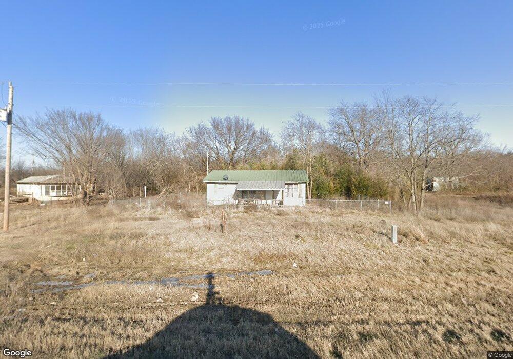
1944 N Highway 64 Haskell, OK 74436
Estimated Value: $79,000 - $203,000
3
Beds
1
Bath
884
Sq Ft
$155/Sq Ft
Est. Value
About This Home
This home is located at 1944 N Highway 64, Haskell, OK 74436 and is currently estimated at $136,951, approximately $154 per square foot. 1944 N Highway 64 is a home with nearby schools including Mary White Elementary School, Haskell Middle School, and Haskell High School.
Ownership History
Date
Name
Owned For
Owner Type
Purchase Details
Closed on
Feb 26, 2019
Sold by
Friend John C
Bought by
Curlee Mike
Current Estimated Value
Purchase Details
Closed on
Jul 29, 2004
Bought by
Friend John C
Purchase Details
Closed on
Jun 30, 2003
Purchase Details
Closed on
Oct 26, 1999
Purchase Details
Closed on
Dec 7, 1994
Create a Home Valuation Report for This Property
The Home Valuation Report is an in-depth analysis detailing your home's value as well as a comparison with similar homes in the area
Home Values in the Area
Average Home Value in this Area
Purchase History
| Date | Buyer | Sale Price | Title Company |
|---|---|---|---|
| Curlee Mike | $18,000 | None Available | |
| Friend John C | $15,000 | -- | |
| -- | $5,000 | -- | |
| -- | -- | -- | |
| -- | $10,500 | -- |
Source: Public Records
Tax History Compared to Growth
Tax History
| Year | Tax Paid | Tax Assessment Tax Assessment Total Assessment is a certain percentage of the fair market value that is determined by local assessors to be the total taxable value of land and additions on the property. | Land | Improvement |
|---|---|---|---|---|
| 2025 | $264 | $2,417 | $227 | $2,190 |
| 2024 | $264 | $2,303 | $217 | $2,086 |
| 2023 | $264 | $2,236 | $138 | $2,098 |
| 2022 | $203 | $2,194 | $138 | $2,056 |
| 2021 | $201 | $1,990 | $138 | $1,852 |
| 2020 | $203 | $1,975 | $138 | $1,837 |
| 2019 | $189 | $1,972 | $138 | $1,834 |
| 2018 | $183 | $1,972 | $138 | $1,834 |
| 2017 | $157 | $1,657 | $138 | $1,519 |
| 2016 | $157 | $1,657 | $138 | $1,519 |
| 2015 | $160 | $1,657 | $138 | $1,519 |
| 2014 | $0 | $1,657 | $138 | $1,519 |
Source: Public Records
Map
Nearby Homes
- 1560 S 178th St W
- 17563 W 17th St S
- 0 S 184th St W
- 1 W 23rd St S
- 219 N Cattle Dr
- 215 N Cattle Dr
- 116 N Cattle Dr
- 211 N Cattle Dr
- 220 N Cattle Dr
- 766 S Cherokee Ave
- 762 S Cherokee Ave
- 758 S Cherokee Ave
- 754 S Cherokee Ave
- 750 S Cherokee Ave
- 749 S Cherokee Ave
- RC Foster II Plan at Cedar Village
- RC Franklin Plan at Cedar Village
- RC Ross Plan at Cedar Village
- RC Morgan Plan at Cedar Village
- RC Carson Plan at Cedar Village
- 17911 W 20th St N
- 43 Oklahoma 72
- 1872 N Highway 64
- 2050 N Highway 64
- 22053 W 45th St N
- 22060 W 45th St N
- 16683 W 20th St N
- 28242 E 181st St S
- 2401 N Hwy 64
- 16683 W 20th St N
- 22008 W 30th St N
- 100 W Magnolia St
- 0 W 20th St Unit 1538884
- 120 Rr 1
- 2285 N Highway 64
- 2285 N Hwy 64
- 155 N Haskell
- 105 Rr 1
- 2518 N 184th St W