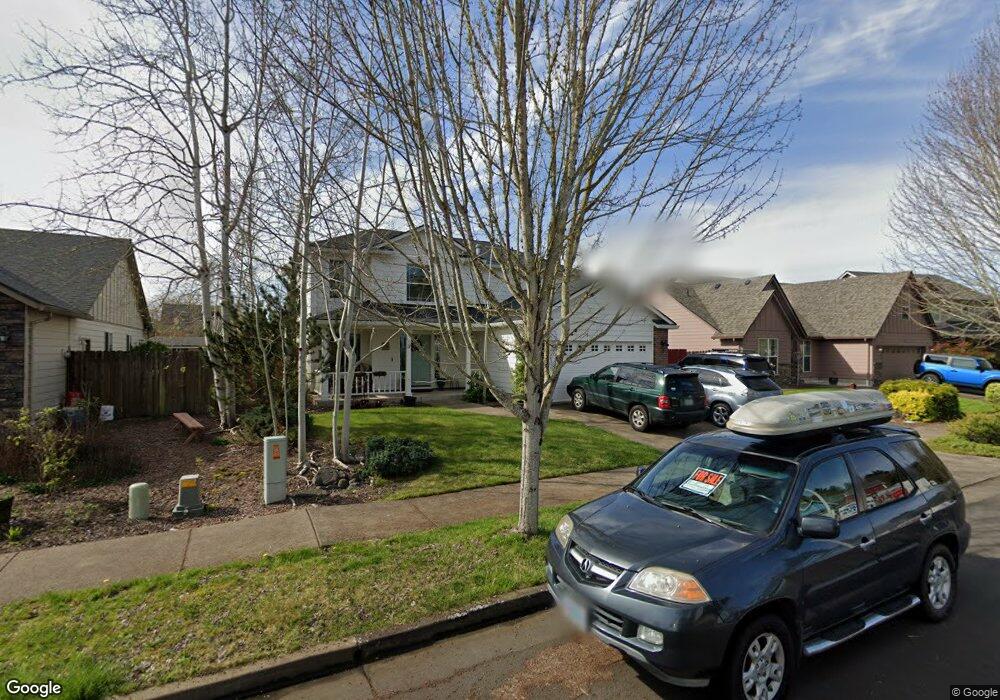
1944 Salmon Run SW Albany, OR 97321
South Albany NeighborhoodEstimated Value: $444,000 - $459,974
3
Beds
3
Baths
1,645
Sq Ft
$275/Sq Ft
Est. Value
About This Home
This home is located at 1944 Salmon Run SW, Albany, OR 97321 and is currently estimated at $451,987, approximately $274 per square foot. 1944 Salmon Run SW is a home located in Linn County with nearby schools including Liberty Elementary School, Memorial Middle School, and West Albany High School.
Ownership History
Date
Name
Owned For
Owner Type
Purchase Details
Closed on
Aug 21, 2025
Sold by
Mathios Peter K and Mathios Rachelle
Bought by
Peter And Rachelle Mathios Revocable Living T and Mathios
Current Estimated Value
Purchase Details
Closed on
Dec 9, 2004
Sold by
Burkoff Afanasy
Bought by
Mathios Peter K and Mathios Rachelle
Home Financials for this Owner
Home Financials are based on the most recent Mortgage that was taken out on this home.
Original Mortgage
$131,400
Interest Rate
3.87%
Mortgage Type
Purchase Money Mortgage
Purchase Details
Closed on
Jun 24, 2004
Sold by
Oak Creek Park Llc
Bought by
Burkoff Afanasy
Create a Home Valuation Report for This Property
The Home Valuation Report is an in-depth analysis detailing your home's value as well as a comparison with similar homes in the area
Home Values in the Area
Average Home Value in this Area
Purchase History
| Date | Buyer | Sale Price | Title Company |
|---|---|---|---|
| Peter And Rachelle Mathios Revocable Living T | -- | None Listed On Document | |
| Mathios Peter K | $182,743 | Lawyers Title Ins | |
| Burkoff Afanasy | $50,000 | Ticor Title |
Source: Public Records
Mortgage History
| Date | Status | Borrower | Loan Amount |
|---|---|---|---|
| Previous Owner | Mathios Peter K | $131,400 |
Source: Public Records
Tax History Compared to Growth
Tax History
| Year | Tax Paid | Tax Assessment Tax Assessment Total Assessment is a certain percentage of the fair market value that is determined by local assessors to be the total taxable value of land and additions on the property. | Land | Improvement |
|---|---|---|---|---|
| 2025 | $5,369 | $269,780 | -- | -- |
| 2024 | $5,213 | $261,930 | -- | -- |
| 2023 | $5,065 | $254,310 | $0 | $0 |
| 2022 | $4,985 | $246,910 | $0 | $0 |
| 2021 | $4,692 | $239,720 | $0 | $0 |
| 2020 | $4,629 | $232,740 | $0 | $0 |
| 2019 | $4,521 | $225,970 | $0 | $0 |
| 2018 | $4,404 | $219,390 | $0 | $0 |
| 2017 | $4,139 | $213,000 | $0 | $0 |
| 2016 | $3,807 | $206,800 | $0 | $0 |
| 2015 | $3,584 | $200,780 | $0 | $0 |
| 2014 | $3,477 | $194,940 | $0 | $0 |
Source: Public Records
Map
Nearby Homes
- 1987 Bobcat Ave SW
- 1691 Bobcat Ave SW
- 1851 Cougar Ave SW
- 2170 Bobcat Ave SW
- PP2020-49 Lot#2 SW Osprey Ct
- 1776 Antelope Cir SW
- 1664 Elk Cir SW
- 2
- 1562 Beaver Ct SW
- 4714 Willetta St SW
- 1221 36th Ave SW
- 1023 37th Ave SW
- 3810 Pacific Blvd SW
- 1124 Lakewood Dr SW
- 1004 Lakewood Dr SW
- 3282 Pacific Place SW
- 6259 Chapman Place SW
- 1712 25th Ave SW
- 530 34th (-536) Ave SE
- 31405 Allen Ln
- 1958 Salmon Run SW
- 1945 Bobcat Ave SW
- 1925 Bobcat Ave SW
- 1957 Bobcat Ave SW
- 1916 Salmon Run SW
- 1972 Salmon Run SW
- 1943 Salmon Run SW
- 1969 Bobcat Ave SW
- 1905 Bobcat Ave SW
- 1961 Salmon Run SW
- 1929 Salmon Run SW
- 1917 Salmon Run SW
- 1902 Salmon Run SW
- 1990 Salmon Run SW
- 1973 Salmon Run SW
- 1899 Bobcat Ave SW
- 1932 Bobcat Ave SW
- 1920 Bobcat Ave SW
- 1946 Bobcat Ave SW
- 4205 Chinook Ct SW