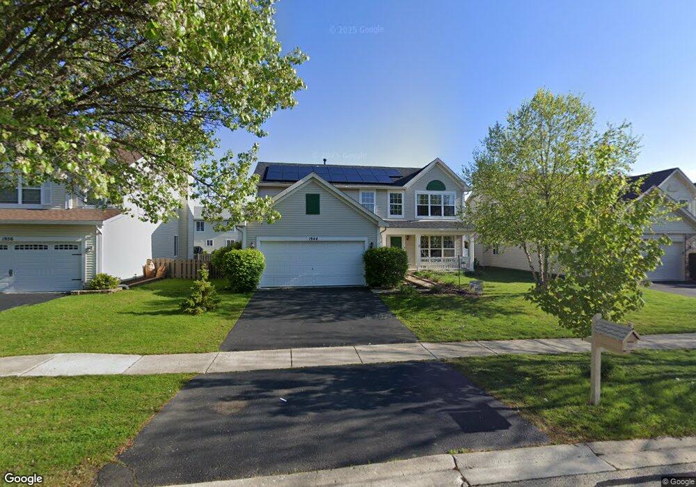
1944 Tilson Ln Romeoville, IL 60446
Lakewood Falls NeighborhoodEstimated Value: $394,000 - $416,000
4
Beds
3
Baths
2,171
Sq Ft
$186/Sq Ft
Est. Value
About This Home
This home is located at 1944 Tilson Ln, Romeoville, IL 60446 and is currently estimated at $403,318, approximately $185 per square foot. 1944 Tilson Ln is a home located in Will County with nearby schools including Creekside Elementary School, John F Kennedy Middle School, and Plainfield East High School.
Ownership History
Date
Name
Owned For
Owner Type
Purchase Details
Closed on
Jan 22, 2007
Sold by
Hodges James and Hodges Jamie
Bought by
Smith Jeffrey P and Smith Lisa A
Current Estimated Value
Home Financials for this Owner
Home Financials are based on the most recent Mortgage that was taken out on this home.
Original Mortgage
$239,400
Outstanding Balance
$142,905
Interest Rate
6.19%
Mortgage Type
New Conventional
Estimated Equity
$260,413
Purchase Details
Closed on
May 30, 2000
Sold by
Lakewood Falls Phase 5 Llc
Bought by
Hodges James and Hodges Jamie
Home Financials for this Owner
Home Financials are based on the most recent Mortgage that was taken out on this home.
Original Mortgage
$176,847
Interest Rate
8.14%
Mortgage Type
FHA
Create a Home Valuation Report for This Property
The Home Valuation Report is an in-depth analysis detailing your home's value as well as a comparison with similar homes in the area
Home Values in the Area
Average Home Value in this Area
Purchase History
| Date | Buyer | Sale Price | Title Company |
|---|---|---|---|
| Smith Jeffrey P | $252,000 | None Available | |
| Hodges James | $178,500 | Chicago Title Insurance Co |
Source: Public Records
Mortgage History
| Date | Status | Borrower | Loan Amount |
|---|---|---|---|
| Open | Smith Jeffrey P | $239,400 | |
| Previous Owner | Hodges James | $176,847 |
Source: Public Records
Tax History Compared to Growth
Tax History
| Year | Tax Paid | Tax Assessment Tax Assessment Total Assessment is a certain percentage of the fair market value that is determined by local assessors to be the total taxable value of land and additions on the property. | Land | Improvement |
|---|---|---|---|---|
| 2024 | $8,576 | $114,087 | $22,680 | $91,407 |
| 2023 | $8,576 | $103,041 | $20,484 | $82,557 |
| 2022 | $7,656 | $92,544 | $18,397 | $74,147 |
| 2021 | $7,220 | $86,489 | $17,193 | $69,296 |
| 2020 | $7,131 | $84,035 | $16,705 | $67,330 |
| 2019 | $6,813 | $80,071 | $15,917 | $64,154 |
| 2018 | $7,127 | $81,928 | $14,954 | $66,974 |
| 2017 | $6,915 | $77,856 | $14,211 | $63,645 |
| 2016 | $6,743 | $74,255 | $13,554 | $60,701 |
| 2015 | $6,400 | $69,560 | $12,697 | $56,863 |
| 2014 | $6,400 | $67,104 | $12,249 | $54,855 |
| 2013 | $6,400 | $67,104 | $12,249 | $54,855 |
Source: Public Records
Map
Nearby Homes
- 195 Morgan Ct
- 2076 Whitmore Dr
- 357 Wedgewood Cir
- 1852 Sierra Trail
- 2075 Longwood Ct
- 2076 Longwood Ct Unit 1
- 142 Sedgewicke Dr
- 2033 Wedgewood Cir
- 1843 S Wentworth Cir
- 1796 S Wentworth Cir
- 251 Summerfield Dr
- 1986 W Brimstone Rd Unit 1
- 1973 W Crestview Cir
- 351 Richmond Dr
- 514 S Stone Bluff Dr
- 22252 W Taylor Rd
- 249 Gladiolus Dr
- 14215 S Longview Ln
- 14203 S Napa Cir
- 1647 Rose Ln Unit 3
- 1938 Tilson Ln
- 1950 Tilson Ln
- 1945 Trafalger Dr
- 1951 Trafalgar Dr
- 1956 Tilson Ln
- 1932 Tilson Ln
- 1951 Trafalger Dr
- 1939 Trafalger Dr
- 1957 Trafalger Dr
- 1933 Trafalger Dr
- 1943 Tilson Ln
- 1962 Tilson Ln
- 1931 Tilson Ln
- 1949 Tilson Ln
- 1937 Tilson Ln
- 1926 Tilson Ln
- 1955 Tilson Ln
- 1963 Trafalger Dr
- 1927 Trafalger Dr
- 1925 Tilson Ln