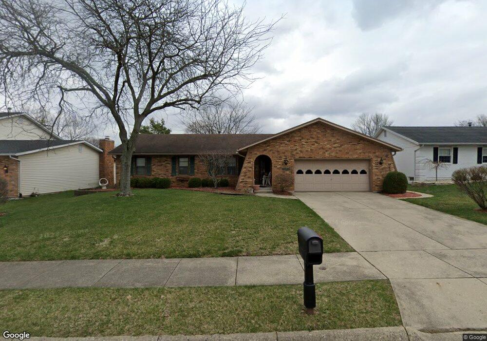
1944 W Mile Rd Springfield, OH 45503
Estimated Value: $255,000 - $281,000
3
Beds
3
Baths
1,744
Sq Ft
$152/Sq Ft
Est. Value
About This Home
This home is located at 1944 W Mile Rd, Springfield, OH 45503 and is currently estimated at $265,522, approximately $152 per square foot. 1944 W Mile Rd is a home located in Clark County with nearby schools including Kenton Elementary School, Roosevelt Middle School, and Springfield High School.
Ownership History
Date
Name
Owned For
Owner Type
Purchase Details
Closed on
Aug 28, 2013
Sold by
Shropshire Norma J
Bought by
Shropshire Todd and The Norma J Shropshire Irrevocable Trust
Current Estimated Value
Purchase Details
Closed on
Nov 1, 1982
Sold by
Vizzari Luigi and Rosina Ann
Bought by
Lawson Phillip Wayne and Nancy Ann
Create a Home Valuation Report for This Property
The Home Valuation Report is an in-depth analysis detailing your home's value as well as a comparison with similar homes in the area
Home Values in the Area
Average Home Value in this Area
Purchase History
| Date | Buyer | Sale Price | Title Company |
|---|---|---|---|
| Shropshire Todd | -- | None Available | |
| Lawson Phillip Wayne | $85,200 | -- |
Source: Public Records
Tax History
| Year | Tax Paid | Tax Assessment Tax Assessment Total Assessment is a certain percentage of the fair market value that is determined by local assessors to be the total taxable value of land and additions on the property. | Land | Improvement |
|---|---|---|---|---|
| 2025 | $3,211 | $75,300 | $16,930 | $58,370 |
| 2024 | $3,129 | $63,350 | $15,120 | $48,230 |
| 2023 | $3,129 | $63,350 | $15,120 | $48,230 |
| 2022 | $3,206 | $63,350 | $15,120 | $48,230 |
| 2021 | $2,785 | $50,690 | $12,100 | $38,590 |
| 2020 | $2,792 | $50,690 | $12,100 | $38,590 |
| 2019 | $2,723 | $50,690 | $12,100 | $38,590 |
| 2018 | $2,755 | $49,250 | $12,100 | $37,150 |
| 2017 | $2,753 | $49,245 | $12,096 | $37,149 |
| 2016 | $2,756 | $49,245 | $12,096 | $37,149 |
| 2015 | $2,993 | $52,458 | $12,096 | $40,362 |
| 2014 | $2,980 | $52,458 | $12,096 | $40,362 |
| 2013 | $2,949 | $52,458 | $12,096 | $40,362 |
Source: Public Records
Map
Nearby Homes
- 2153 Olympic St Unit 2153
- 1535 Winding Trail
- 1323 Greystone Dr
- 1315 Greystone Dr
- 2439 Greystone Ln
- 2442 Greystone Ln
- 1710 Mitchell Blvd
- 1705 Magnolia Blvd
- 2553 Derr Rd
- 2524 Home Orchard Dr
- 1718 Northpoint Rd
- 2400 Thor Dr
- 1811 Devon Dr
- 876 E McCreight Ave Unit 2
- 876 E McCreight Ave Unit 878
- 913 Mitchell Blvd Unit 915
- 26-28 N Belmont Ave
- 1404 Attleboro Ave
- 2529 Marinette Dr
- 329 Roosevelt Dr
- 2006 W Mile Rd
- 1936 W Mile Rd
- 1941 Miracle Mile Unit 1943
- 1929 Miracle Mile
- 1943 W Mile Rd
- 1935 W Mile Rd
- 2005 W Mile Rd
- 2007 Miracle Mile
- 2018 W Mile Rd
- 1259 Apollo Ave
- 1922 W Mile Rd
- 1927 W Mile Rd
- 1907 Miracle Mile
- 2015 Miracle Mile
- 1249 Apollo Ave
- 1919 W Mile Rd
- 1921 W Mile Rd
- 1847 Miracle Mile Unit 1849
- 2022 W Mile Rd
- 1241 Apollo Ave
Your Personal Tour Guide
Ask me questions while you tour the home.