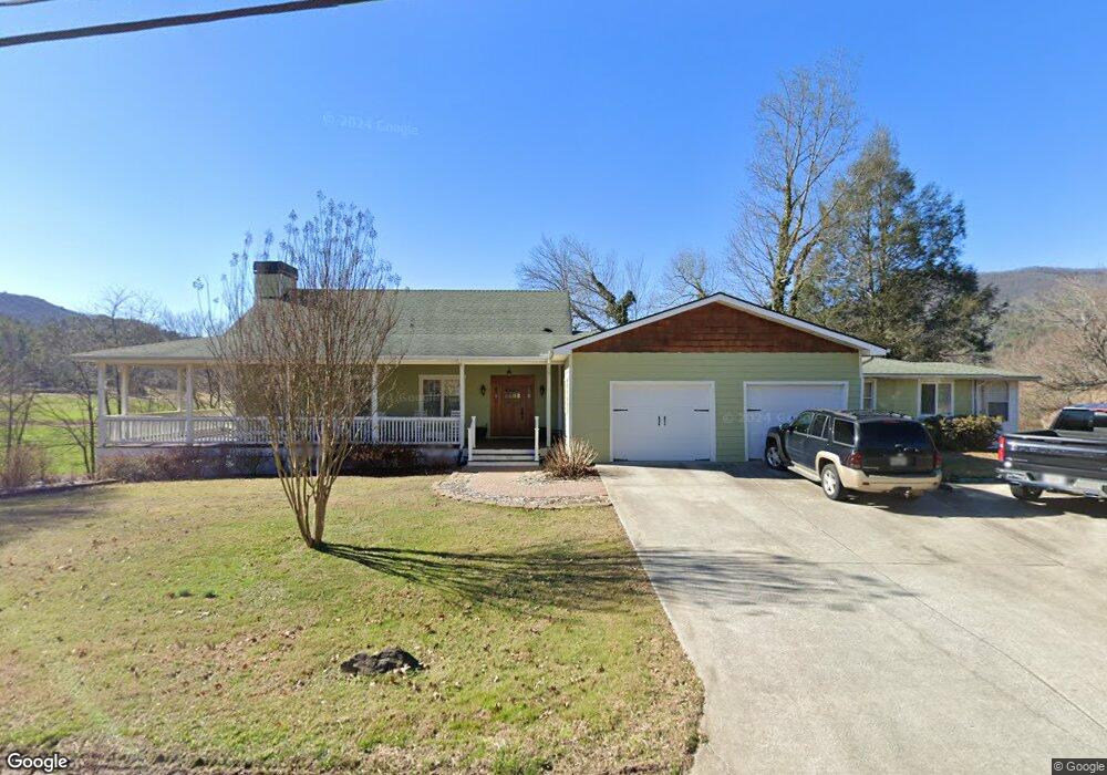
1944 Wolffork Rd Rabun Gap, GA 30568
Estimated Value: $351,000 - $542,000
3
Beds
2
Baths
2,394
Sq Ft
$177/Sq Ft
Est. Value
About This Home
This home is located at 1944 Wolffork Rd, Rabun Gap, GA 30568 and is currently estimated at $424,894, approximately $177 per square foot. 1944 Wolffork Rd is a home located in Rabun County with nearby schools including Rabun County Primary School, Rabun County High School, and Rabun Gap Nacoochee School.
Ownership History
Date
Name
Owned For
Owner Type
Purchase Details
Closed on
May 12, 2009
Sold by
Parsons Barbara A
Bought by
Parsons Joel Frank
Current Estimated Value
Home Financials for this Owner
Home Financials are based on the most recent Mortgage that was taken out on this home.
Original Mortgage
$301,600
Outstanding Balance
$188,500
Interest Rate
4.81%
Mortgage Type
New Conventional
Estimated Equity
$236,394
Purchase Details
Closed on
Jun 1, 1999
Bought by
Parsons Joel Frank
Purchase Details
Closed on
Mar 1, 1958
Create a Home Valuation Report for This Property
The Home Valuation Report is an in-depth analysis detailing your home's value as well as a comparison with similar homes in the area
Home Values in the Area
Average Home Value in this Area
Purchase History
| Date | Buyer | Sale Price | Title Company |
|---|---|---|---|
| Parsons Joel Frank | -- | -- | |
| Parsons Barbara A | $377,000 | -- | |
| Parsons Joel Frank | -- | -- | |
| Parsons Barbara A | $377,000 | -- | |
| Parsons Joel Frank | $68,000 | -- | |
| Parsons Joel Frank | $68,000 | -- | |
| -- | $1,100 | -- | |
| -- | $1,100 | -- |
Source: Public Records
Mortgage History
| Date | Status | Borrower | Loan Amount |
|---|---|---|---|
| Open | Parsons Barbara A | $301,600 | |
| Closed | Parsons Barbara A | $301,600 |
Source: Public Records
Tax History Compared to Growth
Tax History
| Year | Tax Paid | Tax Assessment Tax Assessment Total Assessment is a certain percentage of the fair market value that is determined by local assessors to be the total taxable value of land and additions on the property. | Land | Improvement |
|---|---|---|---|---|
| 2025 | $1,716 | $106,945 | $12,624 | $94,321 |
| 2024 | $1,633 | $101,774 | $12,624 | $89,150 |
| 2023 | $1,617 | $88,362 | $11,881 | $76,481 |
| 2022 | $1,561 | $85,264 | $11,138 | $74,126 |
| 2021 | $1,450 | $77,333 | $10,396 | $66,937 |
| 2020 | $1,454 | $74,954 | $10,396 | $64,558 |
| 2019 | $1,464 | $74,954 | $10,396 | $64,558 |
| 2018 | $1,469 | $74,954 | $10,396 | $64,558 |
| 2017 | $1,409 | $74,954 | $10,396 | $64,558 |
| 2016 | $1,519 | $80,560 | $10,396 | $70,164 |
| 2015 | $1,411 | $73,256 | $10,396 | $62,860 |
| 2014 | $1,418 | $73,256 | $10,396 | $62,860 |
Source: Public Records
Map
Nearby Homes
- 0 Sylvan Lake Dr Unit 47,48 10485897
- 1422 Wolffork Rd
- 46 Clare Ln
- 784 Wolffork Church Rd
- 0 Crest Ln Unit LOT 5 10572844
- 153 Coleman Heights Ln
- 5192 Wolffork Rd
- 0 Pitts Way Unit 10592369
- 373 Western Way
- 5019 Wolffork Rd
- 189 Elm Ln
- 52 Lucky Ln
- 243 Degroff Ln
- 786 Hope Haven Ln
- 230 Majors Ln
- 0 Black Rock Estates Unit 25 10374676
- 0 Alto Ln Unit 10533235
- 137 Olds Mountain Peak Rd
- 0 Allen Cove Rd Unit 10586573
- 0 John Beck Dockins Rd Unit 10606531
- 1947 Wolffork Rd
- 24 Wild Orchid Ln
- 53 Wild Orchid Ln
- 26 Wild Orchid Ln
- 82 Wild Orchid Ln
- 1913 Wolffork Rd
- 1689 Wolffork Rd
- 364 Wolffork Church Rd
- 2260 Wolffork Rd
- 276 Taylors Chapel Rd
- 588 Wolffork Church Rd
- 588 Wolffork Church Rd
- 346 Taylors Chapel Rd
- 228 Taylors Chapel Rd
- 49 Taylors Chapel Rd
- 37 Moses Rd
- 226 Taylors Chapel Rd
- 2330 Wolffork Rd
- 398 Taylors Chapel Rd
- 28 Mayflower Ln