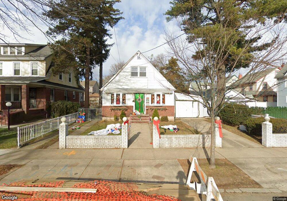
19447 111th Rd Saint Albans, NY 11412
Hollis NeighborhoodEstimated Value: $582,000 - $750,330
--
Bed
--
Bath
1,170
Sq Ft
$589/Sq Ft
Est. Value
About This Home
This home is located at 19447 111th Rd, Saint Albans, NY 11412 and is currently estimated at $689,333, approximately $589 per square foot. 19447 111th Rd is a home located in Queens County with nearby schools including P.S. 118 Lorraine Hansberry, I.S. 192 The Linden, and True Deliverance Christian School.
Ownership History
Date
Name
Owned For
Owner Type
Purchase Details
Closed on
Jul 31, 2007
Sold by
Thornton Barbara L and Thornton Michael
Bought by
Thornton Michael
Current Estimated Value
Purchase Details
Closed on
May 30, 2003
Sold by
Thornton
Bought by
Thornton Michael
Home Financials for this Owner
Home Financials are based on the most recent Mortgage that was taken out on this home.
Original Mortgage
$110,000
Interest Rate
5.8%
Mortgage Type
Purchase Money Mortgage
Create a Home Valuation Report for This Property
The Home Valuation Report is an in-depth analysis detailing your home's value as well as a comparison with similar homes in the area
Home Values in the Area
Average Home Value in this Area
Purchase History
| Date | Buyer | Sale Price | Title Company |
|---|---|---|---|
| Thornton Michael | -- | -- | |
| Thornton Michael | -- | -- | |
| Thornton Michael | -- | -- | |
| Thornton Michael | -- | -- |
Source: Public Records
Mortgage History
| Date | Status | Borrower | Loan Amount |
|---|---|---|---|
| Closed | Thornton Michael | $110,000 | |
| Closed | Thornton Michael | -- | |
| Closed | Thornton Michael | $0 |
Source: Public Records
Tax History Compared to Growth
Tax History
| Year | Tax Paid | Tax Assessment Tax Assessment Total Assessment is a certain percentage of the fair market value that is determined by local assessors to be the total taxable value of land and additions on the property. | Land | Improvement |
|---|---|---|---|---|
| 2025 | $5,844 | $31,769 | $9,144 | $22,625 |
| 2024 | $5,856 | $30,496 | $9,671 | $20,825 |
| 2023 | $5,497 | $28,771 | $8,416 | $20,355 |
| 2022 | $5,457 | $39,720 | $12,900 | $26,820 |
| 2021 | $5,609 | $33,180 | $12,900 | $20,280 |
| 2020 | $5,308 | $29,580 | $12,900 | $16,680 |
| 2019 | $5,023 | $29,580 | $12,900 | $16,680 |
| 2018 | $4,590 | $23,976 | $9,800 | $14,176 |
| 2017 | $4,588 | $23,976 | $11,905 | $12,071 |
| 2016 | $4,365 | $23,976 | $11,905 | $12,071 |
| 2015 | $2,600 | $22,062 | $11,822 | $10,240 |
| 2014 | $2,600 | $21,178 | $13,606 | $7,572 |
Source: Public Records
Map
Nearby Homes
- 194- 24 111th Rd
- 194-29 112th Ave
- 11132 199th St
- 194-16 112th Ave
- 19404 110th Rd
- 190-63 112th Ave
- 112-28 199th St
- 190-59 112th Ave
- 191-40 112th Rd
- 19432 113th Rd
- 19920 Hollis Ave
- 19445 Murdock Ave
- 113-40 198th St
- 19022 111th Rd
- 19319 109th Rd
- 19427 Murdock Ave
- 193-21 109th Rd
- 194-56 Murdock Ave
- 194-42 Murdock Ave
- 200-21 Hollis Ave
- 19447 111th Rd
- 19441 111th Rd
- 194-55 196 St
- 11112 196th St
- 194-55 111 Rd
- 19455 111th Rd
- 19455 111th Rd
- 19437 111th Rd
- 19512 111th Ave
- 11108 196th St
- 19506 111th Ave
- 195-12 111th Ave
- 19502 111th Ave
- 19433 111th Rd
- 19456 111th Rd
- 19440 111th Rd
- 19448 111th Rd
- 19444 111th Rd
- 19516 111th Ave
- 19436 111th Ave