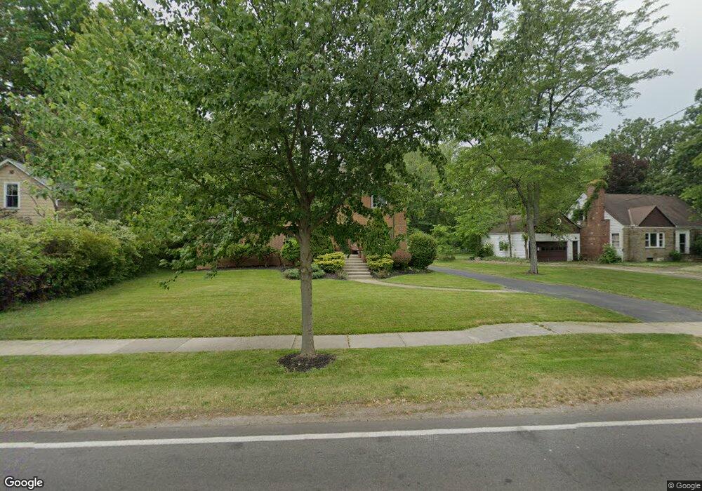
19449 Westwood Dr Strongsville, OH 44149
Estimated Value: $386,000 - $465,000
5
Beds
2
Baths
2,818
Sq Ft
$147/Sq Ft
Est. Value
About This Home
This home is located at 19449 Westwood Dr, Strongsville, OH 44149 and is currently estimated at $415,626, approximately $147 per square foot. 19449 Westwood Dr is a home located in Cuyahoga County with nearby schools including Strongsville High School, Strongsville Academy, and Sts Joseph & John Interparochial School.
Ownership History
Date
Name
Owned For
Owner Type
Purchase Details
Closed on
May 4, 2020
Sold by
Moser Gregory A and Moser Lisa M
Bought by
Bedford William and Bedford Elizabeth S
Current Estimated Value
Home Financials for this Owner
Home Financials are based on the most recent Mortgage that was taken out on this home.
Original Mortgage
$190,800
Outstanding Balance
$170,016
Interest Rate
3.6%
Mortgage Type
New Conventional
Estimated Equity
$245,610
Purchase Details
Closed on
May 26, 1999
Sold by
Mccann Richard F and Mccann M
Bought by
Moser Gregory A and Moser Lisa M
Home Financials for this Owner
Home Financials are based on the most recent Mortgage that was taken out on this home.
Original Mortgage
$162,000
Interest Rate
6.92%
Create a Home Valuation Report for This Property
The Home Valuation Report is an in-depth analysis detailing your home's value as well as a comparison with similar homes in the area
Home Values in the Area
Average Home Value in this Area
Purchase History
| Date | Buyer | Sale Price | Title Company |
|---|---|---|---|
| Bedford William | $212,000 | City Title Agency | |
| Moser Gregory A | $180,000 | Stewart Title |
Source: Public Records
Mortgage History
| Date | Status | Borrower | Loan Amount |
|---|---|---|---|
| Open | Bedford William | $190,800 | |
| Previous Owner | Moser Gregory A | $162,000 |
Source: Public Records
Tax History Compared to Growth
Tax History
| Year | Tax Paid | Tax Assessment Tax Assessment Total Assessment is a certain percentage of the fair market value that is determined by local assessors to be the total taxable value of land and additions on the property. | Land | Improvement |
|---|---|---|---|---|
| 2024 | $5,602 | $119,315 | $14,630 | $104,685 |
| 2023 | $4,912 | $78,440 | $16,380 | $62,060 |
| 2022 | $4,876 | $78,440 | $16,380 | $62,060 |
| 2021 | $4,837 | $78,440 | $16,380 | $62,060 |
| 2020 | $4,583 | $64,300 | $13,440 | $50,860 |
| 2019 | $4,452 | $183,700 | $38,400 | $145,300 |
| 2018 | $4,050 | $64,300 | $13,440 | $50,860 |
| 2017 | $4,044 | $59,440 | $10,680 | $48,760 |
| 2016 | $4,012 | $59,440 | $10,680 | $48,760 |
| 2015 | $3,952 | $59,440 | $10,680 | $48,760 |
| 2014 | $3,952 | $57,720 | $10,360 | $47,360 |
Source: Public Records
Map
Nearby Homes
- 13156 Olympus Way
- 13099 Olympus Way
- 13066 Olympus Way
- 14112 Settlers Way
- 19160 Wheelers Ln
- 19620 Porters Ln Unit 15F
- 12539 Olympus Way
- 12694 Ionia Ct
- 12385 Corinth Ct
- 12647 Edgepark Cir
- 13236 Tomson Dr
- 20078 Trapper Trail
- 18248 Meadow Ln
- 12651 Alameda Dr
- 19513 Lunn Rd
- 18336 Falling Water Rd
- 17809 Cliffside Dr Unit 4926
- 17945 Cliffside Dr
- 18630 Shurmer Rd
- 11499 Pearl Rd Unit A106
- 19419 Westwood Dr
- 19481 Westwood Dr
- 19444 Westwood Dr
- 19385 Westwood Dr
- 19400 Westwood Dr
- 19515 Westwood Dr
- 19510 Westwood Dr
- 19355 Westwood Dr
- 19516 Westwood Dr
- 19354 Westwood Dr
- 19384 Westwood Dr
- 19350 Westwood Dr
- 19327 Westwood Dr
- 19573 Westwood Dr
- 13390 Olympus Way
- 19564 Fair Isle Way
- 19556 Fair Isle Way
- 19322 Westwood Dr
- 13372 Olympus Way
- 19572 Westwood Dr