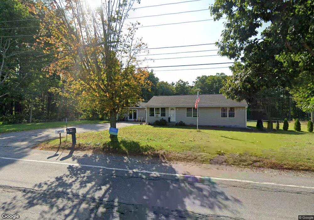
1945 Barre Rd New Braintree, MA 01531
Estimated Value: $269,000 - $319,000
3
Beds
1
Bath
1,144
Sq Ft
$260/Sq Ft
Est. Value
About This Home
This home is located at 1945 Barre Rd, New Braintree, MA 01531 and is currently estimated at $297,954, approximately $260 per square foot. 1945 Barre Rd is a home located in Worcester County with nearby schools including Quabbin Regional Middle School and Quabbin Regional High School.
Ownership History
Date
Name
Owned For
Owner Type
Purchase Details
Closed on
Feb 28, 2020
Sold by
Stgeorge Timothy and Stgeorge Jennifer C
Bought by
Knight-Mulliken Susan
Current Estimated Value
Home Financials for this Owner
Home Financials are based on the most recent Mortgage that was taken out on this home.
Original Mortgage
$160,000
Outstanding Balance
$141,433
Interest Rate
3.4%
Mortgage Type
New Conventional
Estimated Equity
$156,521
Purchase Details
Closed on
May 23, 2007
Sold by
Uracius Donald E and Uracius Elsie M
Bought by
Stgeorge Timothy and Borelli Jennifer C
Home Financials for this Owner
Home Financials are based on the most recent Mortgage that was taken out on this home.
Original Mortgage
$131,100
Interest Rate
6.27%
Mortgage Type
Purchase Money Mortgage
Create a Home Valuation Report for This Property
The Home Valuation Report is an in-depth analysis detailing your home's value as well as a comparison with similar homes in the area
Home Values in the Area
Average Home Value in this Area
Purchase History
| Date | Buyer | Sale Price | Title Company |
|---|---|---|---|
| Knight-Mulliken Susan | $200,000 | None Available | |
| Stgeorge Timothy | $138,000 | -- |
Source: Public Records
Mortgage History
| Date | Status | Borrower | Loan Amount |
|---|---|---|---|
| Open | Knight-Mulliken Susan | $160,000 | |
| Previous Owner | Stgeorge Timothy | $131,100 |
Source: Public Records
Tax History
| Year | Tax Paid | Tax Assessment Tax Assessment Total Assessment is a certain percentage of the fair market value that is determined by local assessors to be the total taxable value of land and additions on the property. | Land | Improvement |
|---|---|---|---|---|
| 2025 | $28 | $191,400 | $42,500 | $148,900 |
| 2024 | $2,783 | $191,400 | $42,500 | $148,900 |
| 2023 | $2,631 | $179,200 | $42,500 | $136,700 |
| 2022 | $2,444 | $150,400 | $40,000 | $110,400 |
| 2021 | $2,491 | $142,600 | $37,300 | $105,300 |
| 2020 | $2,503 | $144,500 | $37,000 | $107,500 |
| 2019 | $2,457 | $144,500 | $37,000 | $107,500 |
| 2018 | $2,450 | $139,500 | $39,600 | $99,900 |
| 2017 | $2,492 | $138,000 | $43,400 | $94,600 |
| 2016 | $2,401 | $138,000 | $43,400 | $94,600 |
| 2015 | $1,837 | $113,100 | $49,400 | $63,700 |
| 2014 | $1,848 | $113,100 | $49,400 | $63,700 |
Source: Public Records
Map
Nearby Homes
- 1940 Barre Rd
- 716 Hardwick Rd
- 661 Wheelwright Rd
- 58 Ruggles St
- 572 Wheelwright Rd
- 278 Oakham Rd
- 0 Station Rd
- 106 Peach St
- 1109 New Braintree Rd
- 29 High St N
- 621 Woods Rd
- 23 Trafalgar Square Unit 23
- 865 S Barre Rd
- 1215 South St
- 38 Edson Rd
- lt3 West Rd
- 926 Old Turnpike Rd
- 0 Bullard Rd
- 1350 Thresher Rd
- Lot 3 Clapp Rd
- 1970 Barre Rd
- 29 Ravine Rd
- LOT 4 Davis Rd
- LOT3 Barre Rd
- LOT5 Barre Rd
- UNKN Oakham Rd
- NB6A Goodfield Rd
- 1 Ravine Rd
- 1889 Barre Rd
- 105 Ravine Rd
- 26 Ravine Rd
- 1926 Barre Rd
- 1845 Barre Rd
- 1914 Barre Rd
- Lot 32-2 Old Turnpike
- 32-2 Old Turnpike Rd
- 71 Old Turnpike Rd
- 151 Ravine Rd
- 2078 Barre Rd
- 150 Ravine Rd
Your Personal Tour Guide
Ask me questions while you tour the home.