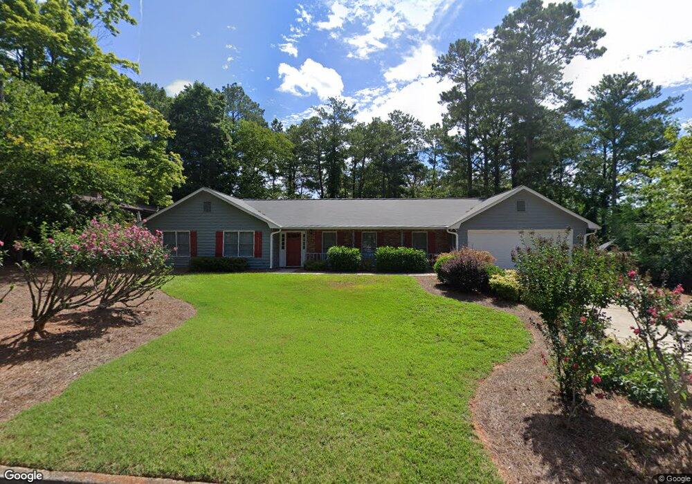
1945 Branch Valley Dr Unit 5 Roswell, GA 30076
Martin's Landing NeighborhoodEstimated Value: $564,000 - $639,000
4
Beds
3
Baths
2,312
Sq Ft
$254/Sq Ft
Est. Value
About This Home
This home is located at 1945 Branch Valley Dr Unit 5, Roswell, GA 30076 and is currently estimated at $586,583, approximately $253 per square foot. 1945 Branch Valley Dr Unit 5 is a home located in Fulton County with nearby schools including Jackson Elementary School, Holcomb Bridge Middle School, and Centennial High School.
Ownership History
Date
Name
Owned For
Owner Type
Purchase Details
Closed on
Mar 27, 2007
Sold by
Landham Thomas J and Landham Stephanie R
Bought by
Landham Living Trust
Current Estimated Value
Purchase Details
Closed on
May 18, 1994
Sold by
Oneill Edward
Bought by
Landham Thomas J Stephanie
Home Financials for this Owner
Home Financials are based on the most recent Mortgage that was taken out on this home.
Original Mortgage
$99,000
Interest Rate
8.73%
Create a Home Valuation Report for This Property
The Home Valuation Report is an in-depth analysis detailing your home's value as well as a comparison with similar homes in the area
Home Values in the Area
Average Home Value in this Area
Purchase History
| Date | Buyer | Sale Price | Title Company |
|---|---|---|---|
| Landham Living Trust | -- | -- | |
| Landham Thomas J Stephanie | $71,800 | -- | |
| Landham Thomas J Stephanie | $71,800 | -- |
Source: Public Records
Mortgage History
| Date | Status | Borrower | Loan Amount |
|---|---|---|---|
| Previous Owner | Landham Thomas J Stephanie | $99,000 |
Source: Public Records
Tax History Compared to Growth
Tax History
| Year | Tax Paid | Tax Assessment Tax Assessment Total Assessment is a certain percentage of the fair market value that is determined by local assessors to be the total taxable value of land and additions on the property. | Land | Improvement |
|---|---|---|---|---|
| 2025 | $481 | $184,240 | $44,800 | $139,440 |
| 2023 | $5,125 | $181,560 | $61,040 | $120,520 |
| 2022 | $1,430 | $160,240 | $37,120 | $123,120 |
| 2021 | $1,740 | $137,080 | $31,280 | $105,800 |
| 2020 | $1,759 | $135,480 | $30,920 | $104,560 |
| 2019 | $340 | $125,360 | $29,440 | $95,920 |
| 2018 | $2,001 | $122,440 | $28,760 | $93,680 |
| 2017 | $1,373 | $84,040 | $19,760 | $64,280 |
| 2016 | $1,368 | $84,040 | $19,760 | $64,280 |
| 2015 | $1,717 | $84,040 | $19,760 | $64,280 |
| 2014 | $1,370 | $84,040 | $19,760 | $64,280 |
Source: Public Records
Map
Nearby Homes
- 530 Silver Pine Trail
- 680 Branch Valley Ct
- 1845 Branch Valley Dr
- 140 Glen Holly Dr
- 2240 Six Branches Dr
- 4211 Canyon Point Cir
- 4040 Declaration Dr
- 1115 Canyon Point Cir
- 2005 Canyon Point Cir
- 109 W Ridge Way
- 315 Sea Holly Cir
- 230 Winterberry Ct
- 225 Winterberry Ct
- 3040 Gray Hawk Ln
- 148 W Ridge Way
- 350 Sea Holly Cir
- 309 Quail Run
- 1955 Branch Valley Dr
- 1935 Branch Valley Dr
- 460 Silver Pine Trail
- 1965 Branch Valley Dr
- 470 Silver Pine Trail
- 1930 Branch Valley Dr
- 450 Silver Pine Trail
- 1925 Branch Valley Dr
- 9160 Eves Cir
- 1920 Branch Valley Dr Unit 5
- 1940 Branch Valley Dr Unit 5
- 9162 Eves Cir Unit 1
- 480 Silver Pine Trail
- 1950 Branch Valley Dr
- 1975 Branch Valley Dr Unit 5
- 9164 Eves Cir
- 1915 Branch Valley Dr Unit 5
- 1960 Branch Valley Dr
- 1910 Branch Valley Dr
- 490 Silver Pine Trail