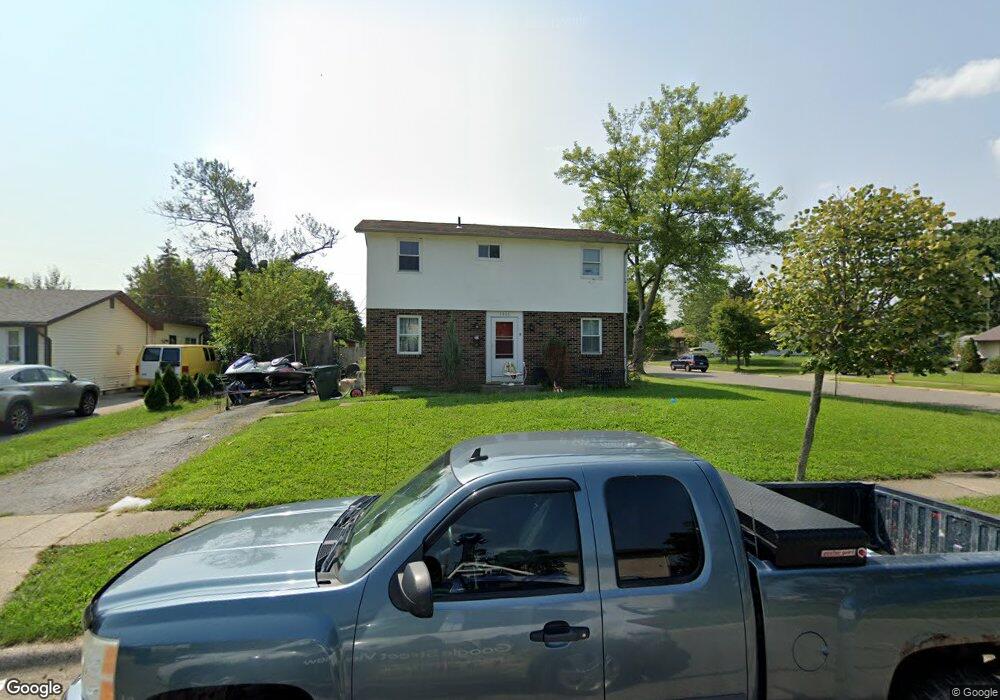
1945 Brimfield Ct Columbus, OH 43229
Forest Park East NeighborhoodEstimated Value: $285,000 - $340,000
6
Beds
4
Baths
1,872
Sq Ft
$167/Sq Ft
Est. Value
About This Home
This home is located at 1945 Brimfield Ct, Columbus, OH 43229 and is currently estimated at $313,558, approximately $167 per square foot. 1945 Brimfield Ct is a home located in Franklin County with nearby schools including Forest Park Elementary School, Woodward Park Middle School, and Northland High School.
Ownership History
Date
Name
Owned For
Owner Type
Purchase Details
Closed on
Sep 8, 2000
Sold by
Werner Blanche N
Bought by
West Michael A
Current Estimated Value
Home Financials for this Owner
Home Financials are based on the most recent Mortgage that was taken out on this home.
Original Mortgage
$94,000
Outstanding Balance
$34,357
Interest Rate
8.14%
Estimated Equity
$279,201
Purchase Details
Closed on
Jun 12, 2000
Sold by
Hershey Myron G
Bought by
Werner Blanche N
Purchase Details
Closed on
Oct 16, 1970
Bought by
Hershey Myron G
Create a Home Valuation Report for This Property
The Home Valuation Report is an in-depth analysis detailing your home's value as well as a comparison with similar homes in the area
Home Values in the Area
Average Home Value in this Area
Purchase History
| Date | Buyer | Sale Price | Title Company |
|---|---|---|---|
| West Michael A | $52,300 | -- | |
| West Michael A | $104,500 | -- | |
| Werner Blanche N | -- | -- | |
| Hershey Myron G | -- | -- |
Source: Public Records
Mortgage History
| Date | Status | Borrower | Loan Amount |
|---|---|---|---|
| Open | West Michael A | $94,000 |
Source: Public Records
Tax History Compared to Growth
Tax History
| Year | Tax Paid | Tax Assessment Tax Assessment Total Assessment is a certain percentage of the fair market value that is determined by local assessors to be the total taxable value of land and additions on the property. | Land | Improvement |
|---|---|---|---|---|
| 2024 | $3,667 | $80,020 | $20,480 | $59,540 |
| 2023 | $3,621 | $80,010 | $20,475 | $59,535 |
| 2022 | $2,426 | $45,650 | $7,950 | $37,700 |
| 2021 | $2,430 | $45,650 | $7,950 | $37,700 |
| 2020 | $2,434 | $45,650 | $7,950 | $37,700 |
| 2019 | $2,102 | $33,810 | $5,880 | $27,930 |
| 2018 | $2,089 | $33,810 | $5,880 | $27,930 |
| 2017 | $2,102 | $33,810 | $5,880 | $27,930 |
| 2016 | $2,283 | $33,610 | $8,860 | $24,750 |
| 2015 | $2,079 | $33,610 | $8,860 | $24,750 |
| 2014 | $2,084 | $33,610 | $8,860 | $24,750 |
| 2013 | $1,081 | $35,350 | $9,310 | $26,040 |
Source: Public Records
Map
Nearby Homes
- 1881 Brimfield Rd
- 2084 Brookfield Rd
- 1914 Walden Dr
- 5726 Beechcroft Rd Unit J
- 5732 Beechcroft Rd Unit B
- 5485 Tamarack Blvd
- 1752 Pine Tree St S Unit H
- 1743 Pine Tree St N Unit A
- 1722 Blue Ash Place
- 1687 Brookfield Square S
- 5578 Parkshire Dr Unit 5578
- 5522 Parkshire Dr Unit 5522
- 5556 Parkshire Dr Unit 5556
- 5204 Honeytree Loop W
- 2294 Teakwood Dr
- 2250 Webster Canyon Ct
- 6019 Beechcroft Rd
- 1492 Cottonwood Dr
- 2058 Northcliff Dr
- 5124 Northcliff Loop W
- 1953 Brimfield Ct
- 1961 Brimfield Ct
- 5610 Beechcroft Rd
- 1925 Brimfield Rd
- 1942 Brookfield Rd
- 1967 Brimfield Ct
- 1950 Brookfield Rd
- 5646 Beechcroft Rd Unit 648
- 1956 Brimfield Ct
- 5615 Beechcroft Rd
- 1958 Brookfield Rd
- 1917 Brimfield Rd
- 1964 Brimfield Ct
- 1973 Brimfield Ct
- 5651 Beechcroft Rd
- 1966 Brookfield Rd
- 1908 Brookfield Rd
- 1972 Brimfield Ct
- 1907 Brimfield Rd
- 1979 Brimfield Ct