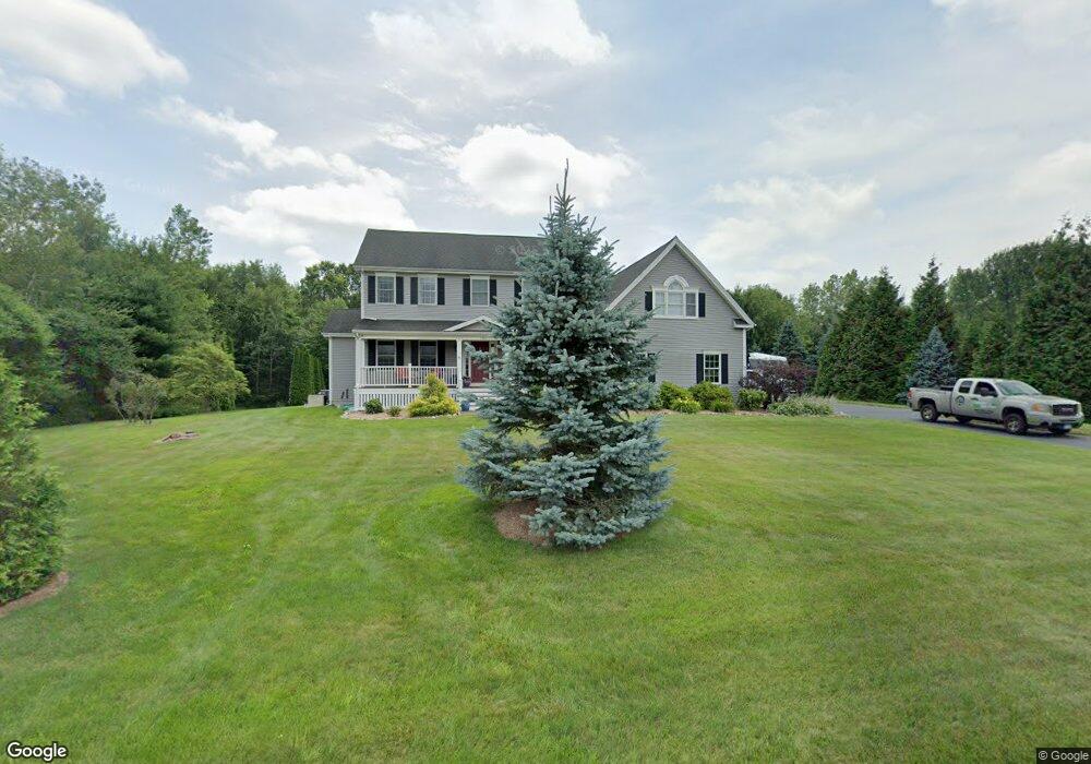
1945 Colson St West Suffield, CT 06093
Estimated Value: $403,000 - $488,000
4
Beds
3
Baths
2,125
Sq Ft
$216/Sq Ft
Est. Value
About This Home
This home is located at 1945 Colson St, West Suffield, CT 06093 and is currently estimated at $457,956, approximately $215 per square foot. 1945 Colson St is a home located in Hartford County with nearby schools including A. Ward Spaulding School, Mcalister Intermediate School, and Suffield Middle School.
Ownership History
Date
Name
Owned For
Owner Type
Purchase Details
Closed on
Sep 14, 2022
Sold by
Kipp Susan
Bought by
Mills Jesse J and Spence Kimberly V
Current Estimated Value
Home Financials for this Owner
Home Financials are based on the most recent Mortgage that was taken out on this home.
Original Mortgage
$306,500
Outstanding Balance
$290,480
Interest Rate
4.99%
Mortgage Type
Purchase Money Mortgage
Estimated Equity
$167,477
Purchase Details
Closed on
Jul 1, 2021
Sold by
Holcomb Dorothy L
Bought by
Kipp Susan and Lu Dorothy L
Create a Home Valuation Report for This Property
The Home Valuation Report is an in-depth analysis detailing your home's value as well as a comparison with similar homes in the area
Home Values in the Area
Average Home Value in this Area
Purchase History
| Date | Buyer | Sale Price | Title Company |
|---|---|---|---|
| Mills Jesse J | $331,500 | None Available | |
| Kipp Susan | -- | None Available |
Source: Public Records
Mortgage History
| Date | Status | Borrower | Loan Amount |
|---|---|---|---|
| Open | Mills Jesse J | $306,500 |
Source: Public Records
Tax History
| Year | Tax Paid | Tax Assessment Tax Assessment Total Assessment is a certain percentage of the fair market value that is determined by local assessors to be the total taxable value of land and additions on the property. | Land | Improvement |
|---|---|---|---|---|
| 2025 | $6,096 | $260,400 | $65,240 | $195,160 |
| 2024 | $5,893 | $260,400 | $65,240 | $195,160 |
| 2023 | $5,730 | $200,270 | $65,240 | $135,030 |
| 2022 | $5,772 | $201,740 | $65,240 | $136,500 |
| 2021 | $5,778 | $201,740 | $65,240 | $136,500 |
| 2020 | $5,778 | $201,740 | $65,240 | $136,500 |
| 2019 | $5,794 | $201,740 | $65,240 | $136,500 |
| 2018 | $5,695 | $194,250 | $63,350 | $130,900 |
| 2017 | $5,612 | $194,250 | $63,350 | $130,900 |
| 2016 | $5,478 | $194,250 | $63,350 | $130,900 |
| 2015 | $5,396 | $194,250 | $63,350 | $130,900 |
| 2014 | $5,268 | $194,250 | $63,350 | $130,900 |
Source: Public Records
Map
Nearby Homes
- 7 Rising Corner Rd
- 384 Pine St
- 534 S West St
- 10 Ridgewood Dr
- 150 S Longyard Rd
- 65 Hendom Dr
- 141 Point Grove Rd
- 306 Feeding Hills Rd
- 138 Elmar Dr
- 2 Stratton Farms Rd
- 187 Griffin Rd
- 387 Southwick St
- 3 Evergreen St
- 1054 Mountain Rd
- 245 Birch Rd
- 212 Feeding Hills Rd
- 4066 Mountain Rd
- 14 Briarcliff Dr
- 180 Southwick St
- 80 Bungalow St
- 1955 Colson St
- 2021 Colson St
- 2026 Colson St
- 1050 N Stone St
- 1242 N Stone St
- 1268 N Stone St
- 1201 N Stone St
- 1280 N Stone St
- 1197 Ratley Rd
- 1320 N Stone St
- 1240 Ratley Rd
- 1250 Ratley Rd
- 1232 Ratley Rd
- 1305 N Stone St
- 1230 Ratley Rd
- 1220 Ratley Rd
- 1105 Ratley Rd
- 1260 Ratley Rd
- 1323 N Stone St
- 1111 N Stone St
Your Personal Tour Guide
Ask me questions while you tour the home.