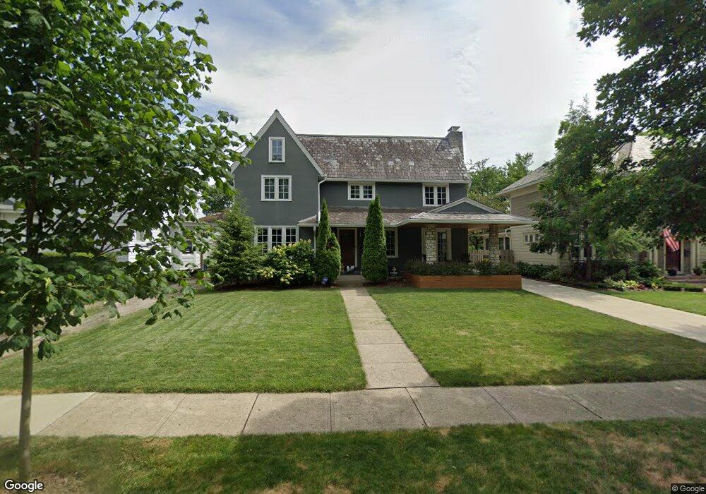
1945 Concord Rd Columbus, OH 43212
Estimated Value: $919,000 - $1,460,000
4
Beds
2
Baths
2,215
Sq Ft
$524/Sq Ft
Est. Value
About This Home
This home is located at 1945 Concord Rd, Columbus, OH 43212 and is currently estimated at $1,160,319, approximately $523 per square foot. 1945 Concord Rd is a home located in Franklin County with nearby schools including Barrington Road Elementary School, Jones Middle School, and Upper Arlington High School.
Ownership History
Date
Name
Owned For
Owner Type
Purchase Details
Closed on
Aug 26, 2016
Sold by
Henningsen Llc
Bought by
Callaghan Sinead O and Blakaj Dukagjin
Current Estimated Value
Purchase Details
Closed on
Oct 22, 2012
Sold by
Spurlock Ruben and Spurlock Vera L
Bought by
Henningsen Llc
Purchase Details
Closed on
May 7, 1968
Bought by
Spurlock Ruben and Spurlock Vera L
Create a Home Valuation Report for This Property
The Home Valuation Report is an in-depth analysis detailing your home's value as well as a comparison with similar homes in the area
Home Values in the Area
Average Home Value in this Area
Purchase History
| Date | Buyer | Sale Price | Title Company |
|---|---|---|---|
| Callaghan Sinead O | $950,000 | Stewart Title Box | |
| Henningsen Llc | $340,000 | Talon Title -A | |
| Spurlock Ruben | -- | -- |
Source: Public Records
Tax History
| Year | Tax Paid | Tax Assessment Tax Assessment Total Assessment is a certain percentage of the fair market value that is determined by local assessors to be the total taxable value of land and additions on the property. | Land | Improvement |
|---|---|---|---|---|
| 2025 | $16,690 | $288,300 | $120,120 | $168,180 |
| 2024 | $16,690 | $288,300 | $120,120 | $168,180 |
| 2023 | $16,923 | $288,295 | $120,120 | $168,175 |
| 2022 | $14,714 | $205,490 | $65,520 | $139,970 |
| 2021 | $13,066 | $205,490 | $65,520 | $139,970 |
| 2020 | $12,953 | $205,490 | $65,520 | $139,970 |
| 2019 | $12,581 | $178,990 | $65,520 | $113,470 |
| 2018 | $10,723 | $178,990 | $65,520 | $113,470 |
| 2017 | $12,316 | $178,990 | $65,520 | $113,470 |
| 2016 | $10,422 | $153,480 | $61,220 | $92,260 |
| 2015 | $8,750 | $128,980 | $61,220 | $67,760 |
| 2014 | $8,760 | $128,980 | $61,220 | $67,760 |
| 2013 | $4,251 | $117,250 | $55,650 | $61,600 |
Source: Public Records
Map
Nearby Homes
- 2015 W 5th Ave Unit 211
- 2015 W 5th Ave Unit 102
- 2015 W 5th Ave Unit 108
- 1585 Arlington Ave Unit 1585A
- 1579 Arlington Ave Unit 1579B
- 1631 Roxbury Rd Unit D2
- 1530 Lincoln Rd
- 1523 Wyandotte Rd
- 1561 Glenn Ave
- 1427 Roxbury Rd Unit Manor House North
- 1942 Bedford Rd
- 1921 Wyandotte Rd
- 1648 Ashland Ave
- 1624 Ashland Ave
- 1654-1656 Ashland Ave
- 2006 Cambridge Blvd
- 1876 Westwood Ave
- 1951 Glenn Ave
- 1439 Cliff Ct Unit 65
- 1443 Cliff Ct Unit 71
- 1953 Concord Rd
- 1937 Concord Rd
- 1961 Concord Rd
- 1931 Concord Rd
- 1952 W 5th Ave
- 1944 W 5th Ave
- 1960 W 5th Ave
- 1966 W 5th Ave
- 1925 Concord Rd
- 1946 Concord Rd
- 1938 Concord Rd
- 1952 Concord Rd
- 1650 Arlington Ave
- 1971 Concord Rd
- 1930 Concord Rd
- 1932 W 5th Ave
- 1960 Concord Rd
- 1640 Arlington Ave
- 1645 Cambridge Blvd
- 1665 Cambridge Blvd
Your Personal Tour Guide
Ask me questions while you tour the home.