Estimated Value: $997,000 - $1,295,603
--
Bed
1
Bath
3,711
Sq Ft
$307/Sq Ft
Est. Value
About This Home
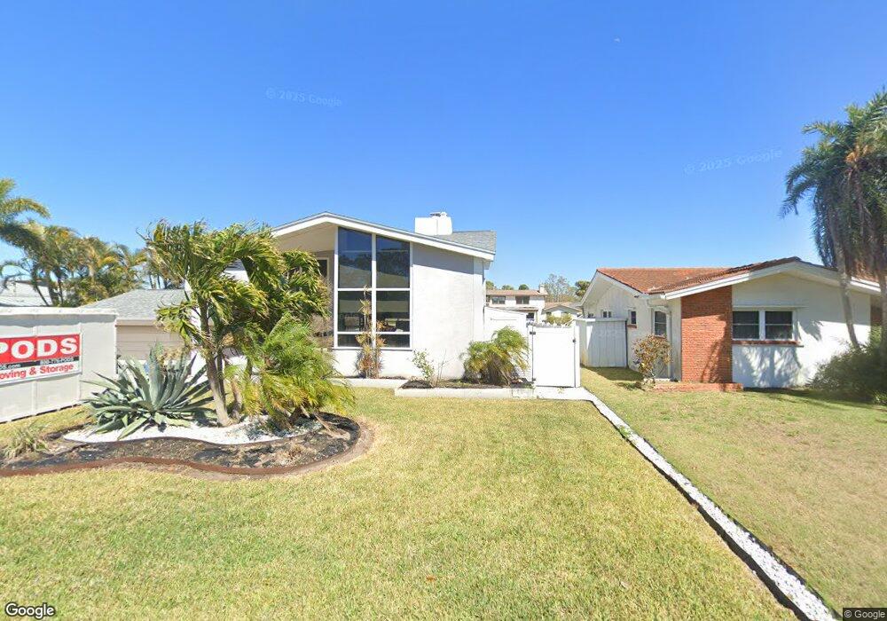
This home is located at 1945 Cove Dr, Largo, FL 33774 and is currently estimated at $1,138,401, approximately $306 per square foot. 1945 Cove Dr is a home with nearby schools including Belcher Elementary School, Largo High School, and Oak Grove Middle School.
Ownership History
Date
Name
Owned For
Owner Type
Purchase Details
Closed on
Feb 1, 2013
Sold by
Bar Joseph Maria
Bought by
Henley Jonathan E and Henley Silvana M
Current Estimated Value
Home Financials for this Owner
Home Financials are based on the most recent Mortgage that was taken out on this home.
Original Mortgage
$74,800
Outstanding Balance
$14,022
Interest Rate
2.5%
Mortgage Type
Adjustable Rate Mortgage/ARM
Estimated Equity
$1,124,379
Purchase Details
Closed on
Jul 14, 2010
Sold by
Bar Joseph Dan
Bought by
Bar Joseph Maria
Create a Home Valuation Report for This Property
The Home Valuation Report is an in-depth analysis detailing your home's value as well as a comparison with similar homes in the area
Home Values in the Area
Average Home Value in this Area
Purchase History
| Date | Buyer | Sale Price | Title Company |
|---|---|---|---|
| Henley Jonathan E | $93,500 | Attorney | |
| Bar Joseph Maria | -- | Attorney |
Source: Public Records
Mortgage History
| Date | Status | Borrower | Loan Amount |
|---|---|---|---|
| Open | Henley Jonathan E | $74,800 |
Source: Public Records
Tax History Compared to Growth
Tax History
| Year | Tax Paid | Tax Assessment Tax Assessment Total Assessment is a certain percentage of the fair market value that is determined by local assessors to be the total taxable value of land and additions on the property. | Land | Improvement |
|---|---|---|---|---|
| 2024 | $9,887 | $581,902 | -- | -- |
| 2023 | $9,887 | $564,953 | $0 | $0 |
| 2022 | $9,634 | $548,498 | $0 | $0 |
| 2021 | $9,783 | $532,522 | $0 | $0 |
| 2020 | $9,470 | $509,662 | $0 | $0 |
| 2019 | $9,318 | $498,203 | $0 | $0 |
| 2018 | $9,254 | $488,914 | $0 | $0 |
| 2017 | $10,718 | $510,360 | $0 | $0 |
| 2016 | $8,956 | $469,009 | $0 | $0 |
| 2015 | $1,664 | $119,407 | $0 | $0 |
| 2014 | $1,046 | $49,131 | $0 | $0 |
Source: Public Records
Map
Nearby Homes
- 1670 Fox Rd
- 1849 Del Robles Dr
- 1950 Arvis Cir W
- 1954 Arvis Cir W
- 2015 Belleair Rd
- 1948 Belleair Rd
- 1681 Long Bow Ln
- 1978 Arvis Cir W
- 1857 Belleair Rd
- 1880 Belleair Rd
- 3119 Roberta St
- 2168 Waterside Dr
- 1560 Bel Keene Dr
- 2146 Egret Dr
- 947 Sousa Dr
- 1012 Irene Ave
- 2156 Egret Dr
- 2186 Waterside Dr
- 853 Seacrest Dr
- 1466 S Hercules Ave