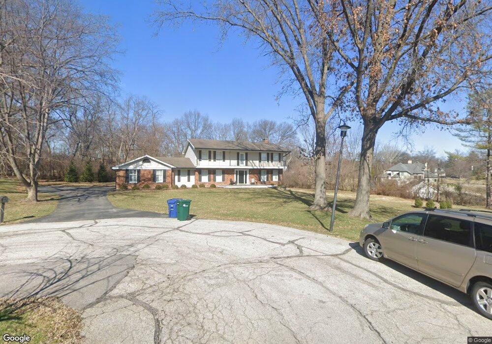
1945 Drexel Hill Ct Saint Louis, MO 63131
Estimated Value: $1,111,000 - $1,262,000
5
Beds
5
Baths
3,584
Sq Ft
$327/Sq Ft
Est. Value
About This Home
This home is located at 1945 Drexel Hill Ct, Saint Louis, MO 63131 and is currently estimated at $1,172,188, approximately $327 per square foot. 1945 Drexel Hill Ct is a home located in St. Louis County with nearby schools including Westchester Elementary School, North Kirkwood Middle School, and Kirkwood Senior High School.
Ownership History
Date
Name
Owned For
Owner Type
Purchase Details
Closed on
Jul 3, 2024
Sold by
Simpler Julie Marie and Poplstein Charles Michael
Bought by
Poplstein Charles Michael
Current Estimated Value
Purchase Details
Closed on
Aug 17, 2023
Sold by
Poplstein Charles Michael
Bought by
Poplstein Charles Michael and Poplstein Julie Marie
Purchase Details
Closed on
Sep 22, 2009
Sold by
Poplstein Charles M and Poplstein Diana M
Bought by
Poplstein Charles M
Home Financials for this Owner
Home Financials are based on the most recent Mortgage that was taken out on this home.
Original Mortgage
$410,000
Interest Rate
5.1%
Mortgage Type
New Conventional
Create a Home Valuation Report for This Property
The Home Valuation Report is an in-depth analysis detailing your home's value as well as a comparison with similar homes in the area
Home Values in the Area
Average Home Value in this Area
Purchase History
| Date | Buyer | Sale Price | Title Company |
|---|---|---|---|
| Poplstein Charles Michael | -- | None Listed On Document | |
| Poplstein Charles Michael | -- | None Listed On Document | |
| Poplstein Charles M | -- | Multiple |
Source: Public Records
Mortgage History
| Date | Status | Borrower | Loan Amount |
|---|---|---|---|
| Previous Owner | Poplstein Charles M | $410,000 |
Source: Public Records
Tax History Compared to Growth
Tax History
| Year | Tax Paid | Tax Assessment Tax Assessment Total Assessment is a certain percentage of the fair market value that is determined by local assessors to be the total taxable value of land and additions on the property. | Land | Improvement |
|---|---|---|---|---|
| 2025 | $9,768 | $221,840 | $86,070 | $135,770 |
| 2024 | $9,768 | $169,140 | $69,940 | $99,200 |
| 2023 | $9,768 | $169,140 | $69,940 | $99,200 |
| 2022 | $8,404 | $137,730 | $69,940 | $67,790 |
| 2021 | $8,314 | $137,730 | $69,940 | $67,790 |
| 2020 | $9,351 | $149,000 | $44,060 | $104,940 |
| 2019 | $9,363 | $149,000 | $44,060 | $104,940 |
| 2018 | $8,242 | $117,650 | $30,610 | $87,040 |
| 2017 | $8,264 | $117,650 | $30,610 | $87,040 |
| 2016 | $8,408 | $121,260 | $30,610 | $90,650 |
| 2015 | $8,418 | $121,260 | $30,610 | $90,650 |
| 2014 | $8,180 | $115,140 | $37,130 | $78,010 |
Source: Public Records
Map
Nearby Homes
- 12439 Springdale Ln Unit TBB
- The Hawthorne Plan at Ballas Ridge
- The Roclare II Plan at Ballas Ridge
- The Westchester IV Plan at Ballas Ridge
- The Nottingham II Plan at Ballas Ridge
- The Hawthorne II Plan at Ballas Ridge
- TBB
- TBB Ballas Ridge Roclare II
- TBB Ballas Ridge Westchester IV
- TBB Ballas Ridge Hawthorne II
- 2056 N Ballas Rd
- 2062 N Ballas Rd
- TBB
- 0 Unknown Unit 22071090
- 2409 N Ballas Rd
- 1515 Topping Rd
- 12841 Thornhill Ct
- 8 Briarbrook Trail
- 5 W Point Ln
- 1824 Topping Rd
- 12457 Balwyck Ln
- 1933 Drexel Hill Ct
- 1946 Drexel Hill Ct
- 1940 Windmoor Place
- 12465 Balwyck Ln
- 1952 Windmoor Place
- 1934 Drexel Hill Ct
- 12451 Balwyck Ln
- 1949 Roth Dr
- 1966 Windmoor Place
- 1924 Windmoor Place
- 12462 Balwyck Ln
- 1922 Drexel Hill Ct
- 1925 Roth Dr
- 1939 Windmoor Place
- 1933 Windmoor Place
- 12445 Balwyck Ln
- 1925 Windmoor Place
- 12444 Balwyck Ln
- 12493 Drexel Hill Dr