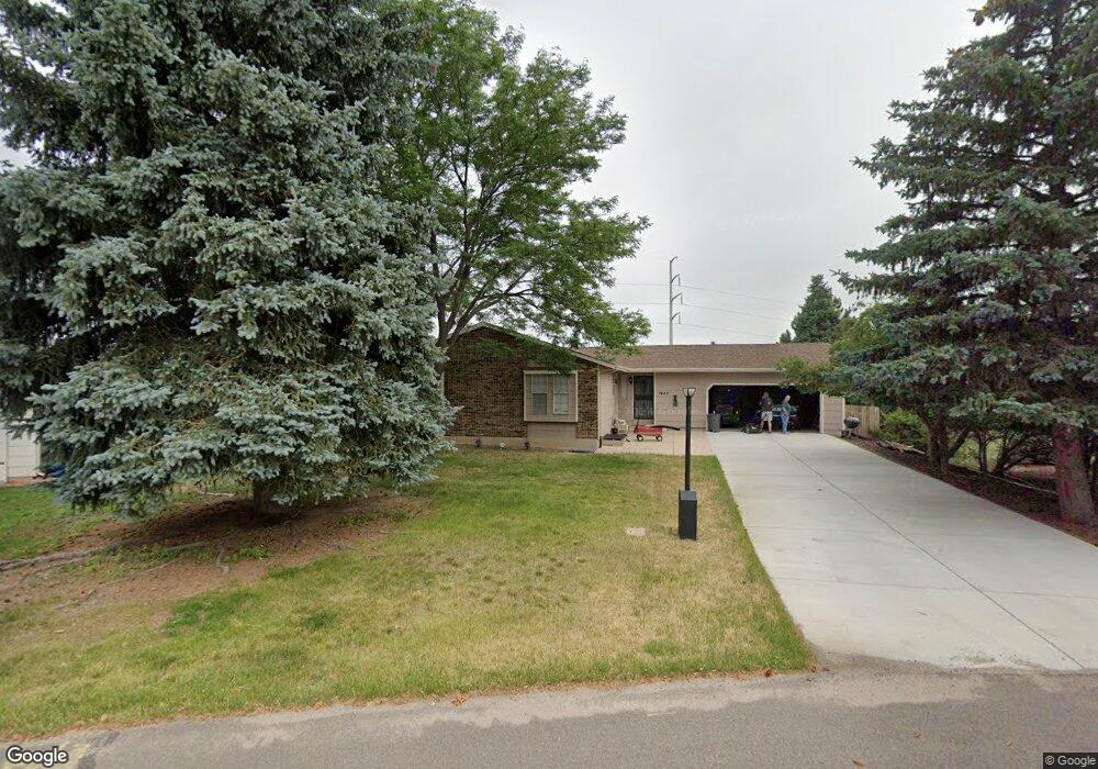
1945 Flintlock Terrace W Colorado Springs, CO 80920
Briargate NeighborhoodEstimated Value: $441,000 - $475,000
2
Beds
2
Baths
1,296
Sq Ft
$350/Sq Ft
Est. Value
About This Home
This home is located at 1945 Flintlock Terrace W, Colorado Springs, CO 80920 and is currently estimated at $454,080, approximately $350 per square foot. 1945 Flintlock Terrace W is a home located in El Paso County with nearby schools including High Plains Elementary School, Mountain Ridge Middle School, and Rampart High School.
Ownership History
Date
Name
Owned For
Owner Type
Purchase Details
Closed on
Sep 28, 1992
Bought by
Bartosch Luann I
Current Estimated Value
Purchase Details
Closed on
Feb 1, 1989
Bought by
Bartosch Larry J
Purchase Details
Closed on
Jun 1, 1988
Bought by
Bartosch Larry J
Purchase Details
Closed on
Nov 1, 1986
Bought by
Bartosch Luann I
Purchase Details
Closed on
Oct 1, 1978
Bought by
Bartosch Larry J
Create a Home Valuation Report for This Property
The Home Valuation Report is an in-depth analysis detailing your home's value as well as a comparison with similar homes in the area
Home Values in the Area
Average Home Value in this Area
Purchase History
| Date | Buyer | Sale Price | Title Company |
|---|---|---|---|
| Bartosch Luann I | -- | -- | |
| Bartosch Larry J | -- | -- | |
| Bartosch Larry J | -- | -- | |
| Bartosch Luann I | -- | -- | |
| Bartosch Larry J | -- | -- |
Source: Public Records
Tax History Compared to Growth
Tax History
| Year | Tax Paid | Tax Assessment Tax Assessment Total Assessment is a certain percentage of the fair market value that is determined by local assessors to be the total taxable value of land and additions on the property. | Land | Improvement |
|---|---|---|---|---|
| 2025 | $2,040 | $34,160 | -- | -- |
| 2024 | $1,552 | $35,550 | $5,360 | $30,190 |
| 2022 | $1,275 | $25,020 | $4,340 | $20,680 |
| 2021 | $1,410 | $25,740 | $4,460 | $21,280 |
| 2020 | $1,107 | $20,750 | $3,720 | $17,030 |
| 2019 | $1,672 | $20,750 | $3,720 | $17,030 |
| 2018 | $1,316 | $16,070 | $2,880 | $13,190 |
| 2017 | $1,312 | $16,070 | $2,880 | $13,190 |
| 2016 | $1,320 | $16,150 | $2,930 | $13,220 |
| 2015 | $1,317 | $16,150 | $2,930 | $13,220 |
| 2014 | $1,233 | $15,100 | $2,930 | $12,170 |
Source: Public Records
Map
Nearby Homes
- 1932 Silkwood Dr
- 2110 Whitehorn Dr N
- 1880 Independence Dr
- 2068 Silkwood Dr
- 1907 Independence Dr
- 2006 Summerset Dr
- 1884 Fuller Rd
- 2114 Summerset Dr
- 8161 Regiment Ct
- 2512 Elite Terrace
- 2650 Bannister Ct
- 8335 Sutterfield Dr
- 7191 Ross Dr
- 1931 London Carriage Grove
- 2270 Cloverdale Dr
- 8146 Horizon Dr
- 2615 Thrush Grove
- 7849 Flicker Grove
- 2326 Parliament Dr
- 2340 Winstead View
- 1949 Flintlock Terrace W
- 1941 Flintlock Terrace W
- 1937 Flintlock Terrace W
- 1938 Flintlock Terrace W
- 1933 Flintlock Terrace W
- 1910 Rusty Hinge Dr
- 1960 Whitehorn Dr N
- 1970 Whitehorn Dr N
- 1950 Whitehorn Dr N
- 1929 Flintlock Terrace W
- 1920 Rusty Hinge Dr
- 1980 Whitehorn Dr N
- 2003 Flintlock Terrace E
- 1930 Flintlock Terrace W
- 1990 Whitehorn Dr N
- 1930 Whitehorn Dr N
- 1925 Flintlock Terrace W
- 1930 Rusty Hinge Dr
- 1915 Rusty Hinge Dr
- 2002 Whitehorn Dr N