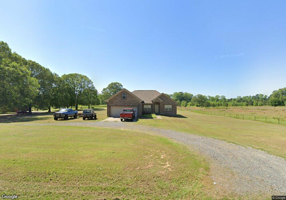
1945 Forbus Rd Lonoke, AR 72086
Estimated Value: $235,000 - $274,878
3
Beds
2
Baths
1,794
Sq Ft
$146/Sq Ft
Est. Value
About This Home
This home is located at 1945 Forbus Rd, Lonoke, AR 72086 and is currently estimated at $262,720, approximately $146 per square foot. 1945 Forbus Rd is a home located in Lonoke County with nearby schools including Southside Elementary School, Cabot Junior High South, and Cabot Middle School South.
Ownership History
Date
Name
Owned For
Owner Type
Purchase Details
Closed on
Jun 23, 2016
Sold by
Farrar Tammy L and Rea Tammy L
Bought by
Farrar Justin
Current Estimated Value
Purchase Details
Closed on
May 10, 2012
Sold by
Akins And Clark Construction Llc
Bought by
Rea Tammy L
Home Financials for this Owner
Home Financials are based on the most recent Mortgage that was taken out on this home.
Original Mortgage
$165,280
Interest Rate
4.02%
Purchase Details
Closed on
Apr 30, 2012
Sold by
Akins And Clark Construction Llc
Bought by
Rea Tammy L
Home Financials for this Owner
Home Financials are based on the most recent Mortgage that was taken out on this home.
Original Mortgage
$165,280
Interest Rate
4.02%
Create a Home Valuation Report for This Property
The Home Valuation Report is an in-depth analysis detailing your home's value as well as a comparison with similar homes in the area
Purchase History
| Date | Buyer | Sale Price | Title Company |
|---|---|---|---|
| Farrar Justin | $153,000 | None Available | |
| Rea Tammy L | -- | -- | |
| Rea Tammy L | -- | -- |
Source: Public Records
Mortgage History
| Date | Status | Borrower | Loan Amount |
|---|---|---|---|
| Previous Owner | Rea Tammy L | $165,280 | |
| Previous Owner | Rea Tammy L | $165,280 |
Source: Public Records
Tax History
| Year | Tax Paid | Tax Assessment Tax Assessment Total Assessment is a certain percentage of the fair market value that is determined by local assessors to be the total taxable value of land and additions on the property. | Land | Improvement |
|---|---|---|---|---|
| 2025 | $1,096 | $33,130 | $4,500 | $28,630 |
| 2024 | $1,096 | $33,130 | $4,500 | $28,630 |
| 2023 | $1,096 | $33,130 | $4,500 | $28,630 |
| 2022 | $1,127 | $33,130 | $4,500 | $28,630 |
| 2021 | $1,068 | $33,130 | $4,500 | $28,630 |
| 2020 | $1,009 | $30,160 | $4,500 | $25,660 |
| 2019 | $1,009 | $30,160 | $4,500 | $25,660 |
| 2018 | $1,034 | $30,160 | $4,500 | $25,660 |
| 2017 | $1,279 | $30,160 | $4,500 | $25,660 |
| 2016 | $1,034 | $30,160 | $4,500 | $25,660 |
| 2015 | $1,231 | $29,040 | $4,500 | $24,540 |
| 2014 | $983 | $29,040 | $4,500 | $24,540 |
Source: Public Records
Map
Nearby Homes
- 165 Sunset Country Ln
- 000 Bratton Rd
- 1D Forbus Rd
- 141 Fuscata Loop
- 125 Ford Dr
- 34 Andy Cove
- 3709 Sandhill Rd
- 320 Juanita Dr
- 486 Pearlstone Dr
- 485 Pearl Stone Dr
- 75 Booker Dr
- 157 Booker Dr
- 000 Sandhill Rd
- 210 Rosewood Valley
- 490 Bobwhite Hollow
- 4484 Sandhill Rd
- 322 Southwood Cir
- 00 Old Stagecoach Rd
- 20 Old Stagecoach Rd
- 2664 Arkansas 236
- 1975 Forbus Rd
- 1936 Forbus Rd
- 1998 Forbus Rd
- 0 Forbus Rd
- 468 Sunset Country Ln
- 1791 Forbus Rd
- 416 Sunset Country Ln
- 1775 Forbus Rd Unit 1791
- 1955 Forbus Rd
- 245 Milner Rd
- 2096 Forbus Rd
- 445 Sunset Country Ln
- 2109 Forbus Rd
- 423 Sunset Country Ln
- 2128 Forbus Rd
- 364 Sunset Country Ln
- 395 Sunset Country Ln
- 2142 Forbus Rd
- 0 Milner Rd
- 1704 Forbus Rd
Your Personal Tour Guide
Ask me questions while you tour the home.