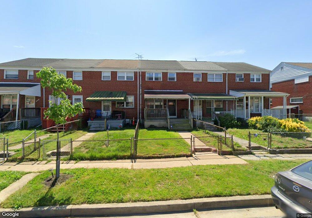
1945 Haselmere Rd Dundalk, MD 21222
Estimated Value: $171,001 - $244,000
--
Bed
1
Bath
1,024
Sq Ft
$192/Sq Ft
Est. Value
About This Home
This home is located at 1945 Haselmere Rd, Dundalk, MD 21222 and is currently estimated at $196,500, approximately $191 per square foot. 1945 Haselmere Rd is a home located in Baltimore County with nearby schools including Sandy Plains Elementary, General John Stricker Middle School, and Patapsco High & Center for Arts.
Ownership History
Date
Name
Owned For
Owner Type
Purchase Details
Closed on
Dec 28, 2007
Sold by
Campbell Donald M
Bought by
Campbell Robert E and Bishoff Brandt R
Current Estimated Value
Home Financials for this Owner
Home Financials are based on the most recent Mortgage that was taken out on this home.
Original Mortgage
$112,000
Outstanding Balance
$66,794
Interest Rate
6.5%
Mortgage Type
Purchase Money Mortgage
Estimated Equity
$129,706
Purchase Details
Closed on
May 17, 2006
Sold by
Campbell Donald M
Bought by
Campbell Robert E and Bishoff Brandt R
Home Financials for this Owner
Home Financials are based on the most recent Mortgage that was taken out on this home.
Original Mortgage
$112,000
Interest Rate
6.5%
Mortgage Type
Purchase Money Mortgage
Purchase Details
Closed on
Apr 27, 1977
Sold by
Rimel Edward Arthur
Bought by
Campbell Donald M
Create a Home Valuation Report for This Property
The Home Valuation Report is an in-depth analysis detailing your home's value as well as a comparison with similar homes in the area
Home Values in the Area
Average Home Value in this Area
Purchase History
| Date | Buyer | Sale Price | Title Company |
|---|---|---|---|
| Campbell Robert E | $140,000 | -- | |
| Campbell Robert E | $140,000 | -- | |
| Campbell Donald M | $27,500 | -- |
Source: Public Records
Mortgage History
| Date | Status | Borrower | Loan Amount |
|---|---|---|---|
| Open | Campbell Robert E | $112,000 | |
| Previous Owner | Campbell Robert E | $112,000 |
Source: Public Records
Tax History Compared to Growth
Tax History
| Year | Tax Paid | Tax Assessment Tax Assessment Total Assessment is a certain percentage of the fair market value that is determined by local assessors to be the total taxable value of land and additions on the property. | Land | Improvement |
|---|---|---|---|---|
| 2025 | $2,212 | $134,067 | -- | -- |
| 2024 | $2,212 | $123,533 | $0 | $0 |
| 2023 | $2,164 | $113,000 | $36,000 | $77,000 |
| 2022 | $2,155 | $110,800 | $0 | $0 |
| 2021 | $2,077 | $108,600 | $0 | $0 |
| 2020 | $1,290 | $106,400 | $36,000 | $70,400 |
| 2019 | $1,245 | $102,700 | $0 | $0 |
| 2018 | $2,318 | $99,000 | $0 | $0 |
| 2017 | $2,108 | $95,300 | $0 | $0 |
| 2016 | $1,958 | $95,300 | $0 | $0 |
| 2015 | $1,958 | $95,300 | $0 | $0 |
| 2014 | $1,958 | $109,700 | $0 | $0 |
Source: Public Records
Map
Nearby Homes
- 1932 Inverton Rd
- 1923 Inverton Rd
- 8401 Kavanagh Rd
- 1614 Lynch Rd
- 60 Del Rio Rd
- 8411 Kavanagh Rd
- 2011 Larkhall Rd
- 1943 Dineen Dr
- 2007 Dineen Dr
- 1920 Nevill Rd
- 2127 Jasmine Rd
- 1913 Nevill Rd
- 1711 Woodland Dr
- 4 Midway Ave
- 1907 Wills Rd
- 8514 Sandy Plains Rd
- 1914 Armco Way
- 1605 Evergreen Dr
- 8110 N Boundary Rd
- 8146 Del Haven Rd
- 1947 Haselmere Rd
- 1941 Haselmere Rd
- 1949 Haselmere Rd
- 1939 Haselmere Rd
- 1951 Haselmere Rd
- 1937 Haselmere Rd
- 1953 Haselmere Rd
- 1955 Haselmere Rd
- 1935 Haselmere Rd
- 1957 Haselmere Rd
- 1934 Inverton Rd
- 1936 Inverton Rd
- 1933 Haselmere Rd
- 1938 Inverton Rd
- 1930 Inverton Rd
- 1928 Inverton Rd
- 1959 Haselmere Rd
- 1940 Inverton Rd
- 1931 Haselmere Rd
- 1926 Inverton Rd