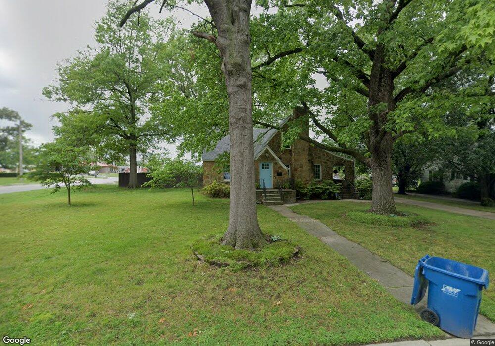
1945 S Maple St Carthage, MO 64836
Estimated Value: $197,000 - $239,000
3
Beds
2
Baths
1,596
Sq Ft
$135/Sq Ft
Est. Value
About This Home
This home is located at 1945 S Maple St, Carthage, MO 64836 and is currently estimated at $215,215, approximately $134 per square foot. 1945 S Maple St is a home located in Jasper County with nearby schools including Carthage High School, St. Ann's Catholic School, and Victory Academy.
Ownership History
Date
Name
Owned For
Owner Type
Purchase Details
Closed on
May 22, 2017
Sold by
Patrick Darrell and Patrick Darlynda
Bought by
Mehl Silas C and Mehl Megan D
Current Estimated Value
Home Financials for this Owner
Home Financials are based on the most recent Mortgage that was taken out on this home.
Original Mortgage
$92,000
Outstanding Balance
$47,145
Interest Rate
3.97%
Mortgage Type
New Conventional
Estimated Equity
$168,070
Purchase Details
Closed on
Aug 31, 2012
Sold by
Blacksher Steven C and Blacksher Natalie A
Bought by
Patrick Darrell and Patrick Darlynda
Home Financials for this Owner
Home Financials are based on the most recent Mortgage that was taken out on this home.
Original Mortgage
$94,897
Interest Rate
3.49%
Mortgage Type
New Conventional
Create a Home Valuation Report for This Property
The Home Valuation Report is an in-depth analysis detailing your home's value as well as a comparison with similar homes in the area
Home Values in the Area
Average Home Value in this Area
Purchase History
| Date | Buyer | Sale Price | Title Company |
|---|---|---|---|
| Mehl Silas C | -- | None Available | |
| Patrick Darrell | -- | None Available |
Source: Public Records
Mortgage History
| Date | Status | Borrower | Loan Amount |
|---|---|---|---|
| Open | Mehl Silas C | $92,000 | |
| Previous Owner | Patrick Darrell | $94,897 |
Source: Public Records
Tax History Compared to Growth
Tax History
| Year | Tax Paid | Tax Assessment Tax Assessment Total Assessment is a certain percentage of the fair market value that is determined by local assessors to be the total taxable value of land and additions on the property. | Land | Improvement |
|---|---|---|---|---|
| 2025 | $1,202 | $26,260 | $3,270 | $22,990 |
| 2024 | $1,202 | $23,350 | $3,270 | $20,080 |
| 2023 | $1,202 | $23,350 | $3,270 | $20,080 |
| 2022 | $1,174 | $22,880 | $3,270 | $19,610 |
| 2021 | $1,161 | $22,880 | $3,270 | $19,610 |
| 2020 | $1,120 | $21,150 | $3,270 | $17,880 |
| 2019 | $1,122 | $21,150 | $3,270 | $17,880 |
| 2018 | $900 | $17,010 | $0 | $0 |
| 2017 | $902 | $17,010 | $0 | $0 |
| 2016 | $878 | $16,610 | $0 | $0 |
| 2015 | $812 | $16,610 | $0 | $0 |
| 2014 | $812 | $16,610 | $0 | $0 |
Source: Public Records
Map
Nearby Homes
- 1830 S Maple St
- 510 W Fairview Ave
- 2816 S Maple St
- 509 W Highland Ave
- TBD Hazel Ave
- 2206 Benjamin Dr
- 1610 S Main St
- 1615 Forest St
- 1513 S Main St
- 1529 S Grand Ave
- 1515 S Garrison Ave
- 1910 Wynwood Dr
- 1421 Grand Ave
- 1922 Southwood Ln
- 504 Cooper St
- 702 E Centennial Ave
- 1335 S Main St
- 739 Sheridan St
- XXXX Clinton
- 837 Modern Way
- 1937 S Maple St
- 2001 S Maple St
- 1925 S Maple St
- 1946 S Garrison Ave
- 1932 S Maple St
- 2002 S Maple St
- 2011 S Maple St
- 1917 S Maple St
- 1924 S Maple St
- 2008 S Maple St
- 1926 S Garrison Ave
- 2018 S Garrison Ave
- 111 W Fairview Ave
- 1920 S Maple St
- 2021 S Maple St
- 2014 S Maple St
- 1916 S Maple St
- 1935 S Main St
- 2020 S Maple St
- 1945 S Main St