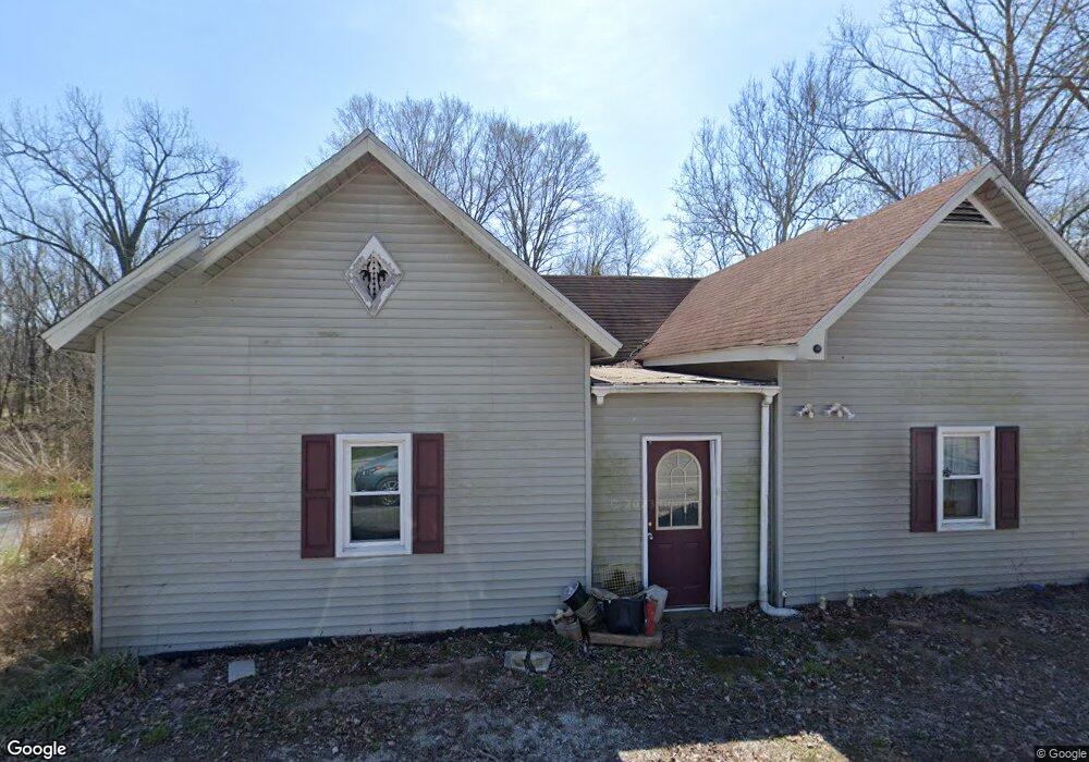
1945 W State Highway 250 Paris Crossing, IN 47270
Estimated Value: $56,190 - $139,000
2
Beds
1
Bath
1,092
Sq Ft
$85/Sq Ft
Est. Value
About This Home
This home is located at 1945 W State Highway 250, Paris Crossing, IN 47270 and is currently estimated at $93,298, approximately $85 per square foot. 1945 W State Highway 250 is a home located in Jennings County with nearby schools including Graham Creek Elementary School, Jennings County Middle School, and Jennings County High School.
Ownership History
Date
Name
Owned For
Owner Type
Purchase Details
Closed on
Feb 7, 2024
Sold by
Diversified Home Buyers Llc
Bought by
Elizabeth Erming
Current Estimated Value
Purchase Details
Closed on
Jan 18, 2021
Sold by
Smith Tanner and Smith Rebecca
Bought by
Vonhoene Christa M
Purchase Details
Closed on
Mar 20, 2020
Sold by
Hearne Roger D
Bought by
Tanner Smith
Home Financials for this Owner
Home Financials are based on the most recent Mortgage that was taken out on this home.
Interest Rate
3.65%
Create a Home Valuation Report for This Property
The Home Valuation Report is an in-depth analysis detailing your home's value as well as a comparison with similar homes in the area
Home Values in the Area
Average Home Value in this Area
Purchase History
| Date | Buyer | Sale Price | Title Company |
|---|---|---|---|
| Elizabeth Erming | $84,900 | Rounsavall Title Group, Llc | |
| Vonhoene Christa M | $32,000 | None Available | |
| Tanner Smith | $20,000 | -- |
Source: Public Records
Mortgage History
| Date | Status | Borrower | Loan Amount |
|---|---|---|---|
| Previous Owner | Tanner Smith | -- |
Source: Public Records
Tax History Compared to Growth
Tax History
| Year | Tax Paid | Tax Assessment Tax Assessment Total Assessment is a certain percentage of the fair market value that is determined by local assessors to be the total taxable value of land and additions on the property. | Land | Improvement |
|---|---|---|---|---|
| 2024 | $276 | $61,700 | $11,800 | $49,900 |
| 2023 | $309 | $63,300 | $11,800 | $51,500 |
| 2022 | $268 | $54,900 | $11,800 | $43,100 |
| 2021 | $259 | $47,900 | $11,800 | $36,100 |
| 2020 | $261 | $48,900 | $11,800 | $37,100 |
| 2019 | $914 | $47,600 | $11,800 | $35,800 |
| 2018 | $884 | $47,700 | $11,800 | $35,900 |
| 2017 | $846 | $47,300 | $11,800 | $35,500 |
| 2016 | $839 | $47,300 | $11,800 | $35,500 |
| 2014 | $809 | $46,400 | $11,800 | $34,600 |
Source: Public Records
Map
Nearby Homes
- 0 S County Road 200 W
- 4536 N Richard Cart Rd
- 4340 W County Road 1100 S
- 14266 Mulberry St
- 14266 W Mulberry St
- 4254 N 1500 W
- 14209 W Main St
- 14750 T2 W Blake Rd
- 14750 W Blake Rd
- 5575 W State Highway 250
- 7257 N Sunnyside Rd
- 4900 W County Road 850 S
- 15533 W Blake Rd
- 0 S County Road 200 E Unit MBR22074451
- S Cr 200 E Unit LotWP001
- 5695 S County Road 300 W
- 12495 W Henry Rd
- 1655 W County Road 500 S
- 8543 N Jake Gayle Rd
- 7900 S County Rd 750 W
- 1915 W State Highway 250
- 1930 W State Highway 250
- 1950 W State Highway 250
- 1955 W State Highway 250
- 2010 W State Highway 250
- 2025 Indiana 250
- 2040 W State Highway 250
- 10650 S County Road 200 W
- 10690 S County Road 200 W
- 2085 W State Highway 250
- 2115 W State Highway 250
- 2060 W State Highway 250
- 1910 W State Highway 250
- 1915 Indiana 250
- 10540 S County Road 200 W
- 10530 S County Road 200 W
- 1885 W State Highway 250
- 10735 S County Road 200 W
- 1885 Indiana 250
- 2150 W State Highway 250