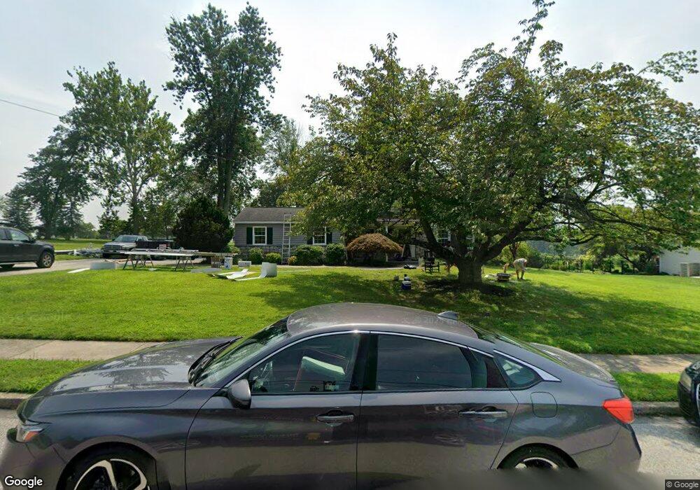
1946 Brandon Rd Norristown, PA 19403
West Norriton Township NeighborhoodEstimated Value: $536,000 - $666,000
4
Beds
3
Baths
2,103
Sq Ft
$280/Sq Ft
Est. Value
About This Home
This home is located at 1946 Brandon Rd, Norristown, PA 19403 and is currently estimated at $588,525, approximately $279 per square foot. 1946 Brandon Rd is a home located in Montgomery County with nearby schools including Charles Blockson Middle School, Paul V Fly Elementary School, and East Norriton Middle School.
Ownership History
Date
Name
Owned For
Owner Type
Purchase Details
Closed on
Feb 14, 2011
Sold by
Delmoro Ann E and Delmoro Adrian
Bought by
Delmoro Adrian and Delmoro Ann E
Current Estimated Value
Home Financials for this Owner
Home Financials are based on the most recent Mortgage that was taken out on this home.
Original Mortgage
$91,500
Outstanding Balance
$62,522
Interest Rate
4.75%
Estimated Equity
$526,003
Purchase Details
Closed on
May 29, 1998
Sold by
Sweeney Edward R
Bought by
Hartman Ann E and Delmoro Adrian
Create a Home Valuation Report for This Property
The Home Valuation Report is an in-depth analysis detailing your home's value as well as a comparison with similar homes in the area
Home Values in the Area
Average Home Value in this Area
Purchase History
| Date | Buyer | Sale Price | Title Company |
|---|---|---|---|
| Delmoro Adrian | -- | None Available | |
| Hartman Ann E | $171,500 | -- |
Source: Public Records
Mortgage History
| Date | Status | Borrower | Loan Amount |
|---|---|---|---|
| Open | Delmoro Adrian | $91,500 |
Source: Public Records
Tax History Compared to Growth
Tax History
| Year | Tax Paid | Tax Assessment Tax Assessment Total Assessment is a certain percentage of the fair market value that is determined by local assessors to be the total taxable value of land and additions on the property. | Land | Improvement |
|---|---|---|---|---|
| 2025 | $8,612 | $176,260 | $50,160 | $126,100 |
| 2024 | $8,612 | $176,260 | $50,160 | $126,100 |
| 2023 | $8,515 | $176,260 | $50,160 | $126,100 |
| 2022 | $8,459 | $176,260 | $50,160 | $126,100 |
| 2021 | $8,408 | $176,260 | $50,160 | $126,100 |
| 2020 | $8,157 | $176,260 | $50,160 | $126,100 |
| 2019 | $7,975 | $176,260 | $50,160 | $126,100 |
| 2018 | $6,261 | $176,260 | $50,160 | $126,100 |
| 2017 | $7,529 | $176,260 | $50,160 | $126,100 |
| 2016 | $7,460 | $176,260 | $50,160 | $126,100 |
| 2015 | $6,912 | $176,260 | $50,160 | $126,100 |
| 2014 | $6,912 | $176,260 | $50,160 | $126,100 |
Source: Public Records
Map
Nearby Homes
- 2039 Berkley Rd
- 526 Bassett Ln
- 1905 Yorktown N
- 2017 Yorktown S
- 1914 Yorktown S
- 2012 Yorktown S
- 307 Brandon Rd
- 402 Brandon Rd
- 1924 Juniata Rd
- 167 Woodstream Dr Unit CONDO 167
- 143 Riversedge Dr Unit CONDO 143
- 176 Riversedge Dr
- 2044 Mill Rd
- 121 Woodstream Dr Unit CONDO 121
- 440 Rittenhouse Blvd
- 0 Roosevelt Blvd
- 365 Norris Hall Ln
- 1633 Williams Way
- 2504 Grant Ct
- 1503 Reagan Ct
- 1942 Brandon Rd
- 1950 Brandon Rd
- 280 School Ln
- 1938 Brandon Rd
- 1939 Brandon Rd
- 1954 Brandon Rd
- 281 School Ln
- 1935 Brandon Rd
- 1958 Brandon Rd
- 1934 Brandon Rd
- 2016 Virginia Ln
- 2010 Virginia Ln
- 271 School Ln
- 1955 Brandon Rd
- 2004 Virginia Ln
- 2124 Hemlock Rd
- 1931 Brandon Rd
- 1998 Virginia Ln
- 1962 Brandon Rd
- 261 School Ln