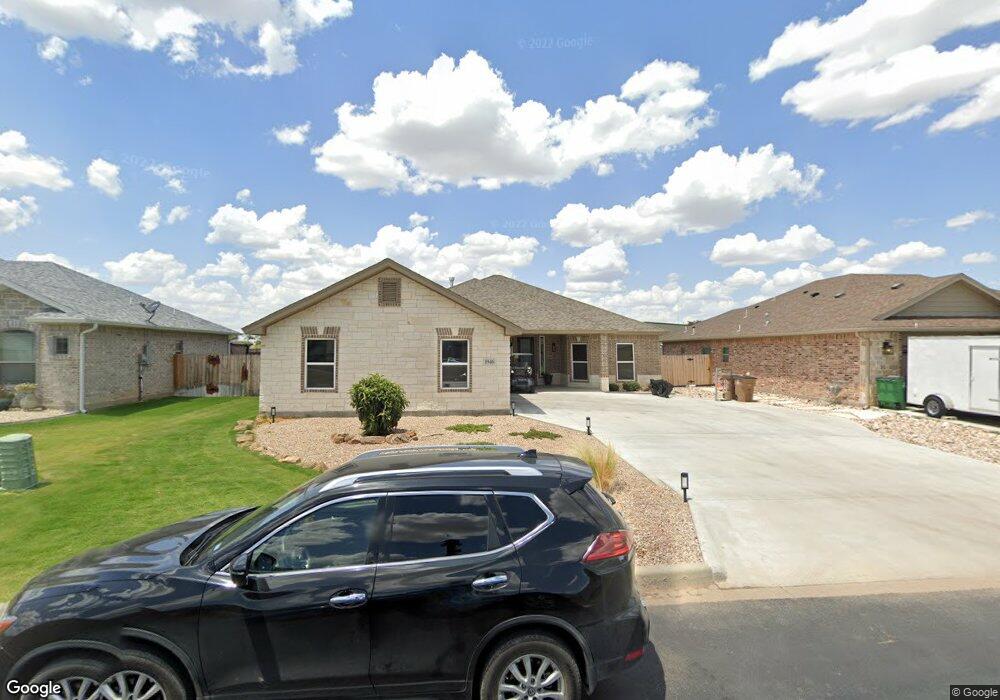
1946 Colonial Dr Unit 13 San Angelo, TX 76904
Country Club NeighborhoodEstimated Value: $416,147 - $433,000
--
Bed
--
Bath
2,019
Sq Ft
$210/Sq Ft
Est. Value
About This Home
This home is located at 1946 Colonial Dr Unit 13, San Angelo, TX 76904 and is currently estimated at $424,787, approximately $210 per square foot. 1946 Colonial Dr Unit 13 is a home located in Tom Green County with nearby schools including Lamar Elementary School, Glenn Middle School, and Central High School.
Ownership History
Date
Name
Owned For
Owner Type
Purchase Details
Closed on
Mar 16, 2022
Sold by
Murphy and Melisa
Bought by
Kolls Kara Wright and Kolls John Michael
Current Estimated Value
Home Financials for this Owner
Home Financials are based on the most recent Mortgage that was taken out on this home.
Original Mortgage
$270,000
Outstanding Balance
$252,067
Interest Rate
3.85%
Mortgage Type
New Conventional
Estimated Equity
$172,720
Purchase Details
Closed on
May 7, 2020
Sold by
Floyd Gary
Bought by
Murphy Derrek
Home Financials for this Owner
Home Financials are based on the most recent Mortgage that was taken out on this home.
Original Mortgage
$330,896
Interest Rate
3.5%
Mortgage Type
FHA
Purchase Details
Closed on
May 23, 2017
Sold by
Stonewall Ranches
Bought by
Floyd Gary
Create a Home Valuation Report for This Property
The Home Valuation Report is an in-depth analysis detailing your home's value as well as a comparison with similar homes in the area
Home Values in the Area
Average Home Value in this Area
Purchase History
| Date | Buyer | Sale Price | Title Company |
|---|---|---|---|
| Kolls Kara Wright | -- | None Listed On Document | |
| Murphy Derrek | -- | None Available | |
| Floyd Gary | -- | -- |
Source: Public Records
Mortgage History
| Date | Status | Borrower | Loan Amount |
|---|---|---|---|
| Open | Kolls Kara Wright | $270,000 | |
| Previous Owner | Murphy Derrek | $330,896 |
Source: Public Records
Tax History Compared to Growth
Tax History
| Year | Tax Paid | Tax Assessment Tax Assessment Total Assessment is a certain percentage of the fair market value that is determined by local assessors to be the total taxable value of land and additions on the property. | Land | Improvement |
|---|---|---|---|---|
| 2025 | $8,740 | $433,980 | $42,500 | $391,480 |
| 2024 | $7,104 | $357,090 | $38,640 | $318,450 |
| 2023 | $6,913 | $347,510 | $49,610 | $297,900 |
| 2022 | $8,124 | $366,620 | $27,830 | $338,790 |
| 2021 | $8,114 | $334,660 | $0 | $0 |
| 2020 | $3,321 | $135,150 | $12,520 | $122,630 |
| 2019 | $704 | $27,830 | $27,830 | $0 |
| 2018 | $702 | $27,830 | $27,830 | $0 |
| 2017 | $698 | $27,830 | $27,830 | $0 |
Source: Public Records
Map
Nearby Homes
- 1942 Pine Valley St
- 4992 Silver Creek Pass
- 4998 Silver Creek Pass
- 1901 Pine Valley St
- 1906 Colonial Dr
- 2022 Silver Creek Ct
- 2030 Silver Creek Ct
- 2033 Silver Creek Ct
- 4809 N Bentwood Dr
- 2118 Valleyview Dr
- 4710 Shadow Creek Dr
- 4833 N Bentwood Dr
- 4742 Royal Troon Dr
- 4702 Karsten Creek Dr
- 5034 Wolf Creek Dr Unit 7
- 5030 Wolf Creek Dr Unit 6
- 5029 Wolf Creek Dr Unit 59
- 4705 Wolf Creek Dr Unit 14
- 5018 Wolf Creek Dr Unit 3
- 4745 Karsten Creek Dr
- 1946 Colonial Dr
- 1942 Colonial Dr Unit 12
- 1942 Colonial Dr
- 1950 Colonial Dr Unit 14
- 1950 Colonial Dr
- 1938 Colonial Dr Unit 11
- 1938 Colonial Dr
- 1937 Colonial Dr Unit 21
- 1954 Colonial Dr
- 1941 Colonial Dr Unit 20
- 1941 Colonial Dr
- 1933 Colonial Dr Unit 22
- 1933 Colonial Dr
- 1958 Colonial Dr
- 1934 Colonial Dr Unit 10
- 1934 Colonial Dr
- 1945 Colonial Dr
- 1929 Colonial Dr Unit 23
- 1929 Colonial Dr
- 1949 Colonial Dr