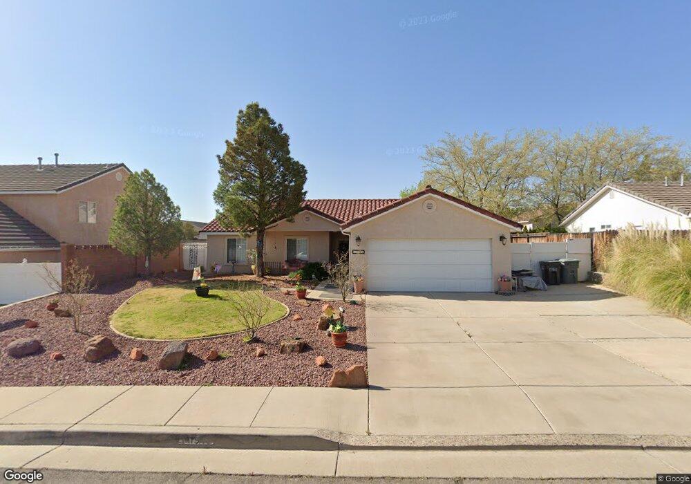
1946 E 10 North Cir Saint George, UT 84790
Estimated Value: $384,582 - $445,000
3
Beds
2
Baths
1,364
Sq Ft
$301/Sq Ft
Est. Value
About This Home
This home is located at 1946 E 10 North Cir, Saint George, UT 84790 and is currently estimated at $410,396, approximately $300 per square foot. 1946 E 10 North Cir is a home located in Washington County with nearby schools including Panorama School, Pine View Middle School, and Fossil Ridge Intermediate School.
Ownership History
Date
Name
Owned For
Owner Type
Purchase Details
Closed on
Dec 26, 2023
Sold by
Swaney Lyle Wesley and Swaney Jill F
Bought by
Swaney Asset Protection Trust and Swaney
Current Estimated Value
Purchase Details
Closed on
Mar 29, 2022
Sold by
Lyle And Carolyn Swaney Revocable Trust
Bought by
Swaney Lyle W and Swaney Wesley L
Home Financials for this Owner
Home Financials are based on the most recent Mortgage that was taken out on this home.
Original Mortgage
$332,000
Interest Rate
4.42%
Mortgage Type
New Conventional
Purchase Details
Closed on
Mar 24, 2022
Sold by
Swaney Lyle W
Bought by
Lyle And Carolyn Swaney Revocable Trust
Home Financials for this Owner
Home Financials are based on the most recent Mortgage that was taken out on this home.
Original Mortgage
$332,000
Interest Rate
4.42%
Mortgage Type
New Conventional
Purchase Details
Closed on
Jan 6, 2021
Sold by
Swaney Lyle W and Swaney Carolyn R
Bought by
Swaney Lyle Wesley and Swaney Carolyn R
Create a Home Valuation Report for This Property
The Home Valuation Report is an in-depth analysis detailing your home's value as well as a comparison with similar homes in the area
Purchase History
| Date | Buyer | Sale Price | Title Company |
|---|---|---|---|
| Swaney Asset Protection Trust | -- | None Listed On Document | |
| Swaney Lyle Wesley | -- | None Listed On Document | |
| Swaney Lyle W | -- | Southern Utah Title | |
| Lyle And Carolyn Swaney Revocable Trust | -- | Southern Utah Title | |
| Swaney Lyle W | -- | Southern Utah Title | |
| Swaney Lyle Wesley | -- | None Available |
Source: Public Records
Mortgage History
| Date | Status | Borrower | Loan Amount |
|---|---|---|---|
| Previous Owner | Swaney Lyle W | $332,000 | |
| Previous Owner | Swaney Lyle W | $332,000 |
Source: Public Records
Tax History
| Year | Tax Paid | Tax Assessment Tax Assessment Total Assessment is a certain percentage of the fair market value that is determined by local assessors to be the total taxable value of land and additions on the property. | Land | Improvement |
|---|---|---|---|---|
| 2025 | $1,442 | $211,695 | $59,400 | $152,295 |
| 2023 | $1,487 | $222,200 | $52,800 | $169,400 |
| 2022 | $1,561 | $219,340 | $49,665 | $169,675 |
| 2021 | $1,392 | $291,700 | $76,000 | $215,700 |
| 2020 | $1,239 | $244,600 | $57,000 | $187,600 |
| 2019 | $1,217 | $234,700 | $57,000 | $177,700 |
| 2018 | $1,179 | $113,905 | $0 | $0 |
| 2017 | $0 | $97,130 | $0 | $0 |
| 2016 | $1,044 | $93,335 | $0 | $0 |
| 2015 | $1,009 | $86,570 | $0 | $0 |
| 2014 | $932 | $80,465 | $0 | $0 |
Source: Public Records
Map
Nearby Homes
- 1932 E 40 South Cir
- 145 N Mall Dr Unit 57
- 145 N Mall Dr Unit 35
- 77 S 2000 E
- 78 N 2000 E
- 210 N Mall Dr Unit 115
- 210 N Mall Dr Unit 27
- 86 S Acantilado Dr
- 201 S 2020 East Cir
- 232 S Acantilado Cir
- 236 S 2020 Cir E
- 4204 S Crimson Cir Unit 10
- 4186 S Crimson Cir Unit 13
- 1646 E 90 Cir S
- 2294 E 170 N
- 0 Null Unit 26-269072
- 1684 E 290 S
- 5664 S Carnelian Pkwy
- 149 N Eastridge Dr
- 345 N 2450 E Unit 220
- 1960 E 10 Cir N
- 1934 E 10 North Cir
- 1960 E 10 North Cir
- 1934 E 10 Cir N
- 1970 Circle
- 1970 Circle Unit Lot 4
- 1947 E 40 S
- 1947 E 40 South Cir
- 30 S 1970 E
- 1935 E 40 South Cir
- 1949 E 10 Cir N
- 1949 E 10 North Cir
- 1922 E 10 North Cir
- 1922 E 10 Cir N
- 1933 E 10 North Cir
- 1963 E 10 North Cir
- 1923 E 40 South Cir
- 1923 E 40 Cir S
- 1925 E 10 North Cir
- 1925 E 10 Cir N
Your Personal Tour Guide
Ask me questions while you tour the home.