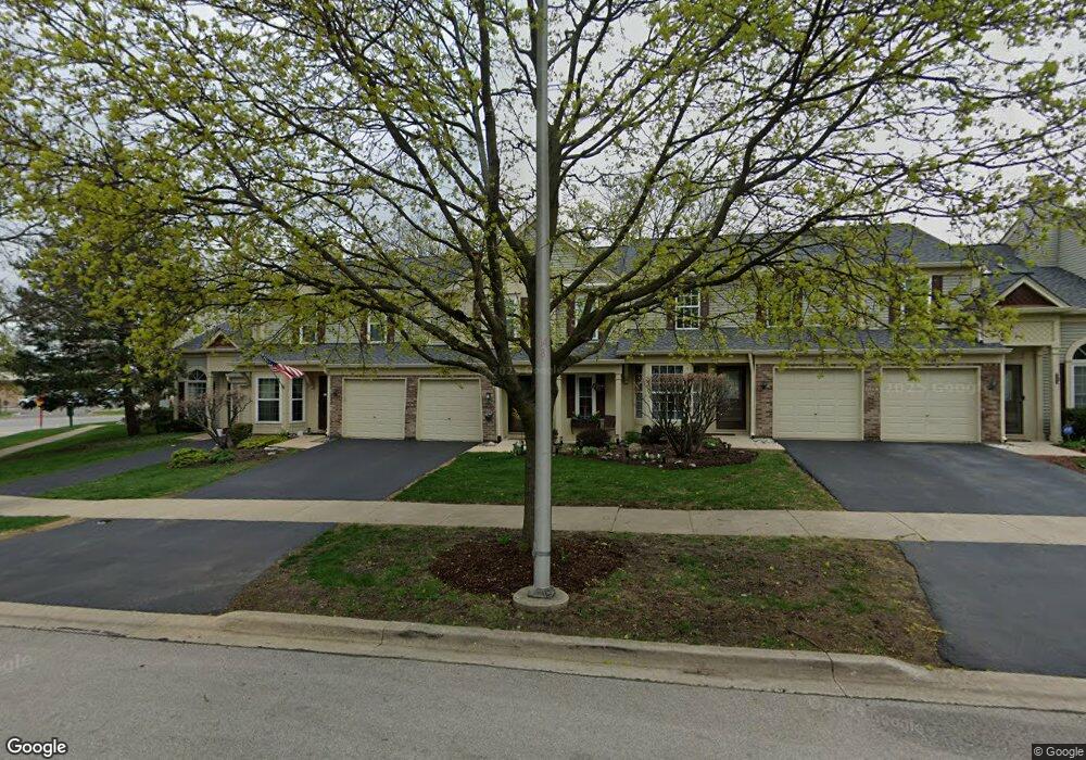
1946 Hastings Ave Downers Grove, IL 60516
South Downers Grove NeighborhoodEstimated Value: $334,502 - $362,000
2
Beds
3
Baths
1,394
Sq Ft
$252/Sq Ft
Est. Value
About This Home
This home is located at 1946 Hastings Ave, Downers Grove, IL 60516 and is currently estimated at $351,626, approximately $252 per square foot. 1946 Hastings Ave is a home located in DuPage County with nearby schools including Indian Trail Elementary School, O'Neill Middle School, and Downers Grove South High School.
Ownership History
Date
Name
Owned For
Owner Type
Purchase Details
Closed on
Jun 25, 2001
Sold by
Dainis Linda A
Bought by
Dainis Linda A
Current Estimated Value
Purchase Details
Closed on
Nov 21, 2000
Sold by
Raha Walter A and Raha Betty J
Bought by
Dainis Linda
Home Financials for this Owner
Home Financials are based on the most recent Mortgage that was taken out on this home.
Original Mortgage
$120,000
Outstanding Balance
$44,155
Interest Rate
7.86%
Mortgage Type
Purchase Money Mortgage
Estimated Equity
$307,472
Purchase Details
Closed on
Feb 8, 2000
Sold by
Putz Sandra and Putz Thomas
Bought by
Raha Walter A and Raha Betty J
Create a Home Valuation Report for This Property
The Home Valuation Report is an in-depth analysis detailing your home's value as well as a comparison with similar homes in the area
Home Values in the Area
Average Home Value in this Area
Purchase History
| Date | Buyer | Sale Price | Title Company |
|---|---|---|---|
| Dainis Linda A | -- | -- | |
| Dainis Linda | $150,000 | -- | |
| Raha Walter A | $146,500 | -- |
Source: Public Records
Mortgage History
| Date | Status | Borrower | Loan Amount |
|---|---|---|---|
| Open | Dainis Linda | $120,000 |
Source: Public Records
Tax History Compared to Growth
Tax History
| Year | Tax Paid | Tax Assessment Tax Assessment Total Assessment is a certain percentage of the fair market value that is determined by local assessors to be the total taxable value of land and additions on the property. | Land | Improvement |
|---|---|---|---|---|
| 2024 | $3,732 | $81,194 | $17,666 | $63,528 |
| 2023 | $3,486 | $74,640 | $16,240 | $58,400 |
| 2022 | $3,454 | $69,680 | $15,160 | $54,520 |
| 2021 | $3,227 | $68,890 | $14,990 | $53,900 |
| 2020 | $3,158 | $67,520 | $14,690 | $52,830 |
| 2019 | $3,320 | $64,780 | $14,090 | $50,690 |
| 2018 | $3,234 | $62,590 | $13,610 | $48,980 |
| 2017 | $3,426 | $65,470 | $13,100 | $52,370 |
| 2016 | $3,350 | $62,480 | $12,500 | $49,980 |
| 2015 | $3,301 | $58,780 | $11,760 | $47,020 |
| 2014 | $3,617 | $62,110 | $12,420 | $49,690 |
| 2013 | $3,542 | $61,820 | $12,360 | $49,460 |
Source: Public Records
Map
Nearby Homes
- 1974 Loomes Ave
- 1909 Bates Place
- 6295 Woodward Ave
- 6330 Prideham St Unit 138
- 6121 Woodward Ave
- 6154 Pershing Ave
- 2032 Wheeler St
- Lot 22 Sherman Ave
- 1527 62nd St
- 1906 Concord Dr
- 5915 Pershing Ave
- LOT 8 Margo Ct
- 6803 Penner Place
- 6819 Prairieview Ave
- 6831 Dove Ave Unit 9
- 5760 Woodward Ave
- 6651 Dunham Rd
- 2548 Huntleigh Ln
- 6111 Dunham Rd
- 2559 Cedar Hill Ln
- 1942 Hastings Ave
- 1950 Hastings Ave
- 1938 Hastings Ave
- 1954 Hastings Ave
- 1930 Hastings Ave
- 1945 Hastings Ave
- 1941 Hastings Ave
- 1937 Hastings Ave
- 1949 Hastings Ave
- 1933 Hastings Ave
- 6376 Brighton St
- 6372 Brighton St
- 1929 Hastings Ave
- 6368 Brighton St
- 1978 Loomes Ave
- 1970 Loomes Ave
- 1966 Loomes Ave
- 1982 Loomes Ave
- 1986 Loomes Ave
- 6364 Brighton St