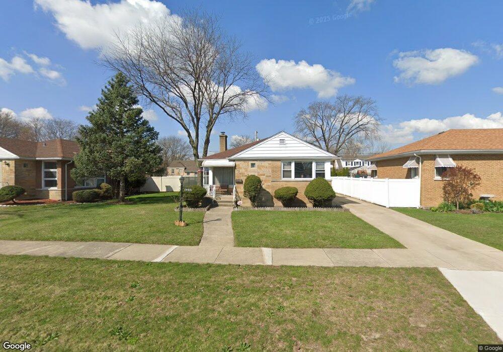
1946 Hawthorne Ave Westchester, IL 60154
Estimated Value: $341,000 - $365,717
3
Beds
1
Bath
1,223
Sq Ft
$288/Sq Ft
Est. Value
About This Home
This home is located at 1946 Hawthorne Ave, Westchester, IL 60154 and is currently estimated at $352,429, approximately $288 per square foot. 1946 Hawthorne Ave is a home located in Cook County with nearby schools including Westchester Primary School, Westchester Intermediate School, and Westchester Middle School.
Ownership History
Date
Name
Owned For
Owner Type
Purchase Details
Closed on
May 22, 2025
Sold by
Teresa Grandolfo Trust and Grandolfo Patricia J
Bought by
Grandolfo Patricia J and Grandolfo Timothy J
Current Estimated Value
Purchase Details
Closed on
May 7, 2025
Sold by
Grandolfo Timothy J
Bought by
Grandolfo Patricia J
Purchase Details
Closed on
Feb 23, 2016
Sold by
Grandolfo Teresa J
Bought by
Teresa Grandolfo Trust 101
Purchase Details
Closed on
Nov 25, 1998
Sold by
Grandolfo Joseph P
Bought by
Grandolfo Teresa J
Home Financials for this Owner
Home Financials are based on the most recent Mortgage that was taken out on this home.
Original Mortgage
$50,000
Interest Rate
6.83%
Create a Home Valuation Report for This Property
The Home Valuation Report is an in-depth analysis detailing your home's value as well as a comparison with similar homes in the area
Home Values in the Area
Average Home Value in this Area
Purchase History
| Date | Buyer | Sale Price | Title Company |
|---|---|---|---|
| Grandolfo Patricia J | -- | None Listed On Document | |
| Grandolfo Patricia J | $100,000 | None Listed On Document | |
| Teresa Grandolfo Trust 101 | -- | None Available | |
| Grandolfo Teresa J | -- | Chicago Title Insurance Co |
Source: Public Records
Mortgage History
| Date | Status | Borrower | Loan Amount |
|---|---|---|---|
| Previous Owner | Grandolfo Teresa J | $50,000 |
Source: Public Records
Tax History Compared to Growth
Tax History
| Year | Tax Paid | Tax Assessment Tax Assessment Total Assessment is a certain percentage of the fair market value that is determined by local assessors to be the total taxable value of land and additions on the property. | Land | Improvement |
|---|---|---|---|---|
| 2024 | $6,741 | $29,000 | $5,355 | $23,645 |
| 2023 | $5,861 | $29,000 | $5,355 | $23,645 |
| 2022 | $5,861 | $22,632 | $4,590 | $18,042 |
| 2021 | $5,700 | $22,631 | $4,590 | $18,041 |
| 2020 | $5,635 | $22,631 | $4,590 | $18,041 |
| 2019 | $4,877 | $20,693 | $4,207 | $16,486 |
| 2018 | $4,812 | $20,693 | $4,207 | $16,486 |
| 2017 | $5,363 | $22,987 | $4,207 | $18,780 |
| 2016 | $5,039 | $17,278 | $3,825 | $13,453 |
| 2015 | $3,680 | $17,278 | $3,825 | $13,453 |
| 2014 | $4,184 | $19,280 | $3,825 | $15,455 |
| 2013 | $4,616 | $22,870 | $3,825 | $19,045 |
Source: Public Records
Map
Nearby Homes
- 10461 Dorchester St
- 1908 Belleview Ave
- 1921 Buckingham Ave
- 10630 W Cermak Rd Unit 2E
- 1860 Buckingham Ave
- 1811 Downing Ave
- 2205 Mayfair Ave
- 2230 Kensington Ave
- 10324 Wight St
- 10567 Waterford Dr
- 10610 Essex St
- 2401 Mayfair Ave
- 10531 Camelot St
- 10511 Preston St
- 10524 Camelot St
- 2316 Boeger Ave
- 1847 Boeger Ave
- 2610 Sunnyside Ave
- 4 Garden Dr Unit 4
- 1907 Suffolk Ave
- 1940 Hawthorne Ave
- 1940 Hawthorne Ave
- 1952 Hawthorne Ave
- 1960 Hawthorne Ave
- 1960 Hawthorne Ave
- 1934 Hawthorne Ave
- 1935 Stratford Ave
- 1931 Stratford Ave
- 1947 Stratford Ave
- 1929 Stratford Ave
- 1932 Hawthorne Ave
- 1951 Stratford Ave
- 1945 Hawthorne Ave
- 1925 Stratford Ave
- 1925 Stratford Ave
- 1939 Hawthorne Ave
- 1939 Hawthorne Ave
- 1951 Hawthorne Ave
- 1921 Stratford Ave
- 1959 Hawthorne Ave