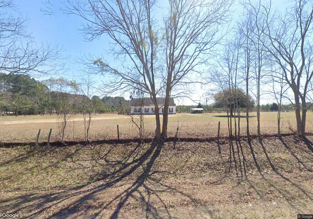
1946 Middle Ground Rd Statesboro, GA 30461
Estimated Value: $322,740 - $338,000
2
Beds
3
Baths
1,810
Sq Ft
$181/Sq Ft
Est. Value
About This Home
This home is located at 1946 Middle Ground Rd, Statesboro, GA 30461 and is currently estimated at $327,935, approximately $181 per square foot. 1946 Middle Ground Rd is a home located in Bulloch County with nearby schools including Julia P. Bryant Elementary School, Statesboro High School, and William James Middle School.
Ownership History
Date
Name
Owned For
Owner Type
Purchase Details
Closed on
Dec 29, 2020
Sold by
Thompson Gary A
Bought by
Ward William H and Ward Teresa K
Current Estimated Value
Home Financials for this Owner
Home Financials are based on the most recent Mortgage that was taken out on this home.
Original Mortgage
$150,000
Outstanding Balance
$133,876
Interest Rate
2.71%
Mortgage Type
New Conventional
Estimated Equity
$194,059
Purchase Details
Closed on
Jul 10, 2009
Sold by
Dempsey Charles A
Bought by
Thompson Gary
Create a Home Valuation Report for This Property
The Home Valuation Report is an in-depth analysis detailing your home's value as well as a comparison with similar homes in the area
Home Values in the Area
Average Home Value in this Area
Purchase History
| Date | Buyer | Sale Price | Title Company |
|---|---|---|---|
| Ward William H | $215,000 | -- | |
| Thompson Gary | $43,500 | -- |
Source: Public Records
Mortgage History
| Date | Status | Borrower | Loan Amount |
|---|---|---|---|
| Open | Ward William H | $150,000 |
Source: Public Records
Tax History Compared to Growth
Tax History
| Year | Tax Paid | Tax Assessment Tax Assessment Total Assessment is a certain percentage of the fair market value that is determined by local assessors to be the total taxable value of land and additions on the property. | Land | Improvement |
|---|---|---|---|---|
| 2024 | $2,068 | $98,948 | $22,160 | $76,788 |
| 2023 | $1,892 | $83,868 | $14,480 | $69,388 |
| 2022 | $1,413 | $71,773 | $12,091 | $59,682 |
| 2021 | $1,255 | $63,025 | $12,091 | $50,934 |
| 2020 | $1,302 | $57,292 | $10,076 | $47,216 |
| 2019 | $1,310 | $57,362 | $10,076 | $47,286 |
| 2018 | $1,257 | $55,307 | $8,395 | $46,912 |
| 2017 | $1,240 | $53,883 | $8,395 | $45,488 |
| 2016 | $1,237 | $52,383 | $8,395 | $43,988 |
| 2015 | $1,215 | $51,224 | $8,395 | $42,829 |
| 2014 | $1,120 | $51,224 | $8,395 | $42,829 |
Source: Public Records
Map
Nearby Homes
- 0 Middle Ground Rd Unit 10506072
- 2743 Middle Ground Rd
- 3195 Middle Ground Rd
- 415 Woodland Trail
- 14.12 ac Middle Ground Rd
- 338 Jerry Hall Rd
- 3900 Middle Ground Rd
- 609 Youngblood Rd
- 222 Archer Rd
- 980 Bernard Smith Rd
- 2001 Glen Oaks Dr
- 316 Tavern Ln
- 0 Two Chop Rd
- 1009 Hunters Pointe Dr
- 296 Tavern Ln
- 292 Tavern Ln
- 829 Woods Hole Cir
- 1002 Chase Ct
- 1004 Chase Ct
- 809 Woods Hole Cir
- 2103 Middle Ground Rd Unit PLANTATI
- 2103 Middle Ground Rd
- 2117 Middle Ground Rd
- 2117 Middle Ground Rd
- 2103 Middle Ground Rd
- 2117 Middle Ground Rd
- 2307 Camelia Dr W
- 2309 Camelia Dr W
- 2308 Camelia Dr W
- 1692 Middle Ground Rd
- 2305 Camelia Dr W
- 1738 Middle Ground Rd
- 2306 Camelia Dr W
- 2303 Camelia Dr W
- 2304 Camelia Dr W
- 2507 Crepe Myrtle W
- 2507 Crepe Myrtle W Unit 41
- 0 Camelia Dr W Unit 7308315
- 0 Camelia Dr W Unit 8628195
- 0 Camelia Dr W Unit 8136178