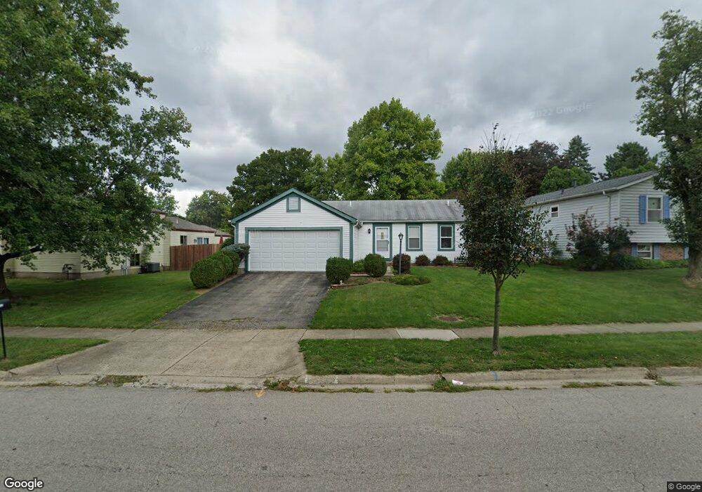
1946 Plains Blvd Powell, OH 43065
Western Hills NeighborhoodEstimated Value: $310,000 - $338,000
3
Beds
2
Baths
1,152
Sq Ft
$281/Sq Ft
Est. Value
About This Home
This home is located at 1946 Plains Blvd, Powell, OH 43065 and is currently estimated at $323,784, approximately $281 per square foot. 1946 Plains Blvd is a home located in Franklin County with nearby schools including Liberty Elementary School, McCord Middle School, and Worthington Kilbourne High School.
Ownership History
Date
Name
Owned For
Owner Type
Purchase Details
Closed on
Sep 27, 2005
Sold by
Oconnor Kevin P and Oconnor Patricia J
Bought by
Oconnor Kevin P and Oconnor Patricia J
Current Estimated Value
Home Financials for this Owner
Home Financials are based on the most recent Mortgage that was taken out on this home.
Original Mortgage
$120,800
Outstanding Balance
$63,349
Interest Rate
5.83%
Mortgage Type
New Conventional
Estimated Equity
$260,435
Purchase Details
Closed on
Sep 30, 1996
Sold by
Masten Earl J
Bought by
Kevin P O'Connor
Home Financials for this Owner
Home Financials are based on the most recent Mortgage that was taken out on this home.
Original Mortgage
$104,295
Interest Rate
7.97%
Mortgage Type
FHA
Purchase Details
Closed on
Oct 1, 1986
Purchase Details
Closed on
Sep 1, 1983
Create a Home Valuation Report for This Property
The Home Valuation Report is an in-depth analysis detailing your home's value as well as a comparison with similar homes in the area
Home Values in the Area
Average Home Value in this Area
Purchase History
| Date | Buyer | Sale Price | Title Company |
|---|---|---|---|
| Oconnor Kevin P | -- | Profession | |
| Kevin P O'Connor | $105,000 | -- | |
| -- | $70,000 | -- | |
| -- | -- | -- |
Source: Public Records
Mortgage History
| Date | Status | Borrower | Loan Amount |
|---|---|---|---|
| Open | Oconnor Kevin P | $120,800 | |
| Closed | Kevin P O'Connor | $104,295 |
Source: Public Records
Tax History
| Year | Tax Paid | Tax Assessment Tax Assessment Total Assessment is a certain percentage of the fair market value that is determined by local assessors to be the total taxable value of land and additions on the property. | Land | Improvement |
|---|---|---|---|---|
| 2025 | $5,714 | $93,070 | $33,250 | $59,820 |
| 2024 | $5,714 | $93,070 | $33,250 | $59,820 |
| 2023 | $5,464 | $93,070 | $33,250 | $59,820 |
| 2022 | $4,289 | $57,970 | $18,100 | $39,870 |
| 2021 | $3,957 | $57,970 | $18,100 | $39,870 |
| 2020 | $3,812 | $57,970 | $18,100 | $39,870 |
| 2019 | $3,553 | $48,760 | $15,090 | $33,670 |
| 2018 | $3,426 | $48,760 | $15,090 | $33,670 |
| 2017 | $3,184 | $48,760 | $15,090 | $33,670 |
| 2016 | $3,410 | $48,030 | $13,410 | $34,620 |
| 2015 | $3,411 | $48,030 | $13,410 | $34,620 |
| 2014 | $3,409 | $48,030 | $13,410 | $34,620 |
| 2013 | $1,696 | $48,020 | $13,405 | $34,615 |
Source: Public Records
Map
Nearby Homes
- 1908 Lost Valley Rd
- 8213 Longhorn Rd
- 8205 Longhorn Rd
- 7898 Sarahurst Dr
- 7965 Boothbay Ct Unit 20
- 1986 Sutter Pkwy
- 8622 Renford Ct
- 1539 Clubview Blvd S
- 7735 Schoolway Ct
- 2074 Hard Rd
- 1760 Fallhaven Dr
- 2024 Sawbury Blvd
- 2026 Sawbury Blvd
- 2001 Sawbury Blvd Unit 2001
- 2423 Sutter Pkwy
- 8292 Breckenridge Way
- 2514 Tevis Ann Ct
- 2456 Sanford Dr
- 2469 Sandstrom Dr
- 2620 Cedar Lake Dr Unit 2620
- 1940 Plains Blvd
- 8270 Lariat Ct
- 8280 Lariat Ct
- 8282 Lariat Ct
- 8284 Lariat Ct
- 1928 Plains Blvd
- 8286 Lariat Ct
- 1927 Lost Valley Rd
- 8290 Lariat Ct
- 8287 Highridge Dr
- 1957 Plains Blvd
- 8294 Lariat Ct
- 1980 Plains Blvd
- 8295 High Ridge Dr
- 1930 Lost Valley Rd
- 8298 Lariat Ct
- 1965 Plains Blvd
- 8279 Lariat Ct
- 8302 Lariat Ct
- 8283 Lariat Ct
Your Personal Tour Guide
Ask me questions while you tour the home.