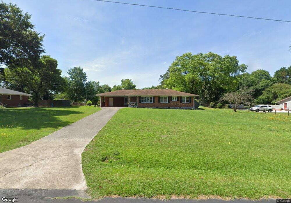
1946 Starr Rd SW Conyers, GA 30094
Estimated Value: $244,000 - $263,000
3
Beds
2
Baths
1,385
Sq Ft
$181/Sq Ft
Est. Value
About This Home
This home is located at 1946 Starr Rd SW, Conyers, GA 30094 and is currently estimated at $250,061, approximately $180 per square foot. 1946 Starr Rd SW is a home located in Rockdale County with nearby schools including Shoal Creek Elementary School, Edwards Middle School, and Rockdale County High School.
Ownership History
Date
Name
Owned For
Owner Type
Purchase Details
Closed on
Mar 8, 2023
Sold by
Mcintosh Harris
Bought by
Bryan Sophia
Current Estimated Value
Home Financials for this Owner
Home Financials are based on the most recent Mortgage that was taken out on this home.
Original Mortgage
$162,800
Outstanding Balance
$156,951
Interest Rate
5.37%
Mortgage Type
FHA
Estimated Equity
$93,110
Purchase Details
Closed on
Oct 1, 2015
Sold by
Keene James Michael
Bought by
Mcintosh Harris and Bryan Sophia
Home Financials for this Owner
Home Financials are based on the most recent Mortgage that was taken out on this home.
Original Mortgage
$85,000
Interest Rate
3.16%
Mortgage Type
New Conventional
Purchase Details
Closed on
Sep 21, 2012
Sold by
Keene Linda Meeks
Bought by
Keene James Michael and Keene Linda Meeks
Purchase Details
Closed on
Jun 20, 2011
Sold by
Meeks Inez P
Bought by
Keene Linda M and Keene James M
Create a Home Valuation Report for This Property
The Home Valuation Report is an in-depth analysis detailing your home's value as well as a comparison with similar homes in the area
Home Values in the Area
Average Home Value in this Area
Purchase History
| Date | Buyer | Sale Price | Title Company |
|---|---|---|---|
| Bryan Sophia | -- | -- | |
| Mcintosh Harris | $100,000 | -- | |
| Keene James Michael | $10,000 | -- | |
| Keene Linda M | -- | -- |
Source: Public Records
Mortgage History
| Date | Status | Borrower | Loan Amount |
|---|---|---|---|
| Open | Bryan Sophia | $162,800 | |
| Previous Owner | Mcintosh Harris | $85,000 |
Source: Public Records
Tax History Compared to Growth
Tax History
| Year | Tax Paid | Tax Assessment Tax Assessment Total Assessment is a certain percentage of the fair market value that is determined by local assessors to be the total taxable value of land and additions on the property. | Land | Improvement |
|---|---|---|---|---|
| 2024 | $2,448 | $102,800 | $21,200 | $81,600 |
| 2023 | $2,153 | $94,440 | $25,600 | $68,840 |
| 2022 | $1,334 | $62,520 | $7,080 | $55,440 |
| 2021 | $1,041 | $48,880 | $7,080 | $41,800 |
| 2020 | $853 | $43,440 | $7,080 | $36,360 |
| 2019 | $875 | $43,440 | $7,080 | $36,360 |
| 2018 | $836 | $42,000 | $7,080 | $34,920 |
| 2017 | $717 | $37,840 | $7,080 | $30,760 |
| 2016 | $339 | $26,720 | $4,920 | $21,800 |
| 2015 | $1,217 | $26,720 | $4,920 | $21,800 |
| 2014 | $8 | $26,720 | $4,920 | $21,800 |
| 2013 | -- | $38,360 | $10,000 | $28,360 |
Source: Public Records
Map
Nearby Homes
- 0 Klondike Rd SW Unit 7601318
- 0 Klondike Rd SW Unit 10547455
- 1039 Smyrna Rd SW
- 411 Sunflower St Unit 172
- 411 Sunflower St
- 402 Sunflower St
- 113 Maplewood Ln Unit 176
- 113 Maplewood Ln
- 1799 Wiggins Cir SW
- 1804 Wiggins Cir SW
- Wellington Plan at Hillbrooke Preserve
- Britton Plan at Hillbrooke Preserve
- Clifton 2 Car Garage Plan at Hillbrooke Preserve
- Newhall Plan at Hillbrooke Preserve
- Wynbrooke 4 Bedroom Plan at Hillbrooke Preserve
- Wynbrooke Brick Plan at Hillbrooke Preserve
- Leighton 2 Car Garage Plan at Hillbrooke Preserve
- 502 Meadowbrook Way
- 1377 Hill Dr SW
- 304 Cedar Hollow Dr
- 1936 Starr Rd SW
- 1956 Starr Rd SW
- 1969 Ramal Ct SW
- 0 Starr Rd SW Unit 8213165
- 0 Starr Rd SW Unit 8765082
- 0 Starr Rd SW Unit 8318006
- 0 Starr Rd SW
- 1953 Ramal Ct SW
- 1928 Starr Rd SW
- 2011 Meadowbrook Cir SW
- 1943 Starr Rd SW
- 1941 Ramal Ct SW
- 0 Meadowbrook Cir SW Unit 8834022
- 0 Meadowbrook Cir SW Unit 8804738
- 0 Meadowbrook Cir SW Unit 8076114
- 0 Meadowbrook Cir SW
- 1935 Starr Rd SW
- 2019 Meadowbrook Cir SW
- 1976 Ramal Ct SW
- 1966 Starr Rd SW