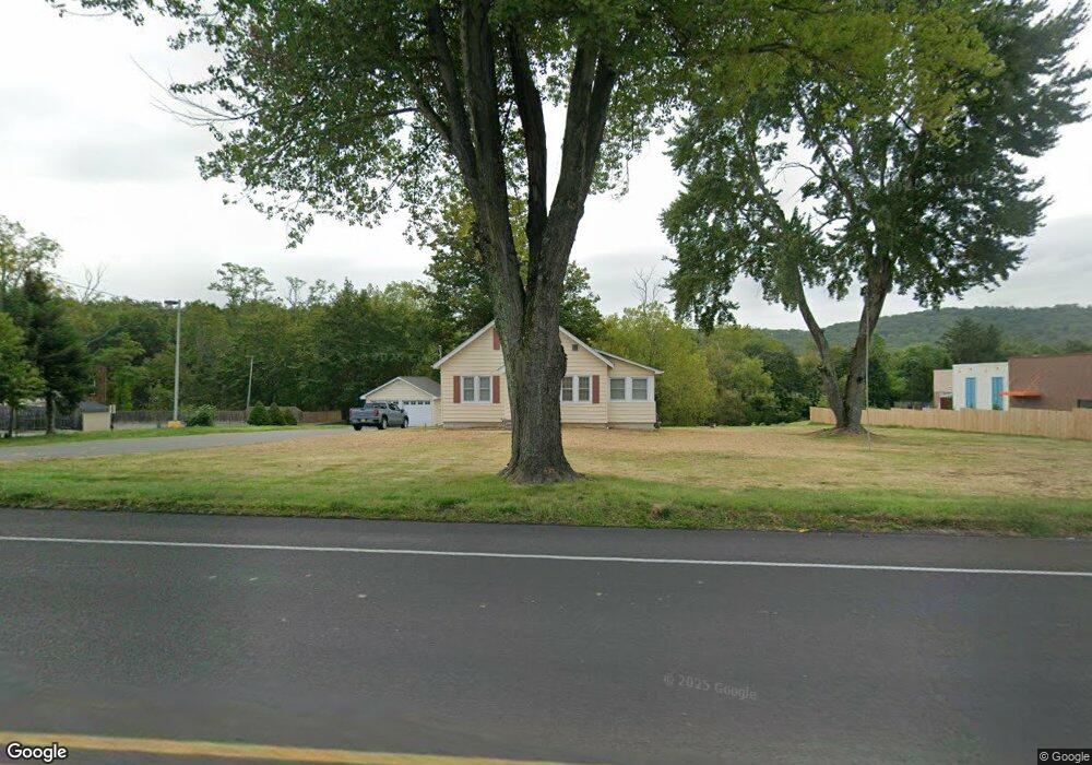
1946 State Route 57 Hackettstown, NJ 07840
Estimated Value: $360,000 - $671,000
--
Bed
--
Bath
1,438
Sq Ft
$364/Sq Ft
Est. Value
About This Home
This home is located at 1946 State Route 57, Hackettstown, NJ 07840 and is currently estimated at $522,782, approximately $363 per square foot. 1946 State Route 57 is a home located in Warren County with nearby schools including Mansfield Twp Elementary School, Warren Hills Regional Middle School, and Warren Hills Reg High School.
Ownership History
Date
Name
Owned For
Owner Type
Purchase Details
Closed on
Jul 7, 2023
Sold by
Mascharka William L and Mascharka Carolyn H
Bought by
Frazier Industrial Company
Current Estimated Value
Purchase Details
Closed on
May 21, 2009
Sold by
Brucker Laura
Bought by
Mascharka William L and Mascharka Carolyn H
Purchase Details
Closed on
Jan 15, 2002
Sold by
Beam Elizabeth and Beam Alfred
Bought by
Brucker Laura
Purchase Details
Closed on
Sep 26, 1997
Sold by
Beam Elizabeth and Beam Alfred
Bought by
Beam Alfred and Beam Elizabeth
Create a Home Valuation Report for This Property
The Home Valuation Report is an in-depth analysis detailing your home's value as well as a comparison with similar homes in the area
Home Values in the Area
Average Home Value in this Area
Purchase History
| Date | Buyer | Sale Price | Title Company |
|---|---|---|---|
| Frazier Industrial Company | $600,000 | None Listed On Document | |
| Frazier Industrial Company | $600,000 | None Listed On Document | |
| Mascharka William L | $514,000 | None Available | |
| Brucker Laura | $265,000 | -- | |
| Beam Alfred | -- | -- |
Source: Public Records
Tax History Compared to Growth
Tax History
| Year | Tax Paid | Tax Assessment Tax Assessment Total Assessment is a certain percentage of the fair market value that is determined by local assessors to be the total taxable value of land and additions on the property. | Land | Improvement |
|---|---|---|---|---|
| 2025 | $5,330 | $150,700 | $59,300 | $91,400 |
| 2024 | $5,353 | $150,700 | $59,300 | $91,400 |
| 2023 | $5,258 | $150,700 | $59,300 | $91,400 |
| 2022 | $5,258 | $150,700 | $59,300 | $91,400 |
| 2021 | $5,160 | $150,700 | $59,300 | $91,400 |
| 2020 | $5,241 | $150,700 | $59,300 | $91,400 |
| 2019 | $5,071 | $150,700 | $59,300 | $91,400 |
| 2018 | $4,964 | $150,700 | $59,300 | $91,400 |
| 2017 | $4,964 | $150,700 | $59,300 | $91,400 |
| 2016 | $4,851 | $150,700 | $59,300 | $91,400 |
| 2015 | $4,749 | $150,700 | $59,300 | $91,400 |
| 2014 | $4,598 | $150,700 | $59,300 | $91,400 |
Source: Public Records
Map
Nearby Homes
- 53 Winchester Ave
- 102 Sunnyview Ave E
- 48 Brantwood Terrace
- 250 Riva Dr
- 225 Riva Dr
- 29 Trafalgar Ct
- 209 Riva Dr Unit 3A24H
- 135 Cynthia Dr
- 9 Brantwood Terrace
- 21 Highland Ave
- 17 Meadow Ln
- 13 Highland Ave
- 150 College View Dr
- 130 Kings Hwy
- 1 Heather Ct
- 133 Deerfield Dr
- 0 Sliker Ln
- 16 Setting Sun Dr
- 11 Shadow Hill Way
- 310 Warren St
- 1940 State Route 57
- 1930 State Route 57
- 1962 State Route 57
- 1935 State Route 57
- 14 Ridgley St
- 16 Ridgley St
- 18 Ridgley St
- 12 Ridgley St
- 20 Ridgley St
- 10 Ridgley St
- 22 Ridgley St
- 24 Ridgley St
- 8 Ridgley St
- 2000 State Route 57
- 26 Ridgley St
- 13 Ridgley St
- 15 Ridgley St
- 17 Ridgley St
- 3 Chapin Place
- 59 Newburgh Rd