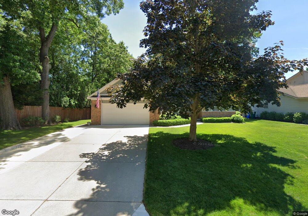
1946 W Ridge Dr Unit Bldg-Unit Commerce Township, MI 48390
Estimated Value: $424,000 - $458,000
3
Beds
2
Baths
1,845
Sq Ft
$238/Sq Ft
Est. Value
About This Home
This home is located at 1946 W Ridge Dr Unit Bldg-Unit, Commerce Township, MI 48390 and is currently estimated at $439,561, approximately $238 per square foot. 1946 W Ridge Dr Unit Bldg-Unit is a home located in Oakland County with nearby schools including Walled Lake Central High School, St. Matthew Lutheran School, and St. William School.
Ownership History
Date
Name
Owned For
Owner Type
Purchase Details
Closed on
Feb 5, 2018
Sold by
Pacaitis Mary Lynn and Estate Of Vince Pacaitis
Bought by
Gulledge Dean L
Current Estimated Value
Home Financials for this Owner
Home Financials are based on the most recent Mortgage that was taken out on this home.
Original Mortgage
$200,000
Outstanding Balance
$169,211
Interest Rate
3.95%
Mortgage Type
New Conventional
Estimated Equity
$270,350
Purchase Details
Closed on
Sep 20, 1994
Sold by
E R Thomas Development C
Bought by
Pacaitis Vince and Pacaitis Izolina
Create a Home Valuation Report for This Property
The Home Valuation Report is an in-depth analysis detailing your home's value as well as a comparison with similar homes in the area
Home Values in the Area
Average Home Value in this Area
Purchase History
| Date | Buyer | Sale Price | Title Company |
|---|---|---|---|
| Gulledge Dean L | $250,000 | First American Title | |
| Pacaitis Vince | $173,900 | -- |
Source: Public Records
Mortgage History
| Date | Status | Borrower | Loan Amount |
|---|---|---|---|
| Open | Gulledge Dean L | $200,000 |
Source: Public Records
Tax History Compared to Growth
Tax History
| Year | Tax Paid | Tax Assessment Tax Assessment Total Assessment is a certain percentage of the fair market value that is determined by local assessors to be the total taxable value of land and additions on the property. | Land | Improvement |
|---|---|---|---|---|
| 2024 | $2,895 | $190,540 | $0 | $0 |
| 2023 | $2,729 | $176,540 | $0 | $0 |
| 2022 | $4,206 | $164,430 | $0 | $0 |
| 2021 | $4,128 | $156,440 | $0 | $0 |
| 2020 | $2,697 | $149,910 | $0 | $0 |
| 2019 | $3,936 | $126,500 | $0 | $0 |
| 2018 | $2,993 | $136,650 | $0 | $0 |
| 2017 | $2,950 | $136,650 | $0 | $0 |
| 2016 | $2,913 | $130,300 | $0 | $0 |
| 2015 | -- | $118,090 | $0 | $0 |
| 2014 | -- | $106,470 | $0 | $0 |
| 2011 | -- | $85,390 | $0 | $0 |
Source: Public Records
Map
Nearby Homes
- 3165 Jennella Dr
- 4278 Arbour Dr
- 4079 Cumberland Ct
- 9255 Richardson Rd
- 8102 Heron Hills Dr
- 1131 Indianwood Trail Unit 12
- 2994 Lankford Ln
- 2450 S Commerce Rd
- Cascade Plan at Townes at Merrill Park
- Ashton Plan at Townes at Merrill Park
- 1570 Addison Cir
- 1047 Addison Cir
- 1569 Addison Cir
- 103 Addison Cir
- 101 Addison Cir
- 8559 Pine Cove Dr
- 2124 Welch Rd
- 2551 Oakview Dr
- 260 Forest Crest Dr
- 2130 Park Place Dr
- 1946 W Ridge Dr
- 1930 W Ridge Dr
- 3201 Viking Dr
- 3181 Viking Dr
- 3121 Viking Dr
- 1914 W Ridge Dr
- 1898 W Ridge Dr
- 3271 Viking Dr
- 1947 W Ridge Dr
- 1931 W Ridge Dr
- 1915 W Ridge Dr
- 3301 Viking Dr
- 1899 W Ridge Dr
- 3210 Viking Dr
- 3120 Viking Dr
- 3180 Viking Dr
- 1882 W Ridge Dr
- 3240 Viking Dr
- 1883 W Ridge Dr
- 3150 Viking Dr