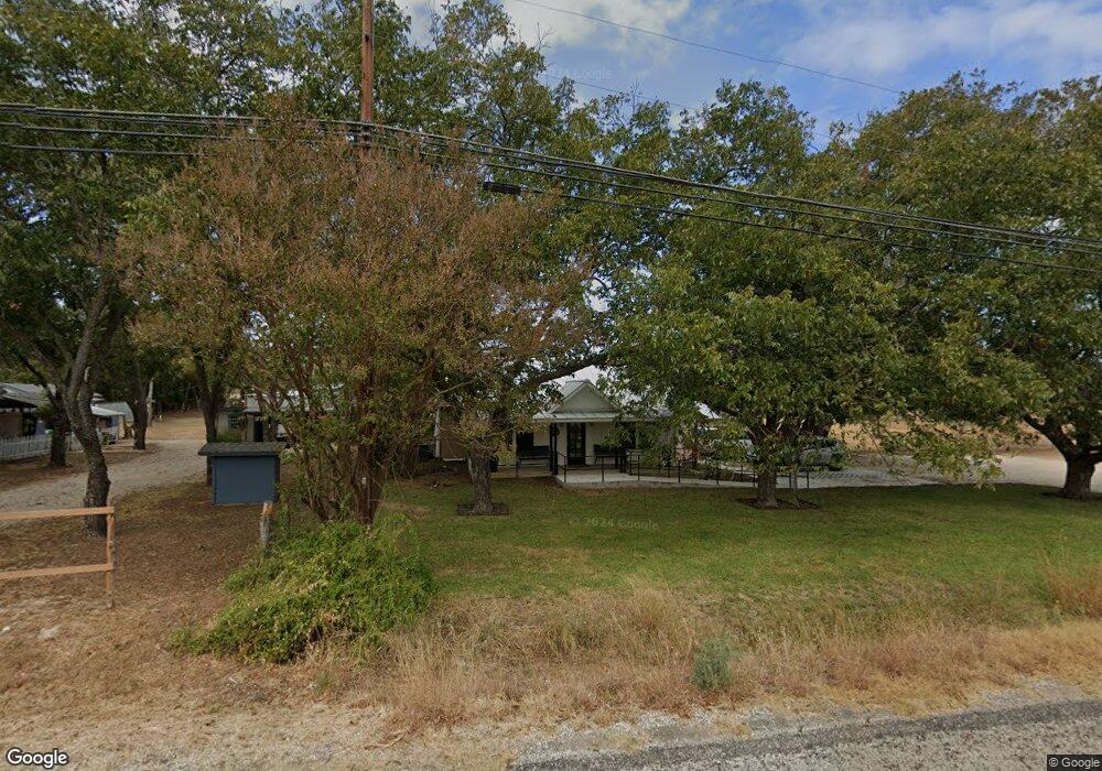
1946 W Us Hwy 290 Fredericksburg, TX 78624
Estimated Value: $540,820 - $750,000
--
Bed
--
Bath
992
Sq Ft
$616/Sq Ft
Est. Value
About This Home
This home is located at 1946 W Us Hwy 290, Fredericksburg, TX 78624 and is currently estimated at $610,705, approximately $615 per square foot. 1946 W Us Hwy 290 is a home located in Gillespie County with nearby schools including Fredericksburg High School, Ambleside School of Fredericksburg, and St. Mary's Catholic School.
Ownership History
Date
Name
Owned For
Owner Type
Purchase Details
Closed on
Jun 20, 2025
Sold by
Palmer Andrew A and Palmer Arvie D
Bought by
Palmer Charity and Palmer Joseph
Current Estimated Value
Home Financials for this Owner
Home Financials are based on the most recent Mortgage that was taken out on this home.
Original Mortgage
$324,000
Outstanding Balance
$323,160
Interest Rate
6.76%
Mortgage Type
New Conventional
Estimated Equity
$287,545
Purchase Details
Closed on
Dec 17, 2008
Sold by
Heinemann Victor C and Heinemann Janie
Bought by
Hohmann Tonie L
Purchase Details
Closed on
Jul 17, 1998
Sold by
Heinemann Victor C and Heinemann Janie
Bought by
Palmer Andrew A
Create a Home Valuation Report for This Property
The Home Valuation Report is an in-depth analysis detailing your home's value as well as a comparison with similar homes in the area
Home Values in the Area
Average Home Value in this Area
Purchase History
| Date | Buyer | Sale Price | Title Company |
|---|---|---|---|
| Palmer Charity | -- | Capital Title | |
| Hohmann Tonie L | -- | None Available | |
| Palmer Andrew A | -- | None Listed On Document |
Source: Public Records
Mortgage History
| Date | Status | Borrower | Loan Amount |
|---|---|---|---|
| Open | Palmer Charity | $324,000 |
Source: Public Records
Tax History Compared to Growth
Tax History
| Year | Tax Paid | Tax Assessment Tax Assessment Total Assessment is a certain percentage of the fair market value that is determined by local assessors to be the total taxable value of land and additions on the property. | Land | Improvement |
|---|---|---|---|---|
| 2025 | $6,667 | $636,990 | $187,290 | $449,700 |
| 2024 | $6,667 | $630,090 | $187,290 | $442,800 |
| 2023 | $6,678 | $630,090 | $187,290 | $442,800 |
| 2022 | $6,090 | $468,950 | $117,110 | $351,840 |
| 2021 | $3,116 | $262,870 | $109,800 | $153,070 |
| 2020 | $2,889 | $193,230 | $60,600 | $132,630 |
| 2019 | $3,017 | $193,230 | $60,600 | $132,630 |
| 2018 | $2,793 | $179,790 | $57,900 | $121,890 |
| 2017 | $2,679 | $176,650 | $57,900 | $118,750 |
| 2016 | $2,435 | $153,300 | $48,180 | $105,120 |
| 2015 | -- | $147,860 | $48,180 | $99,680 |
| 2014 | -- | $144,110 | $48,180 | $95,930 |
Source: Public Records
Map
Nearby Homes
- 219 Armory Rd
- 139 Armory Rd
- 817 Usner Rd
- 119 Darby Dr
- 100 Ellendale Place
- 116 Ellendale Place
- 125 Alameda Dr
- 137 Alameda Dr
- LOT 85 Pinnacle Dr
- 112 Ellendale Place
- 5386
- LOT 625 W Eldorado Ridge Dr Unit 625
- 121 Alameda Dr
- 30 Buckskin Path
- LOT 13 Pinnacle Dr Unit 13
- 77 Arch Ray
- LOT 8 Longview Dr
- LOT 51 Badger Ridge Rd Unit 3.689
- LOT 64 Longbow Ln
- TBD Herbert-Schaefer
- 1946 W Us Highway 290
- 1974 W Us Highway 290
- 1892 W Us Highway 290
- 1892 W Us Hwy 290
- 2006 W Us Highway 290
- 10034 E Us Hwy 290
- 1 E Us Hwy 290
- 1993 W Us Highway 290
- 2085 W Us Hwy 290
- 0 W Us Hwy 290 Unit 31-P 17867
- 0 W Us Hwy 290 Unit 80213
- 1969 W Us Highway 290
- 1868 W Us Highway 290
- 1887 W Us Highway 290
- 1861 W Us Highway 290
- 2037 W Us Highway 290
- 1825 W Us Highway 290
- 0 Armory Rd Unit 74451
- 0 Armory Rd Unit 3 96687
- 0 Armory Rd Unit 73662